← Back
Historical Survey Sheet Digitization
Allai Irrigation Scheme – Mutur, Trincomalee (1943–1955)
Project Overview
This project documents the georeferencing and digitization of historical
engineering survey sheets of the Allai Irrigation Scheme in Mutur,
Trincomalee District. The original analogue survey maps, prepared between
1943 and 1955, were converted into a GIS-ready digital dataset to preserve
terrain information for future irrigation and engineering analysis.
Project Background
During my internship at the GIS Branch, Irrigation Department Head Office, Colombo 07,
I was assigned a set of 71 scanned engineering survey sheets related to the
Allai Irrigation Scheme. Due to their age and analogue nature, these maps
required careful georeferencing and extensive manual digitization to
reconstruct accurate terrain information within a modern GIS environment.
Study Area
The study area covers the Allai Irrigation Scheme located in the Mutur area
of the Trincomalee District, Eastern Province of Sri Lanka. The region
includes varied terrain with complex elevation patterns that are critical
for irrigation planning and water management.
Data Sources
- Historical engineering survey sheets (1943–1955) – Irrigation Department of Sri Lanka
- Scanned analogue maps (soft copy format)
- Reference basemaps for georeferencing
Methodology
- Georeferencing of scanned historical survey sheets
- Sheet-wise alignment and edge matching
- Manual digitization of high-density contour lines
- Topology awareness and line continuity checking
- Layer organization and quality control in ArcGIS Pro
Project Visualization
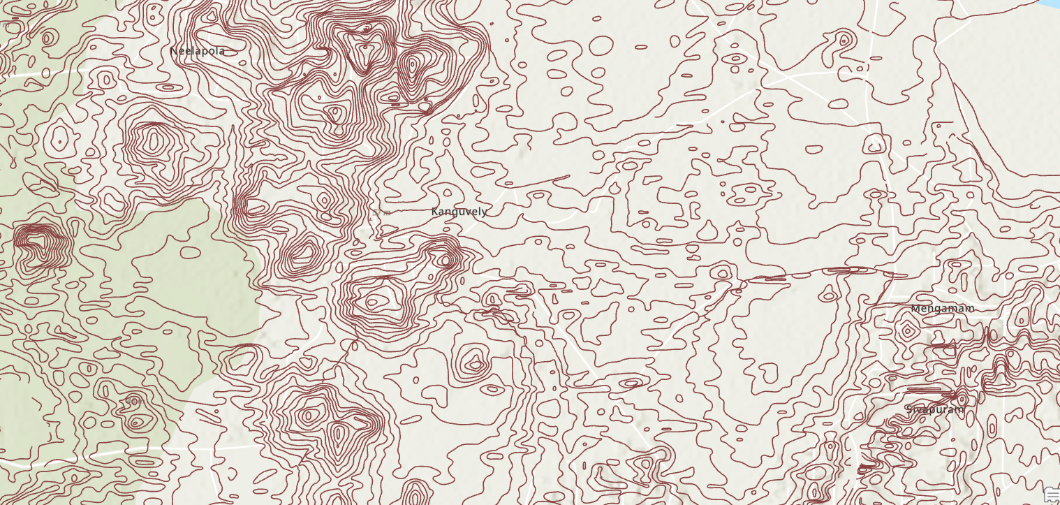
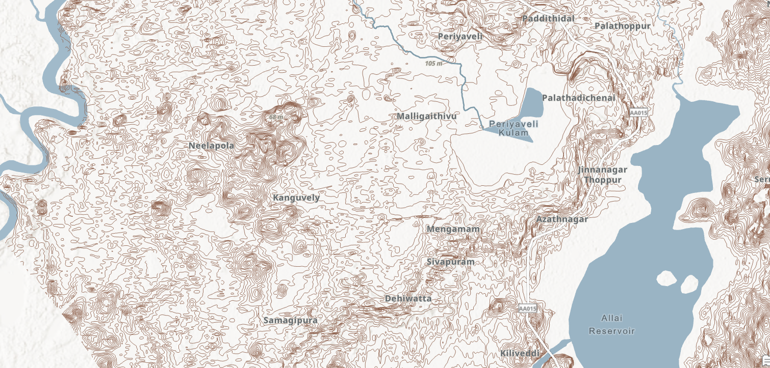
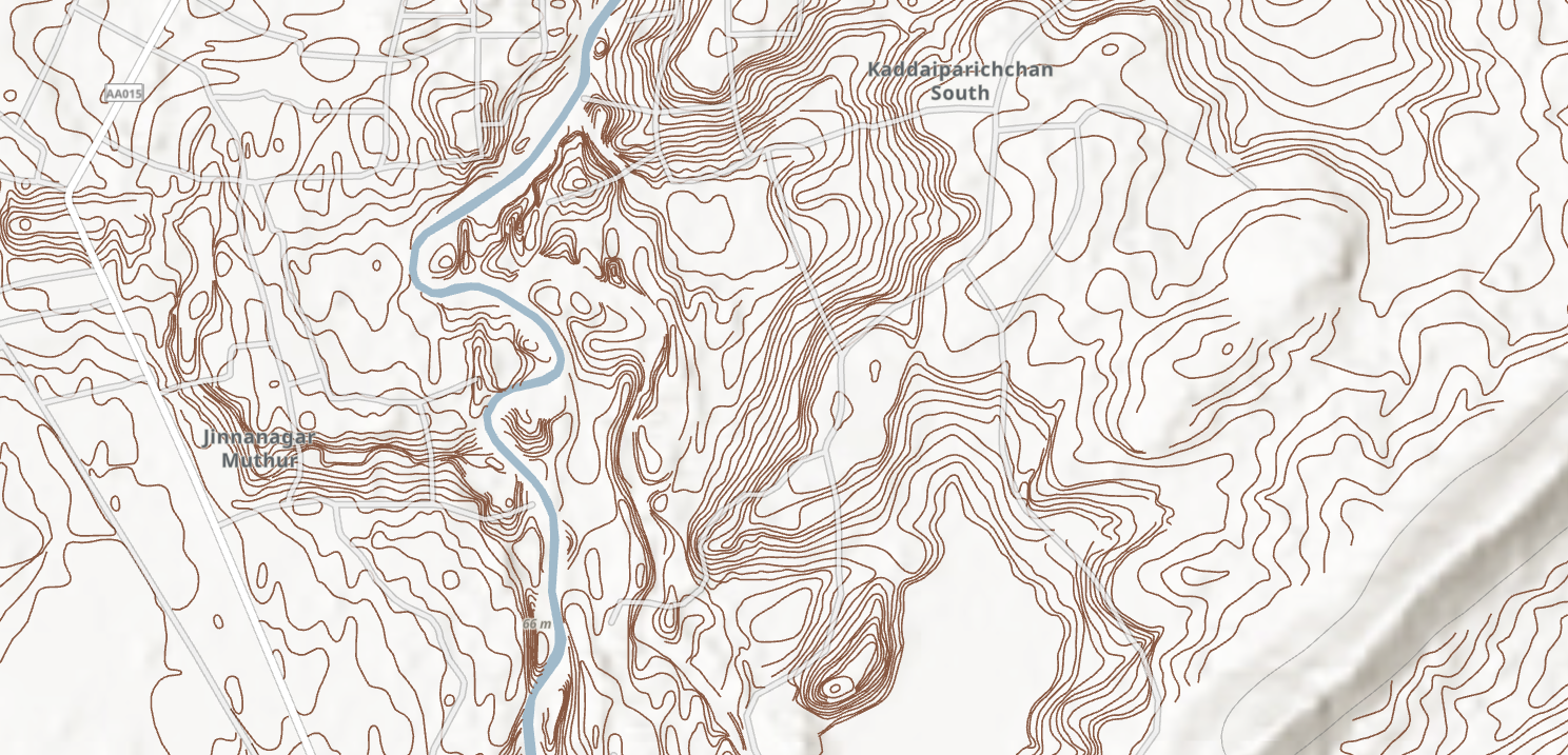
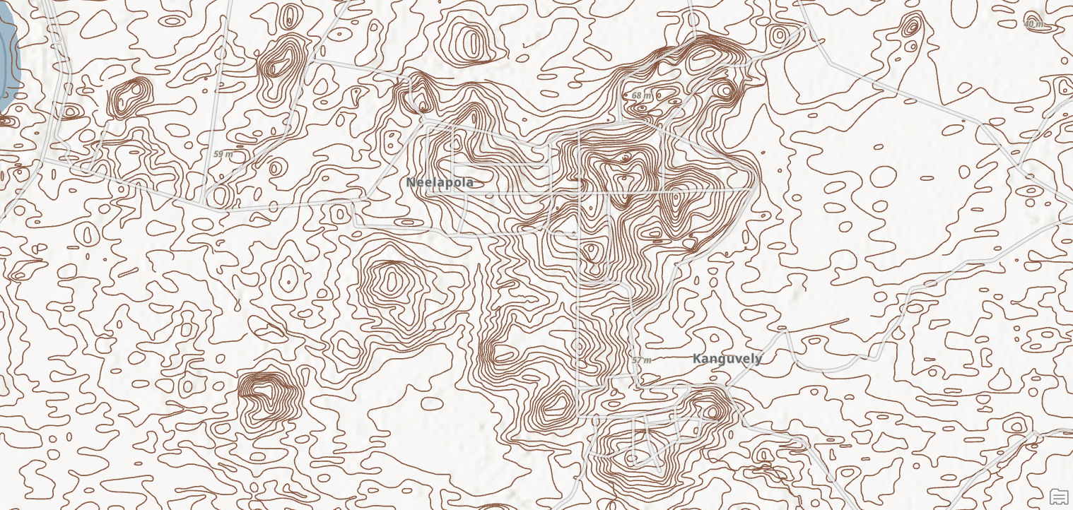
Digitized Contour Coverage – Full Extent
Overview of the Allai Scheme showing the complete spatial extent of manually
digitized contour lines derived from 71 historical survey sheets.
Contour Digitization
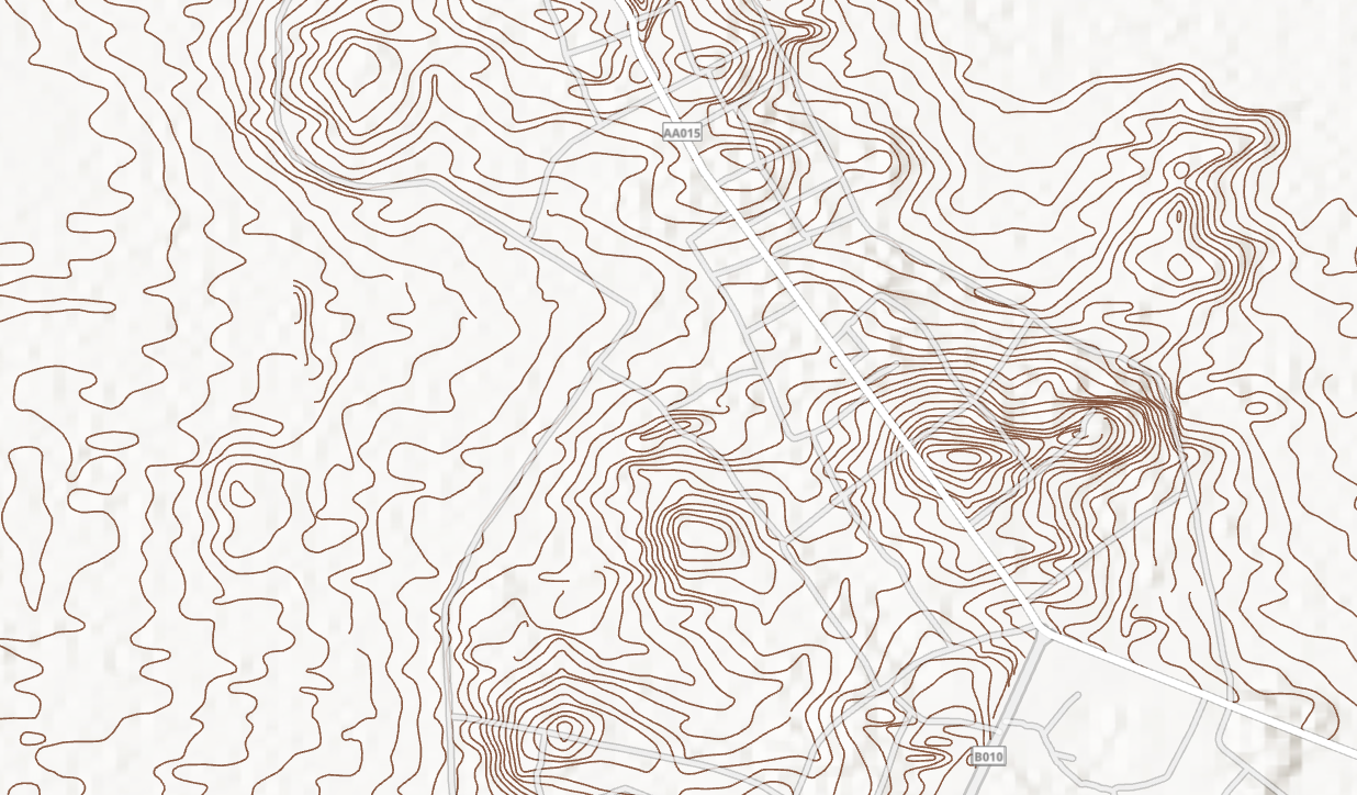
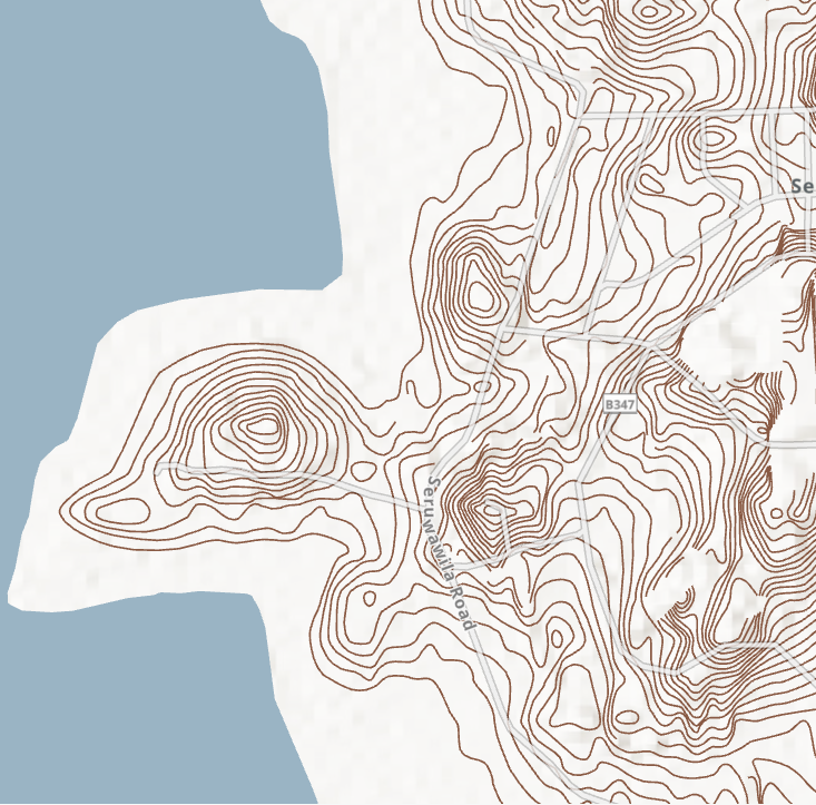
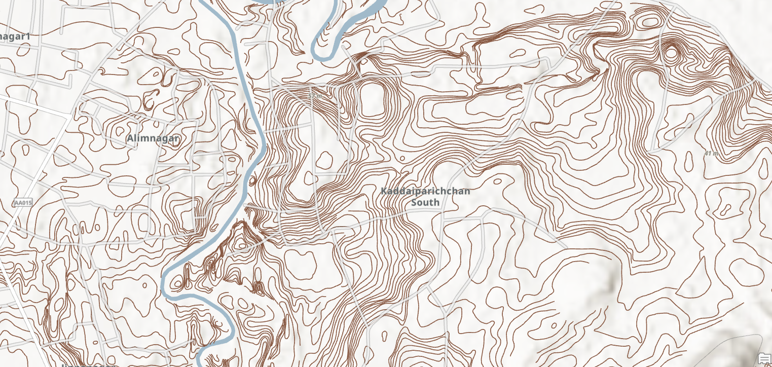
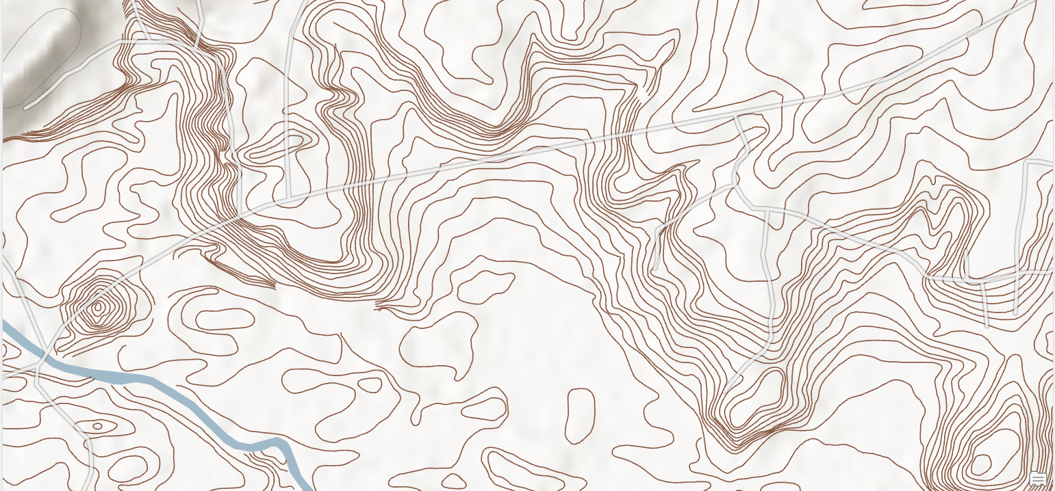
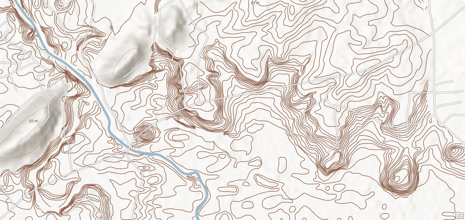
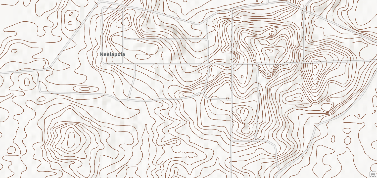
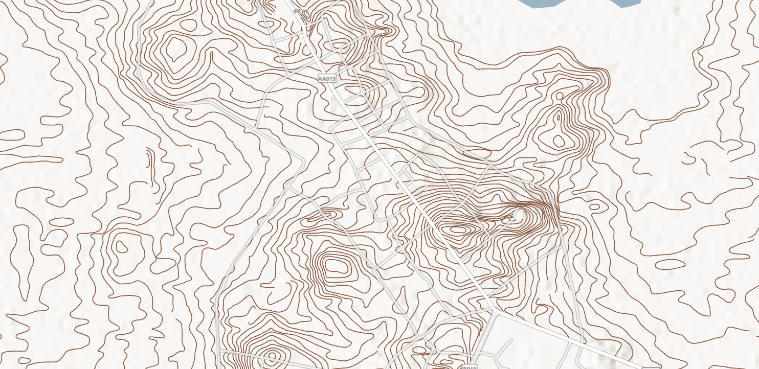
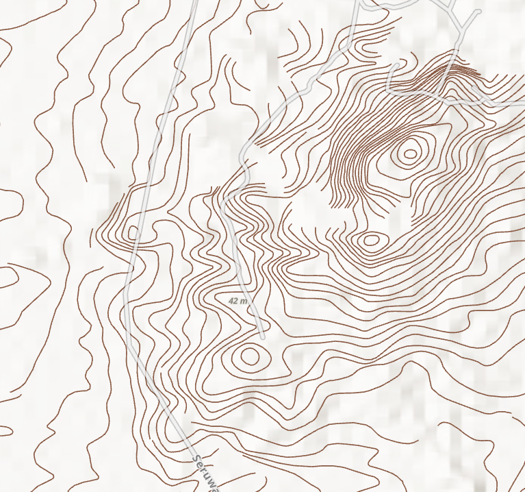
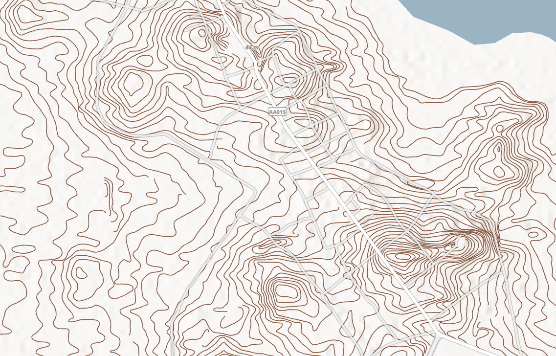
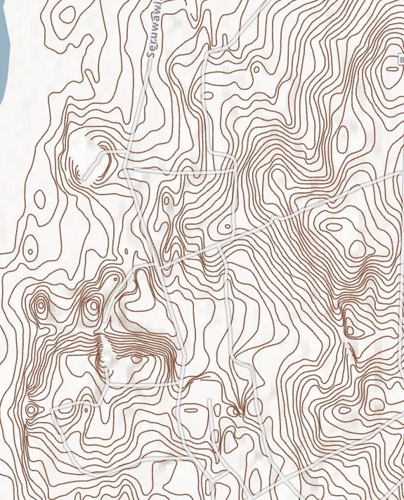
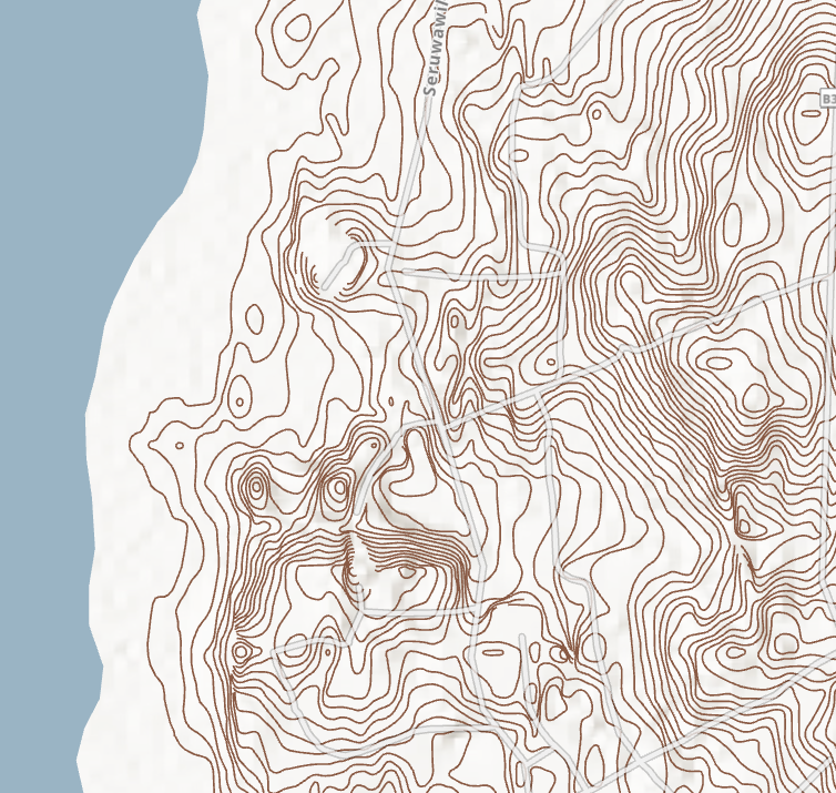
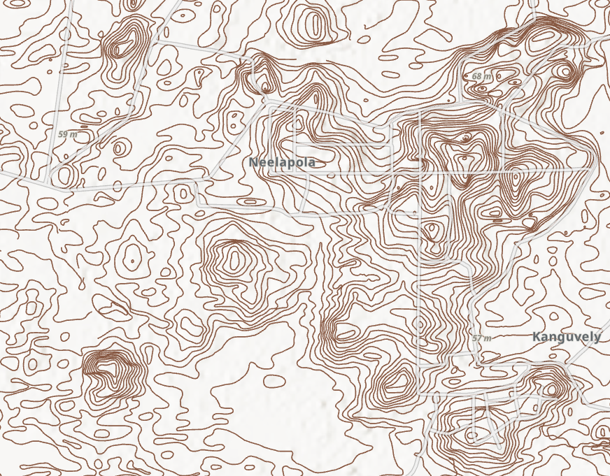
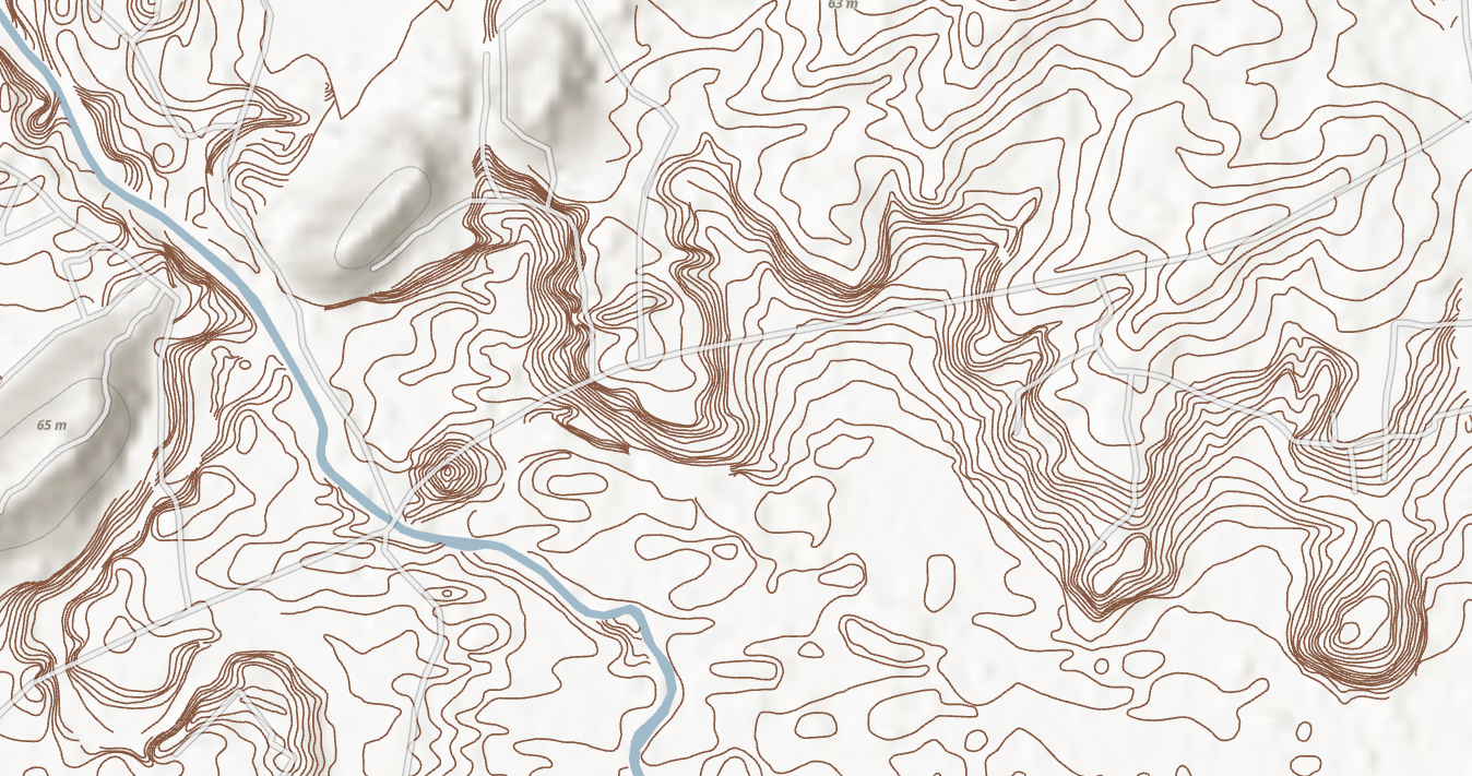
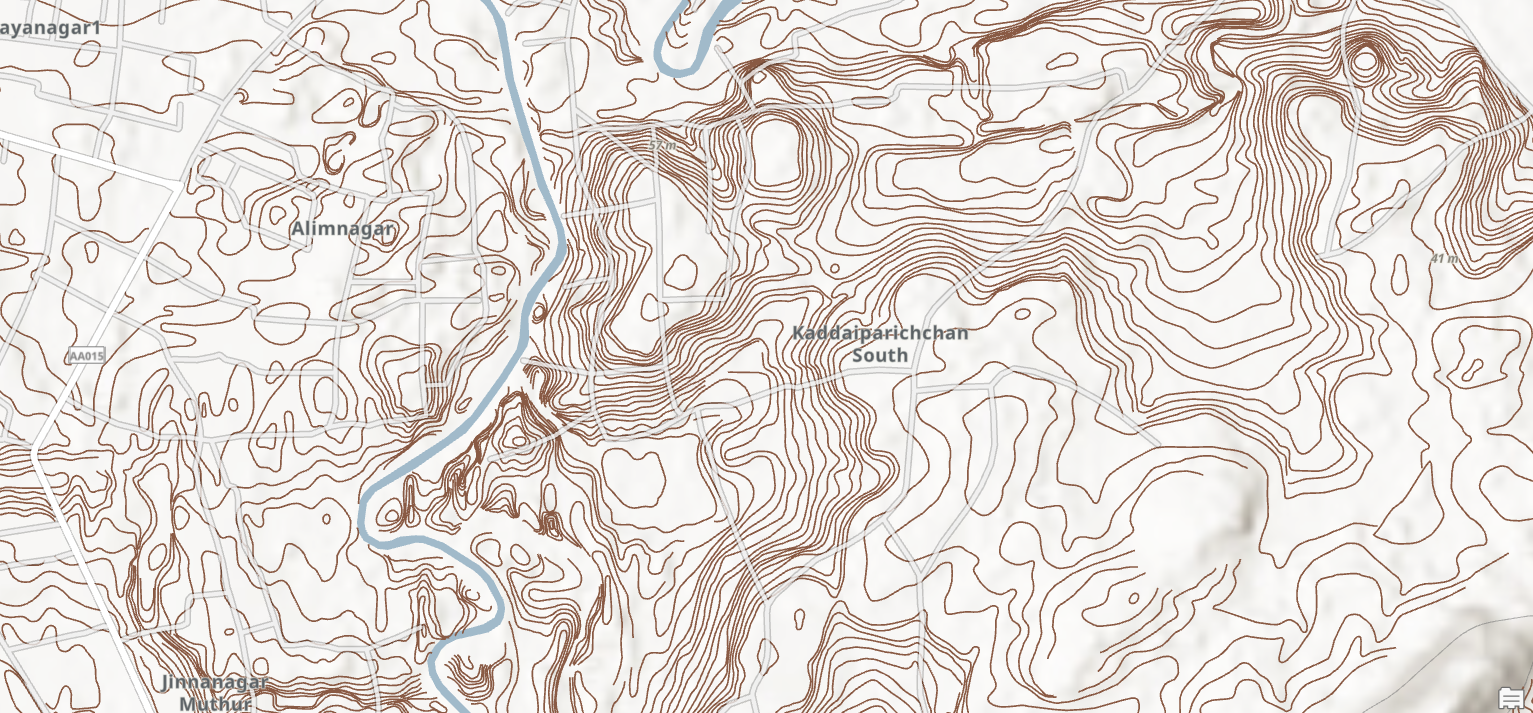
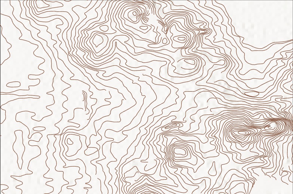
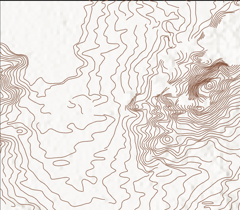
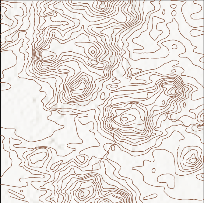
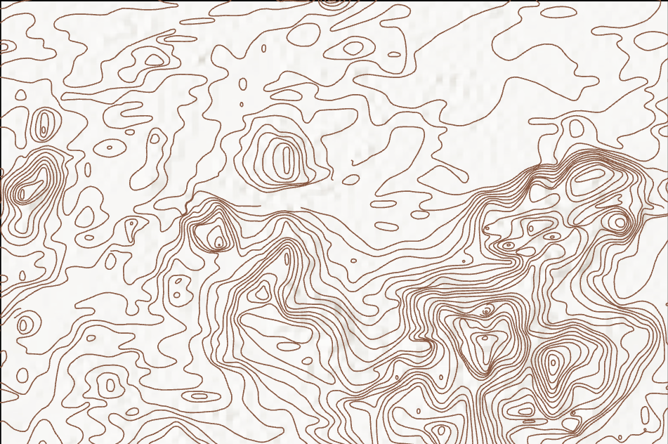
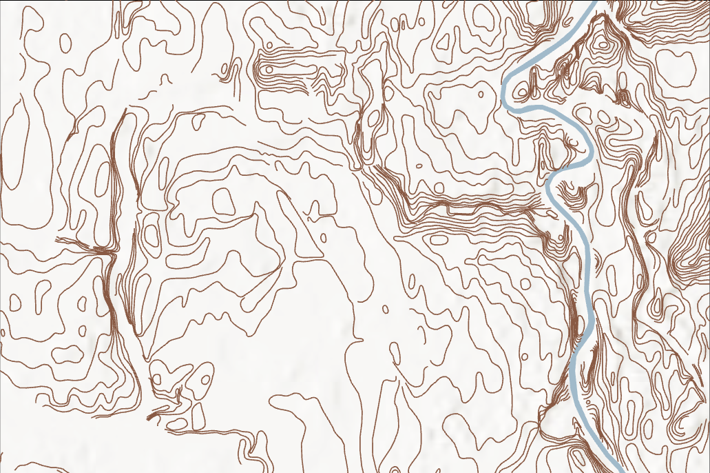
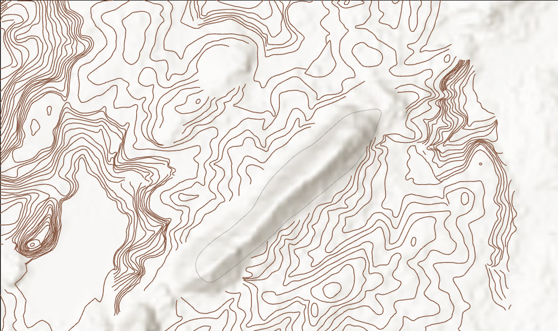
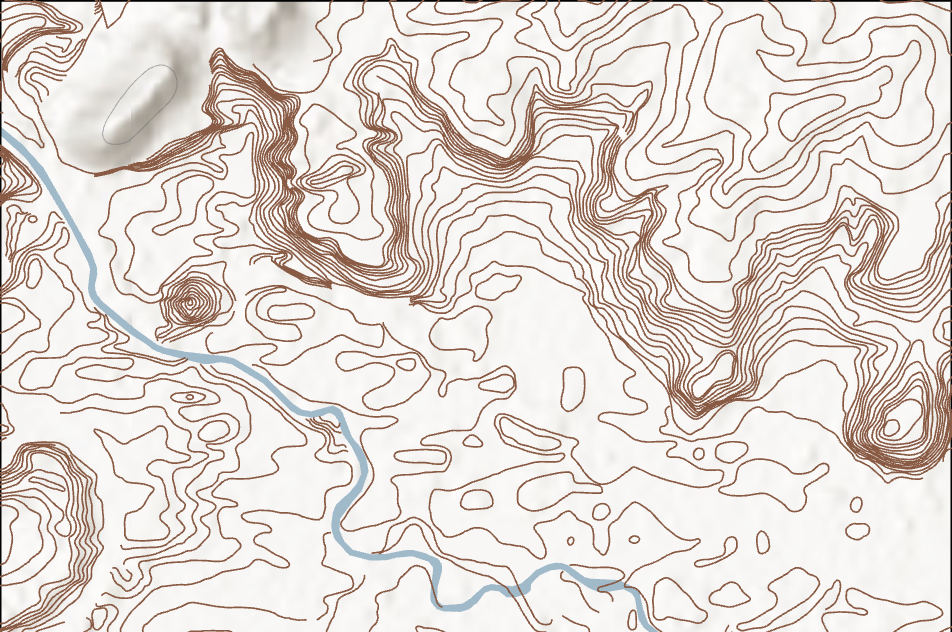
High-Density Contour Digitization – Zoomed Views
Sequential zoomed views showing the density, continuity, and precision of
manually digitized contour lines derived from historical survey sheets.
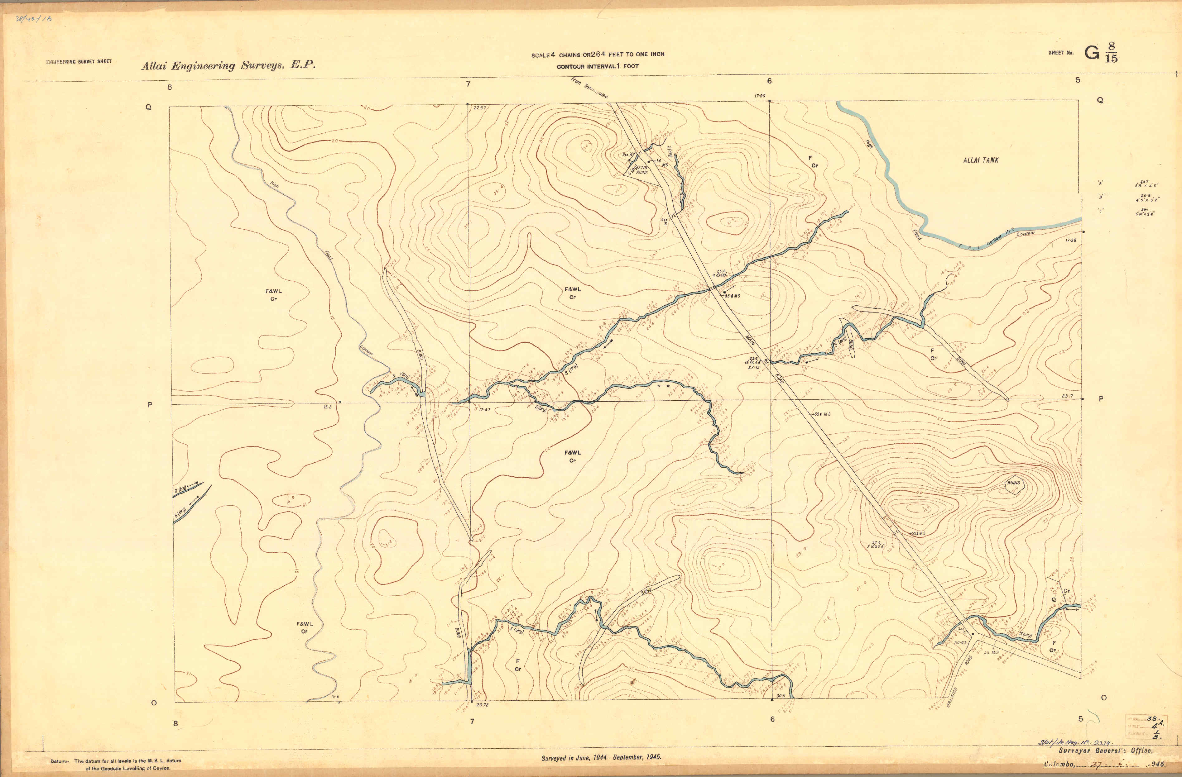
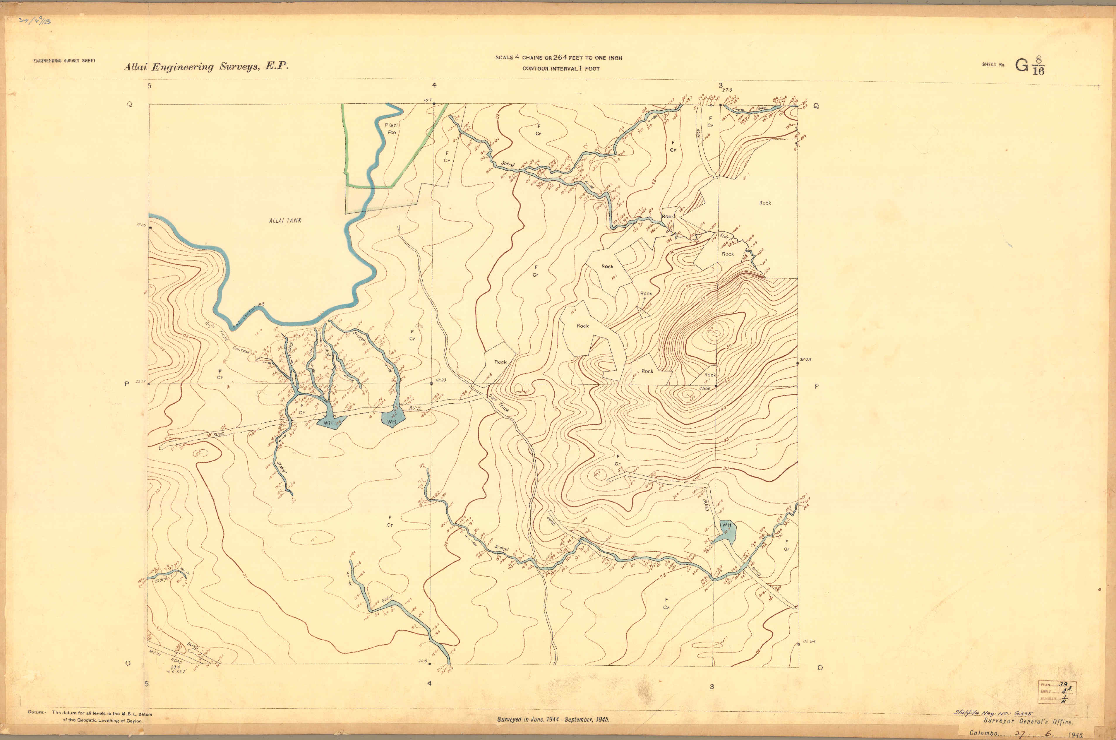
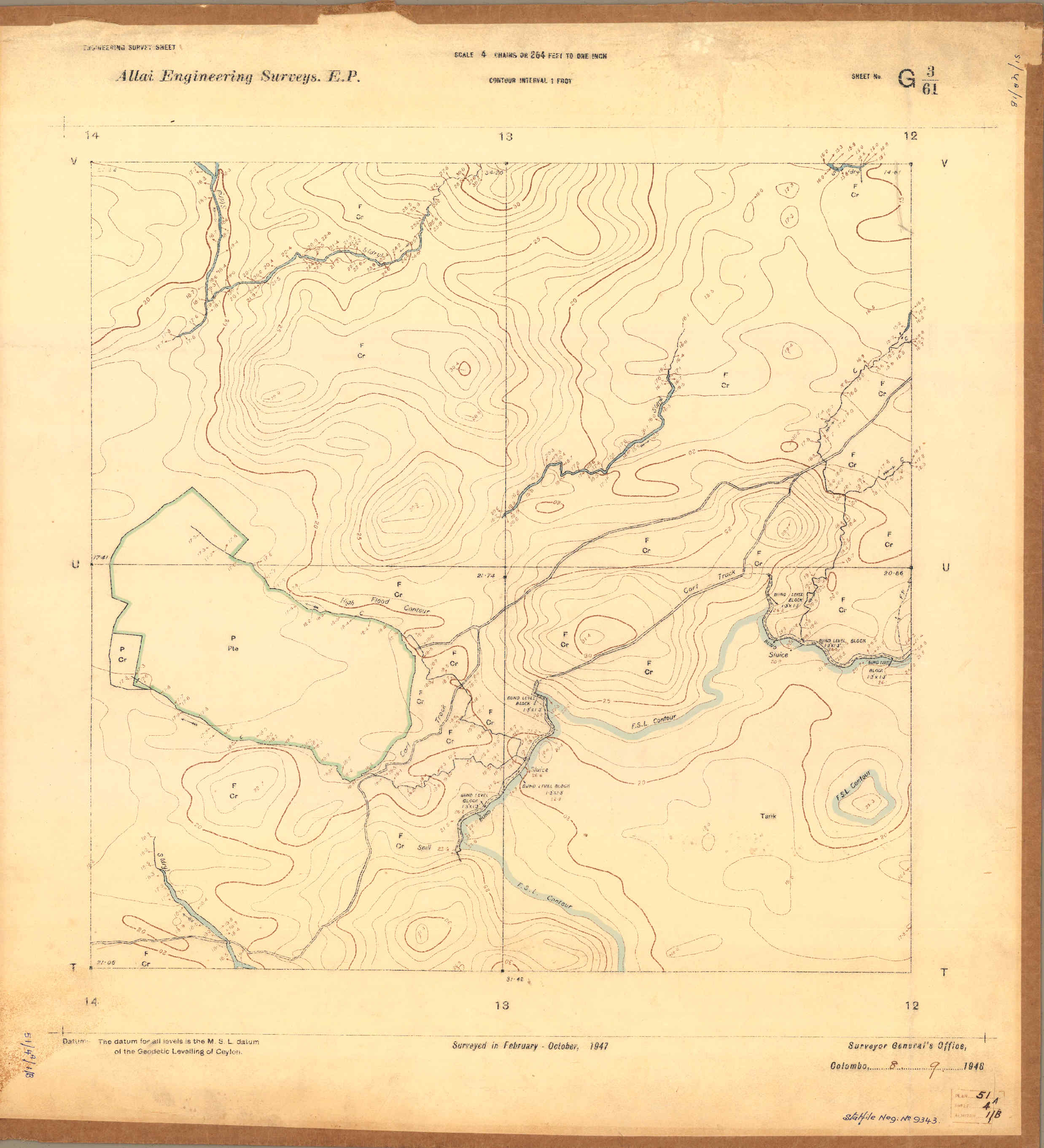
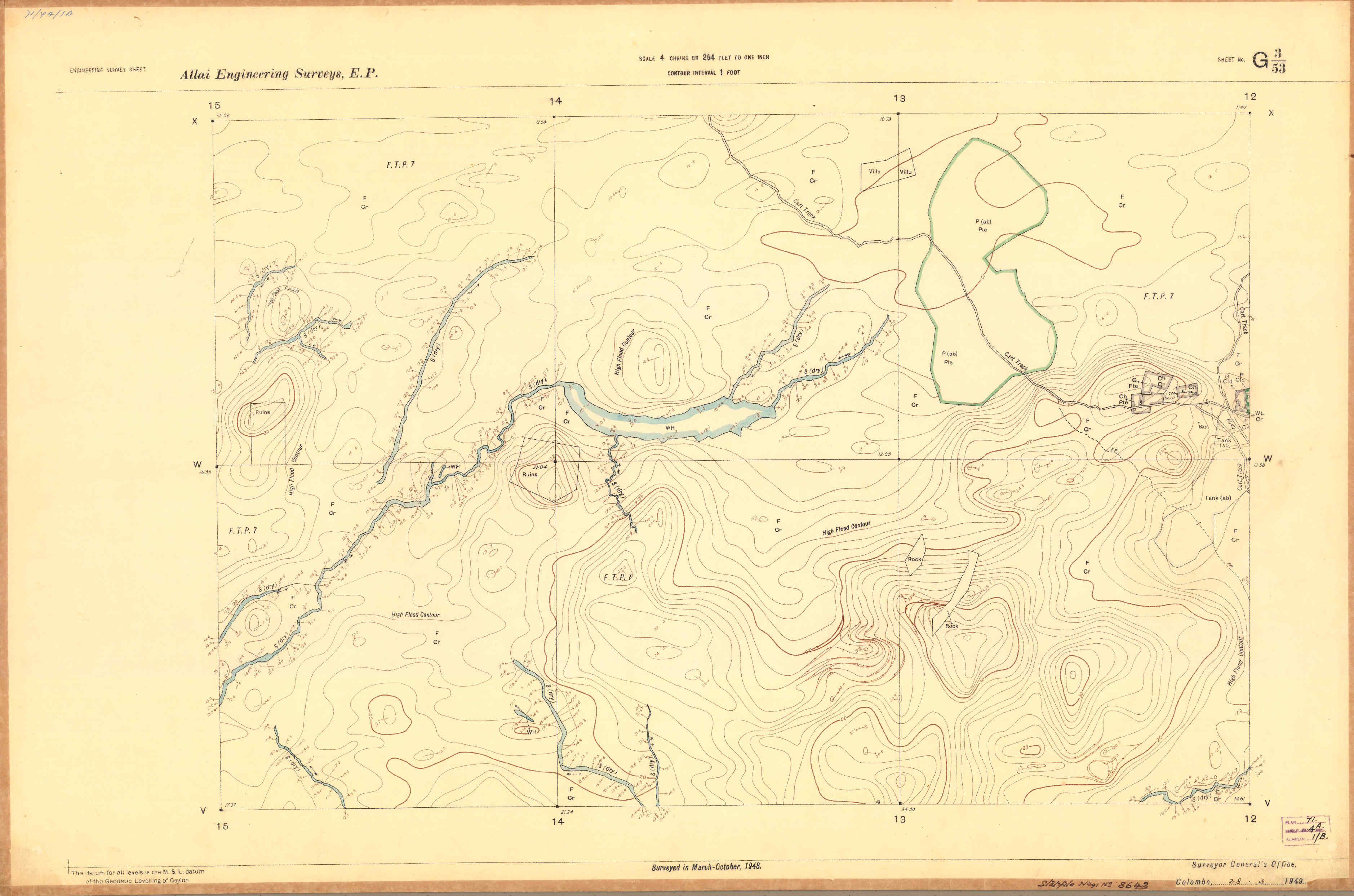
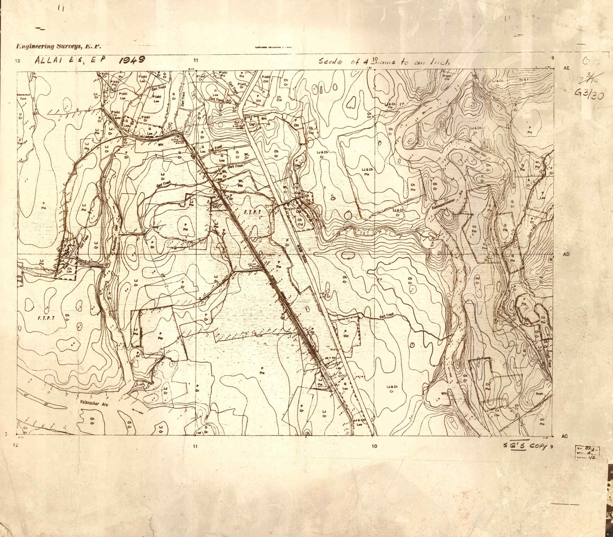
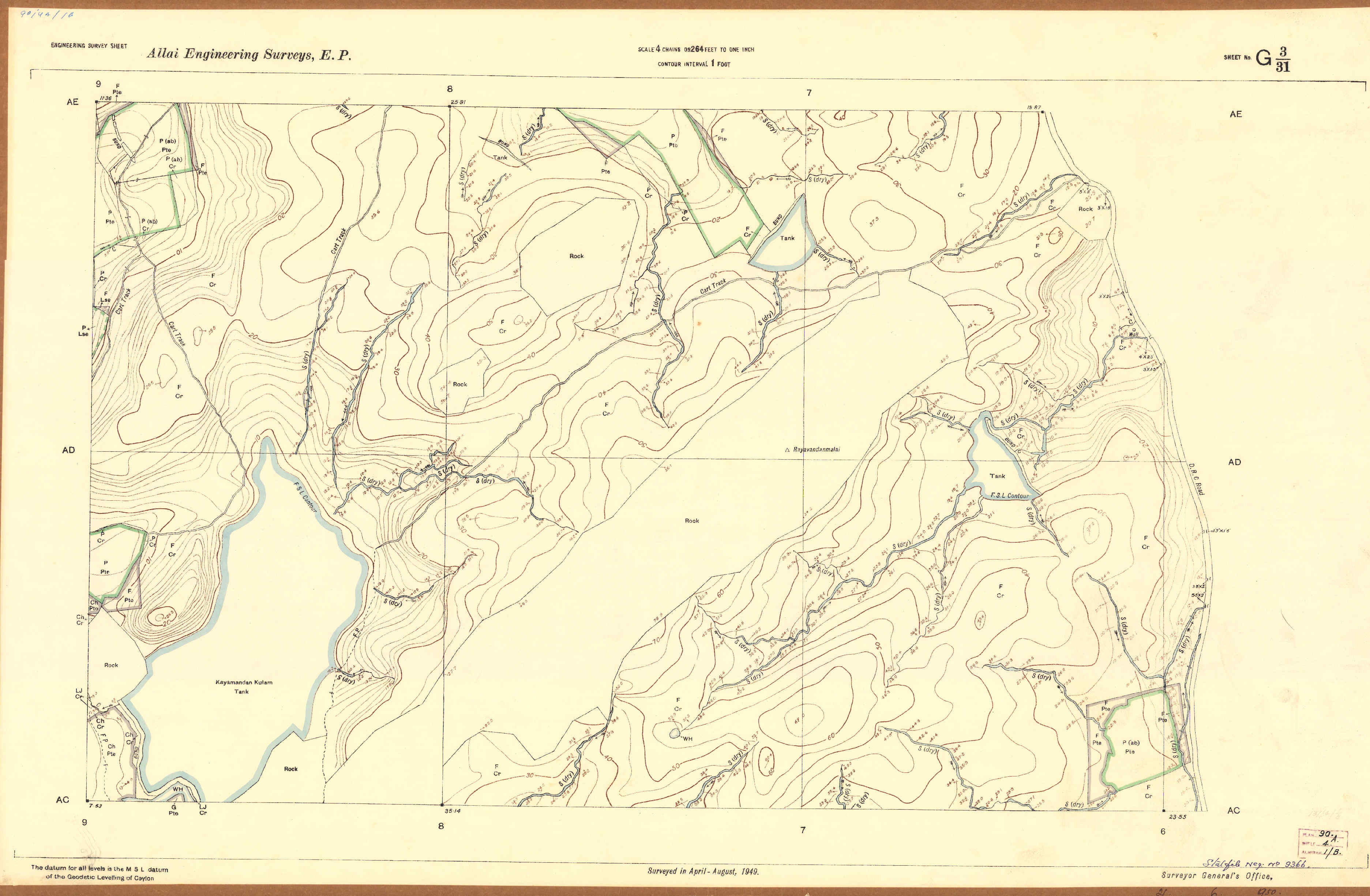
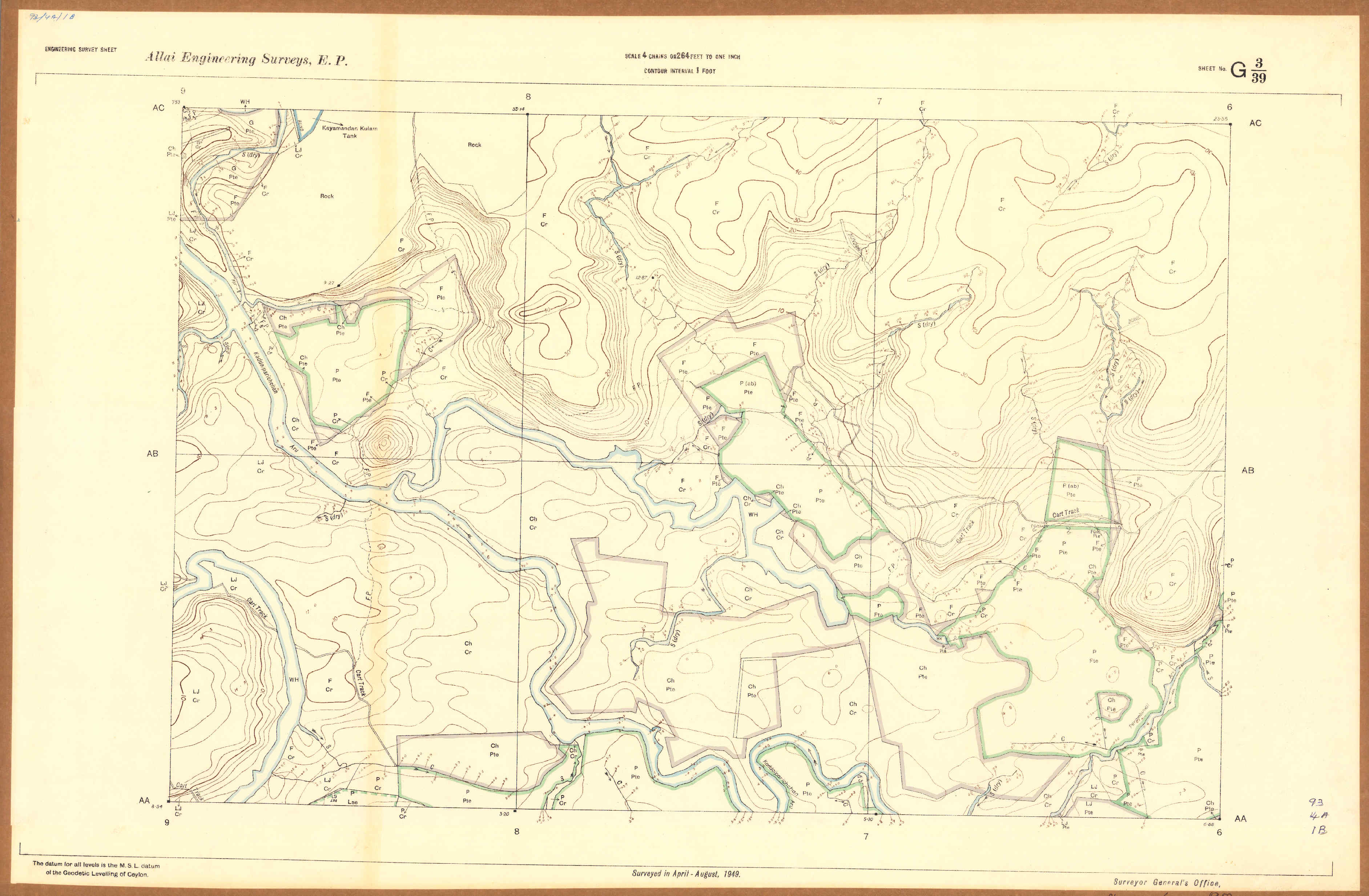
Analogue to Digital Transformation
Comparison between an original scanned engineering survey sheet and its
GIS-based digital representation after georeferencing and contour
digitization.
Challenges & Solutions
- Very old and distorted analogue survey maps
- Inconsistent scales and map conditions across sheets
- Extremely dense contour networks requiring manual digitization
- Time-intensive editing and quality control process
Tools & Skills Demonstrated
- ArcGIS Pro
- Historical map georeferencing
- Manual contour digitization
- Terrain data reconstruction
- Large multi-sheet dataset management
Conclusion
This project demonstrates practical experience in handling legacy
engineering survey data and transforming historical analogue maps into
structured GIS datasets. The digitized contour information forms a
valuable foundation for future irrigation, hydrological, and terrain
analysis in the Allai Scheme area.