Project Overview
This project employs multi-temporal remote sensing and GIS-based multi-criteria decision analysis to delineate Climate-Smart Agricultural (CSA) zones in the drought-prone Anuradhapura District of Sri Lanka. The resulting CSA suitability maps for Maha and Yala seasons support climate-resilient agricultural planning and drought risk mitigation.
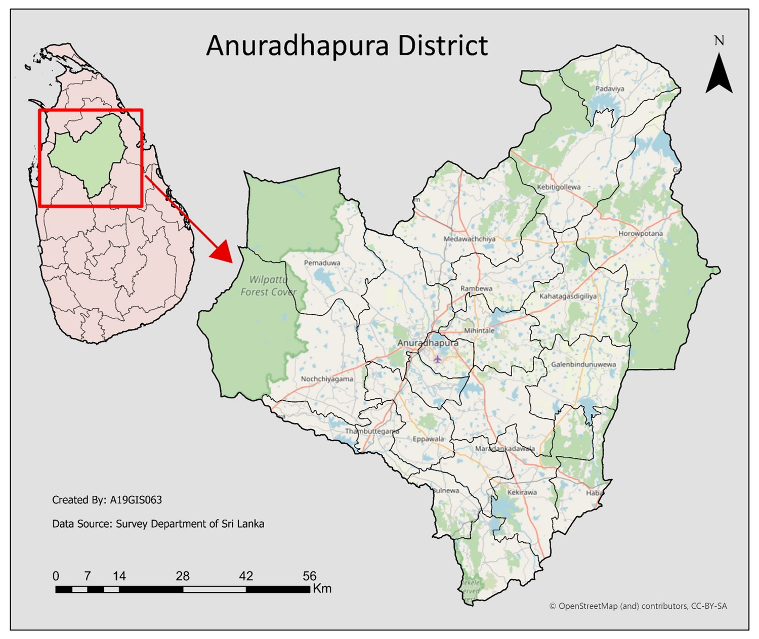
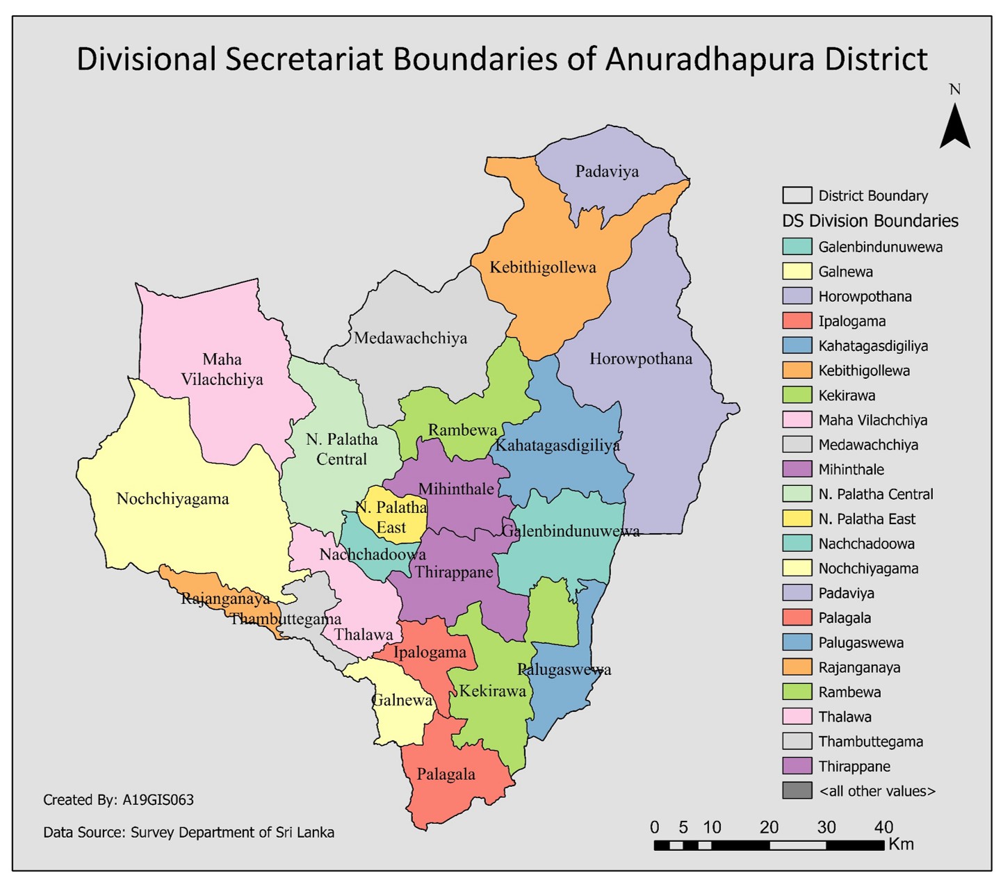
Study Area
Data Sources
- Vegetation & drought indices – Landsat 8 & 9 (Google Earth Engine)
- Land use / land cover – Sentinel-2
- Rainfall data – Department of Meteorology, Sri Lanka & CHIRPS
- Soil type – Irrigation Department, Sri Lanka
- Slope / topography – SRTM DEM (Google Earth Engine)
- Irrigation infrastructure – Irrigation Department, Sri Lanka
- Administrative boundaries – DIVA GIS
Methodology
- Satellite image preprocessing (Landsat 8 & 9, Sentinel-2)
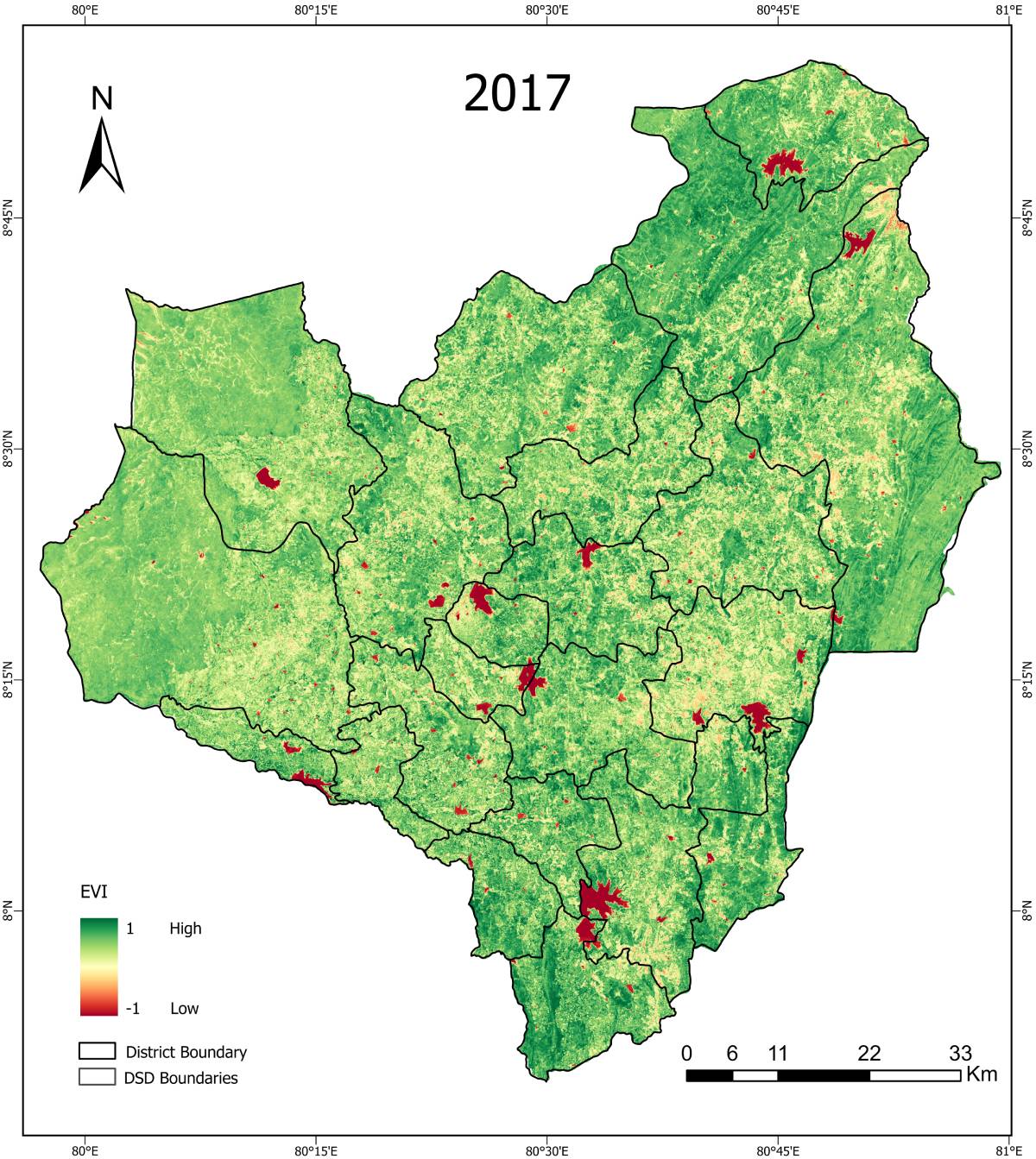
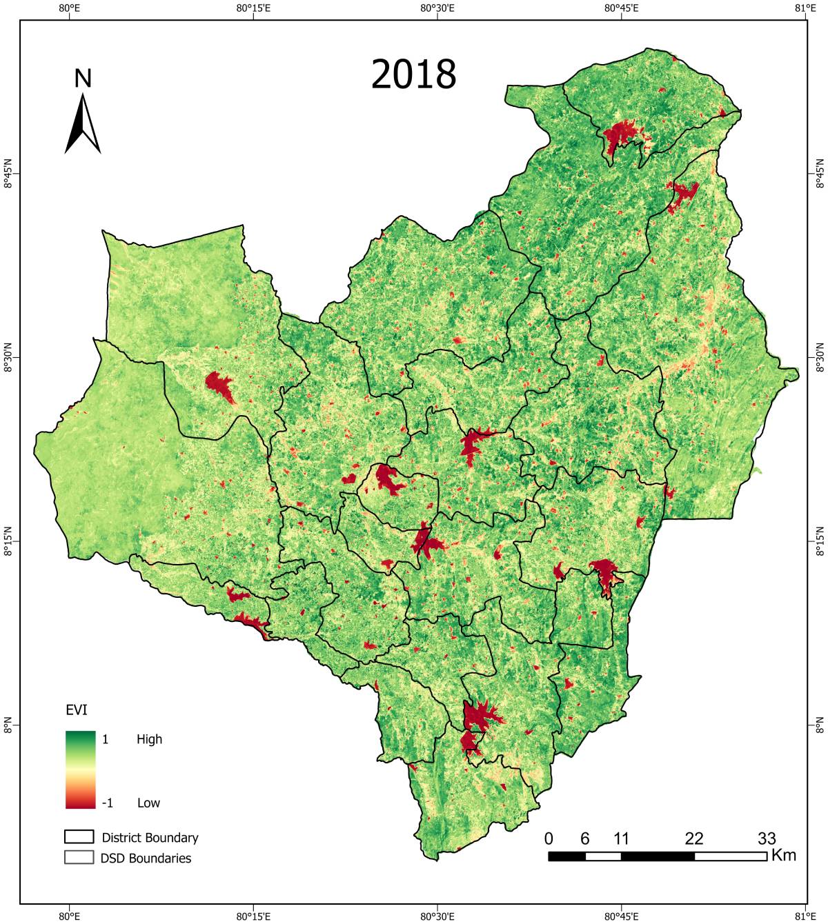
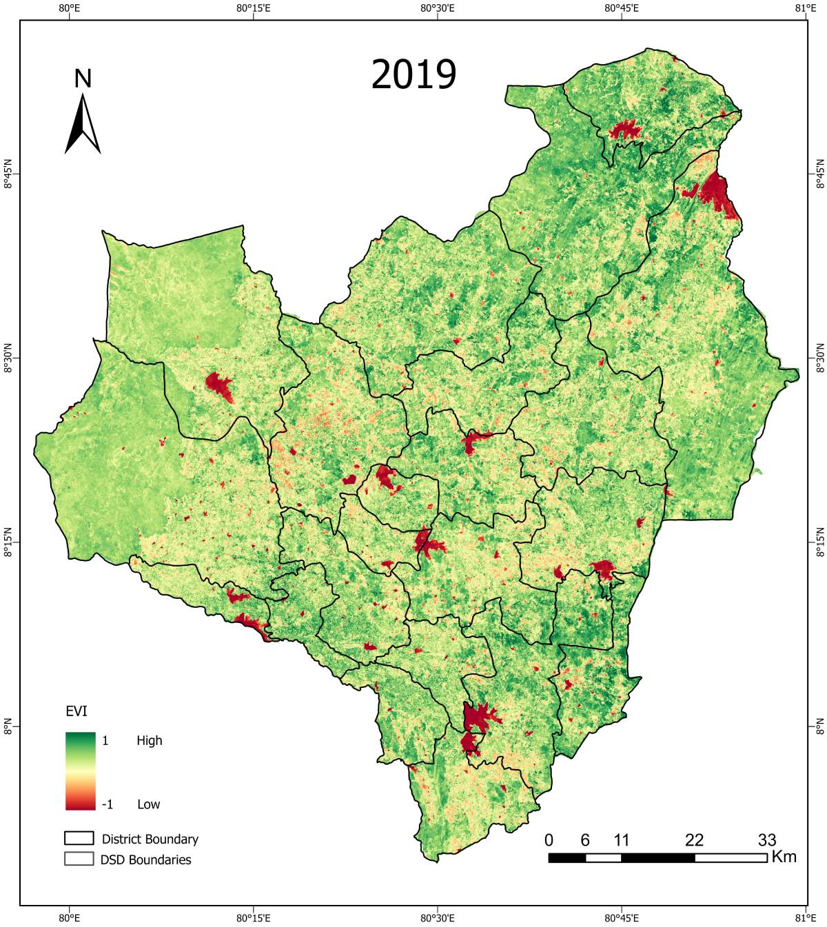
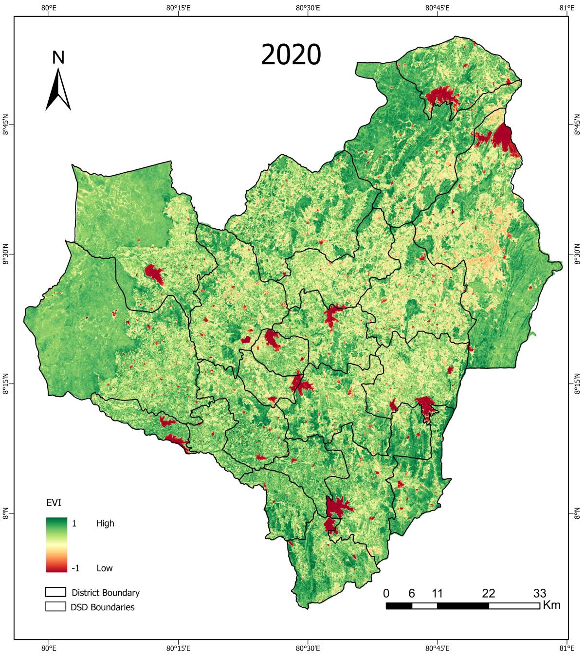
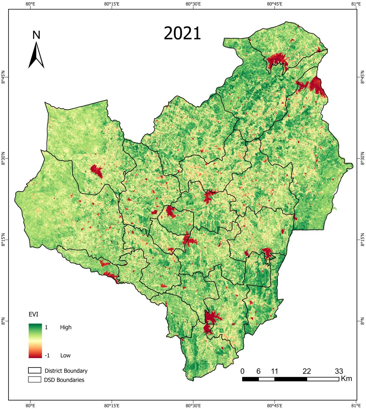
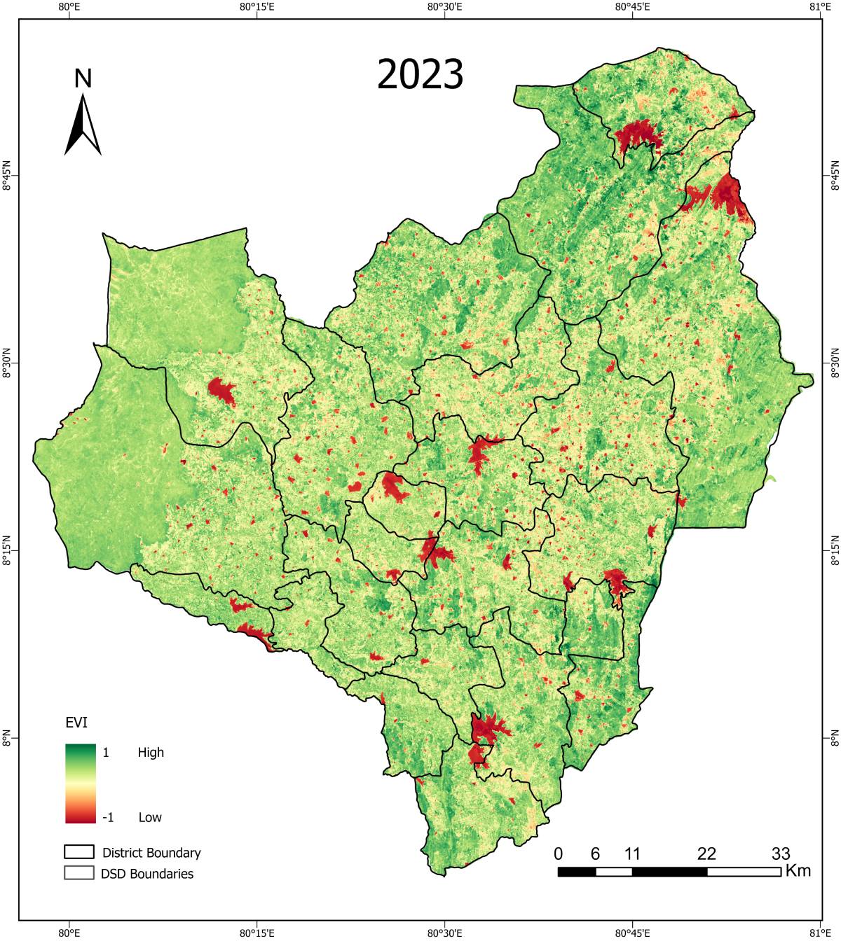
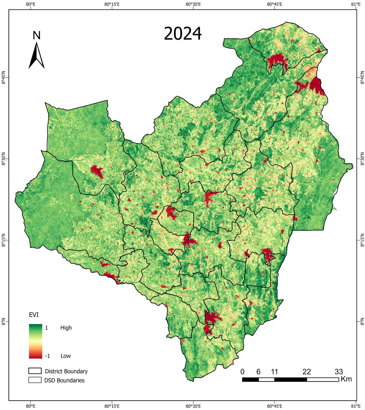
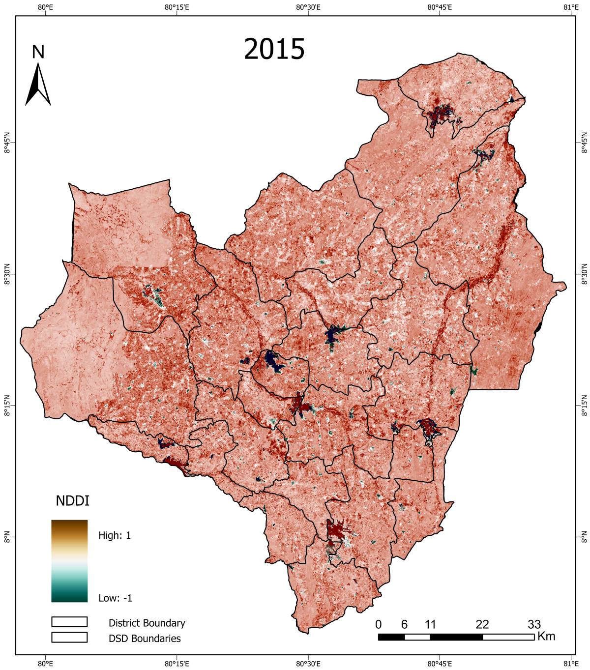
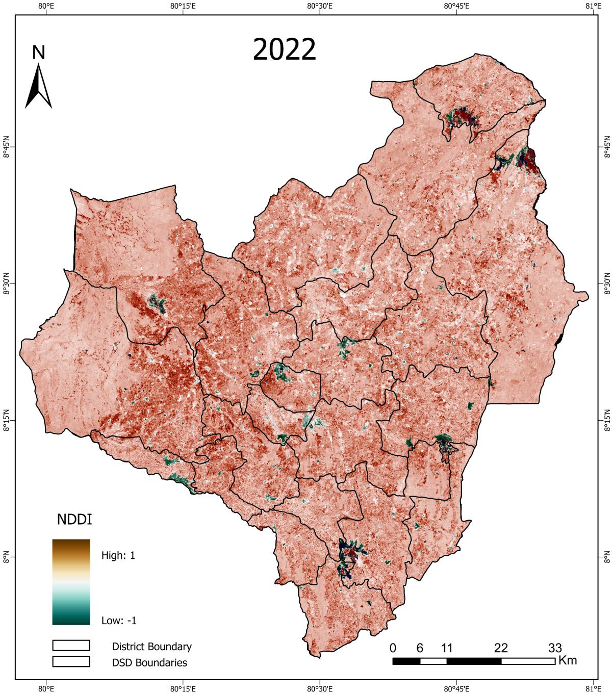
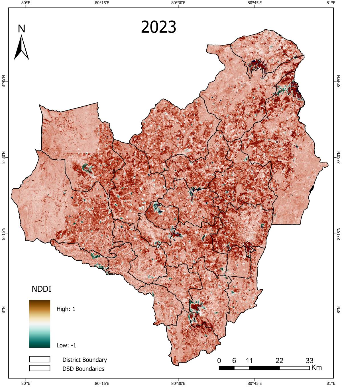
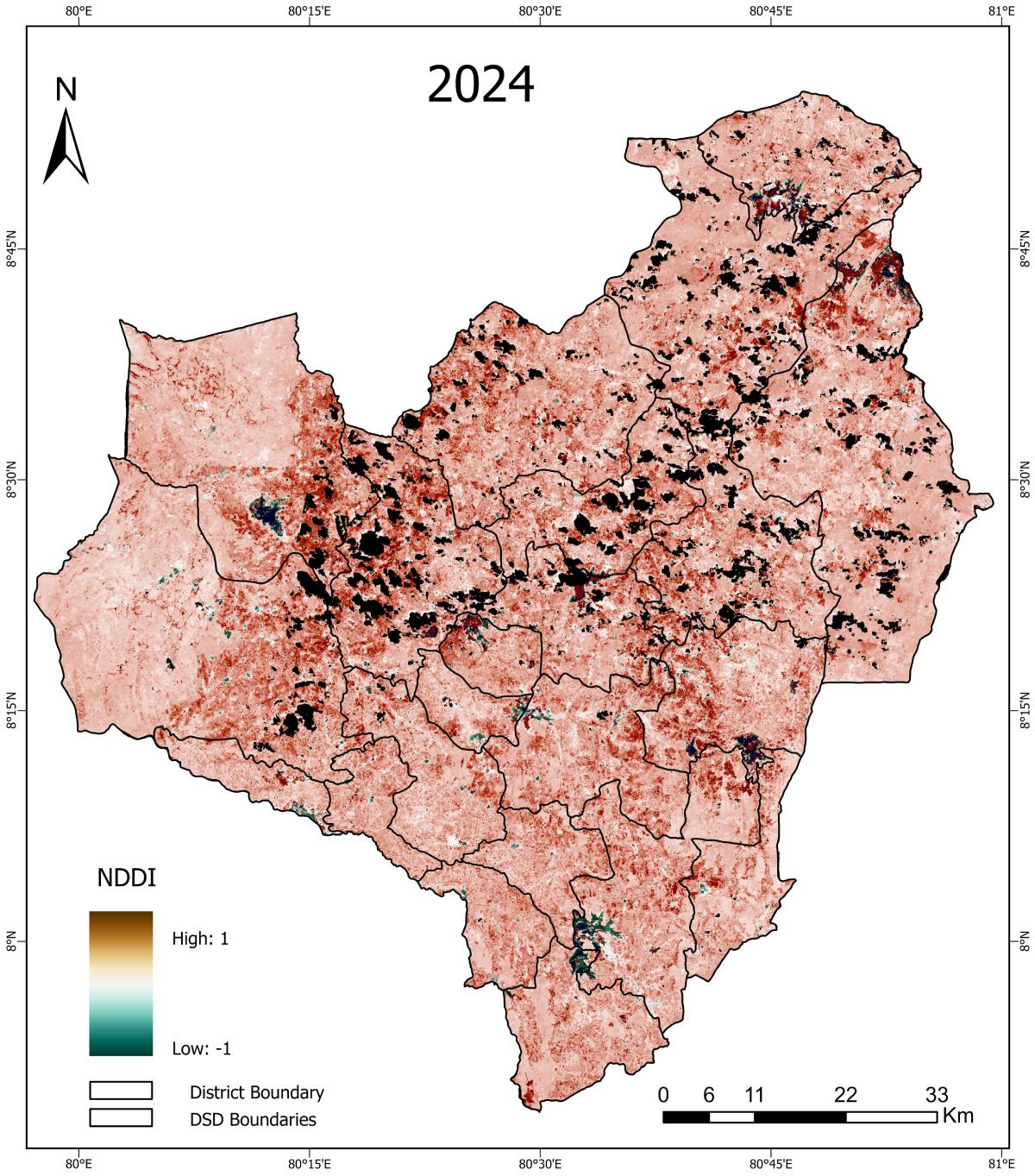
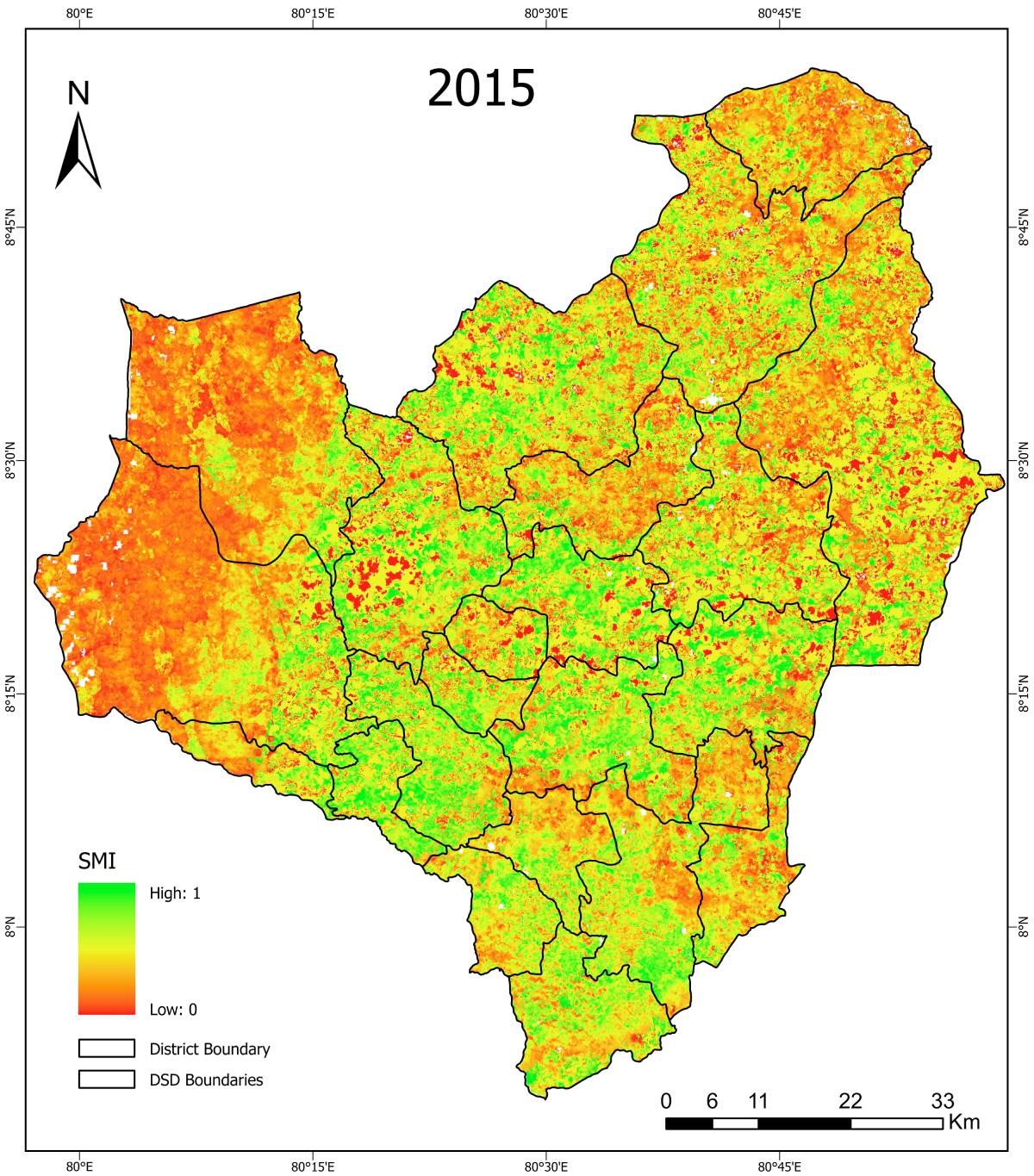
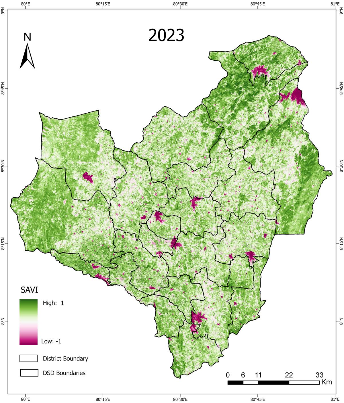
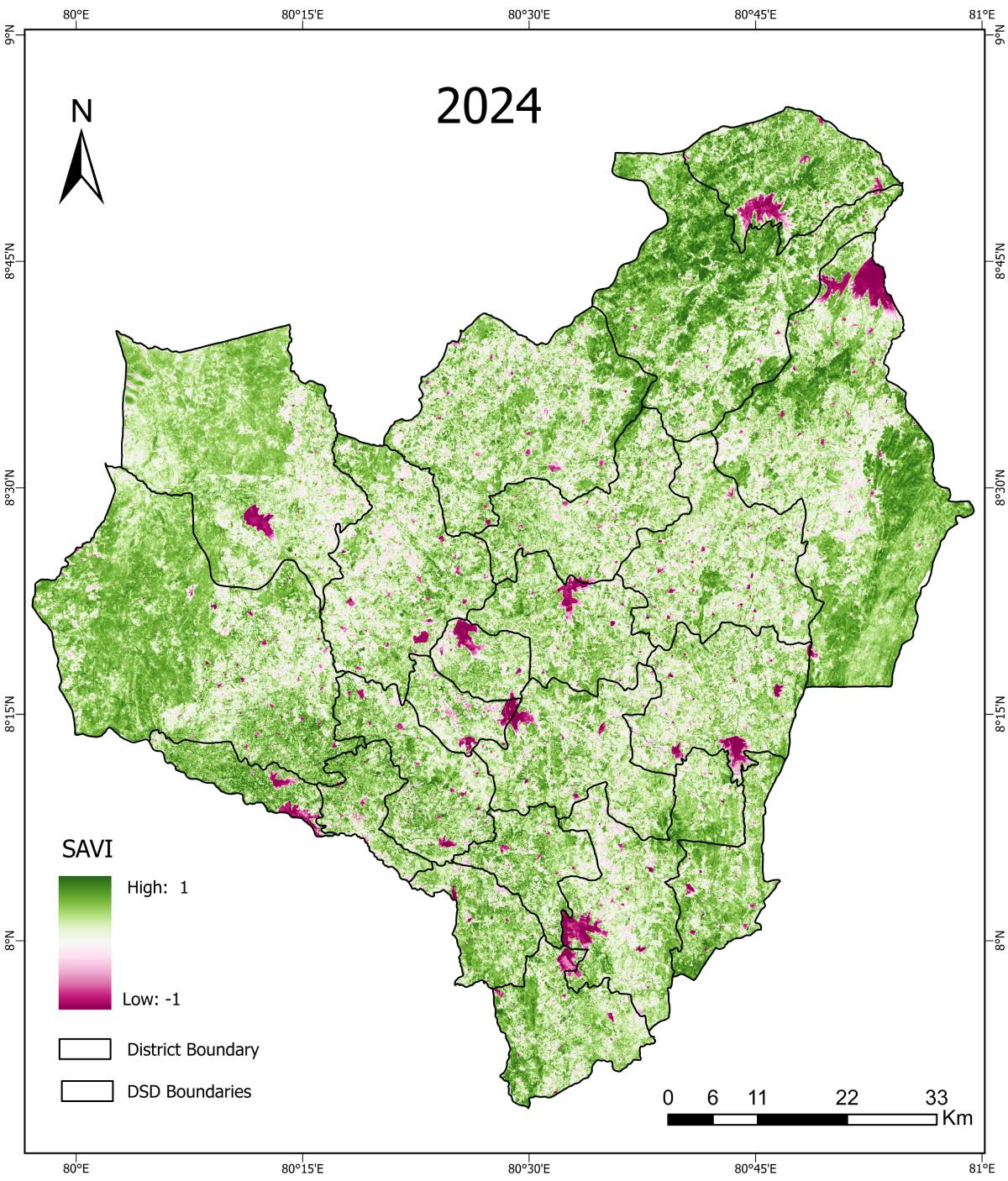
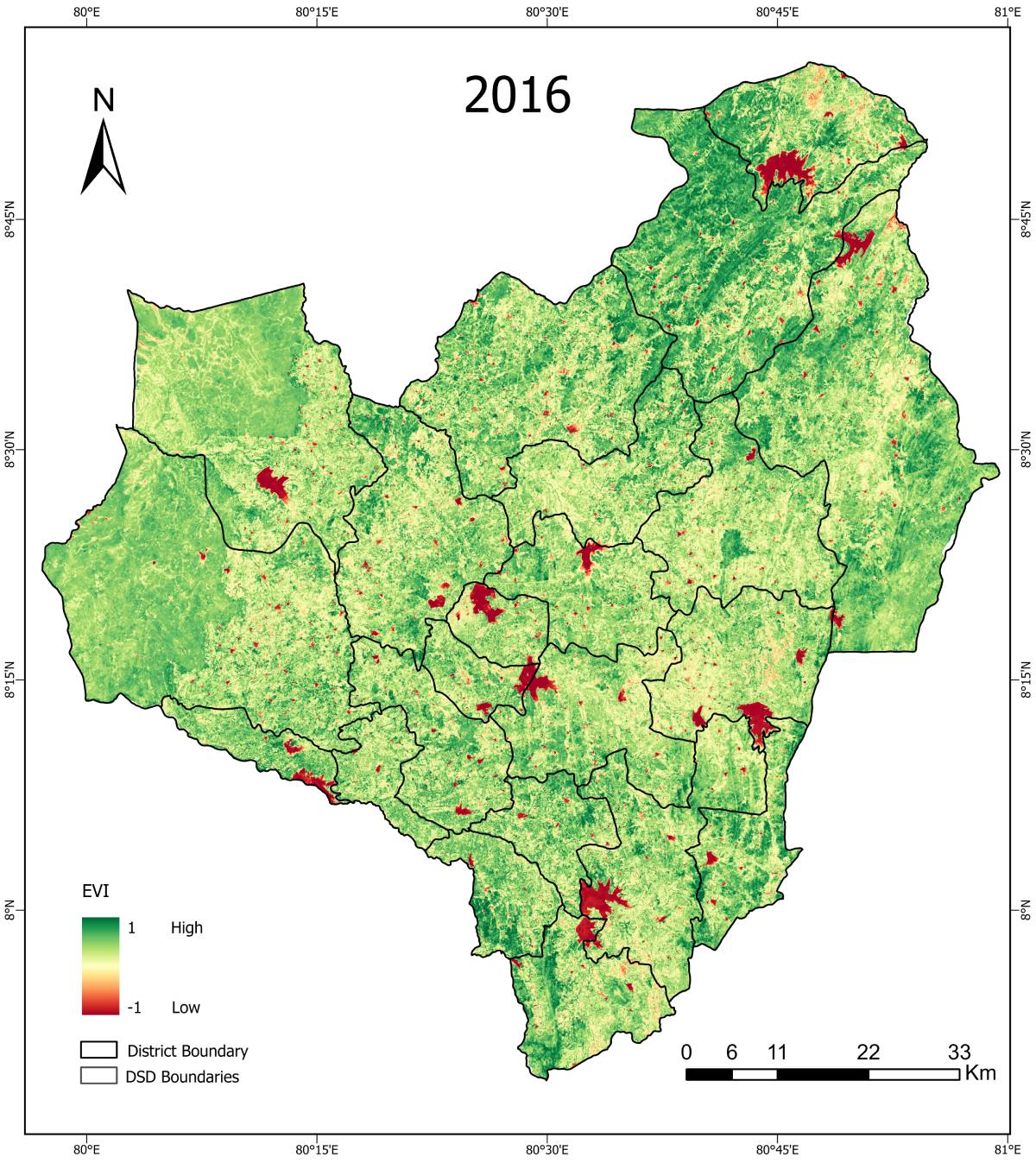
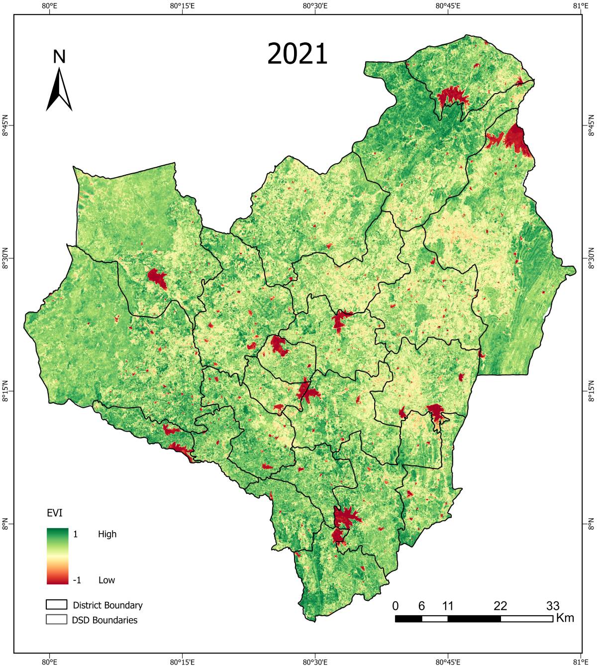
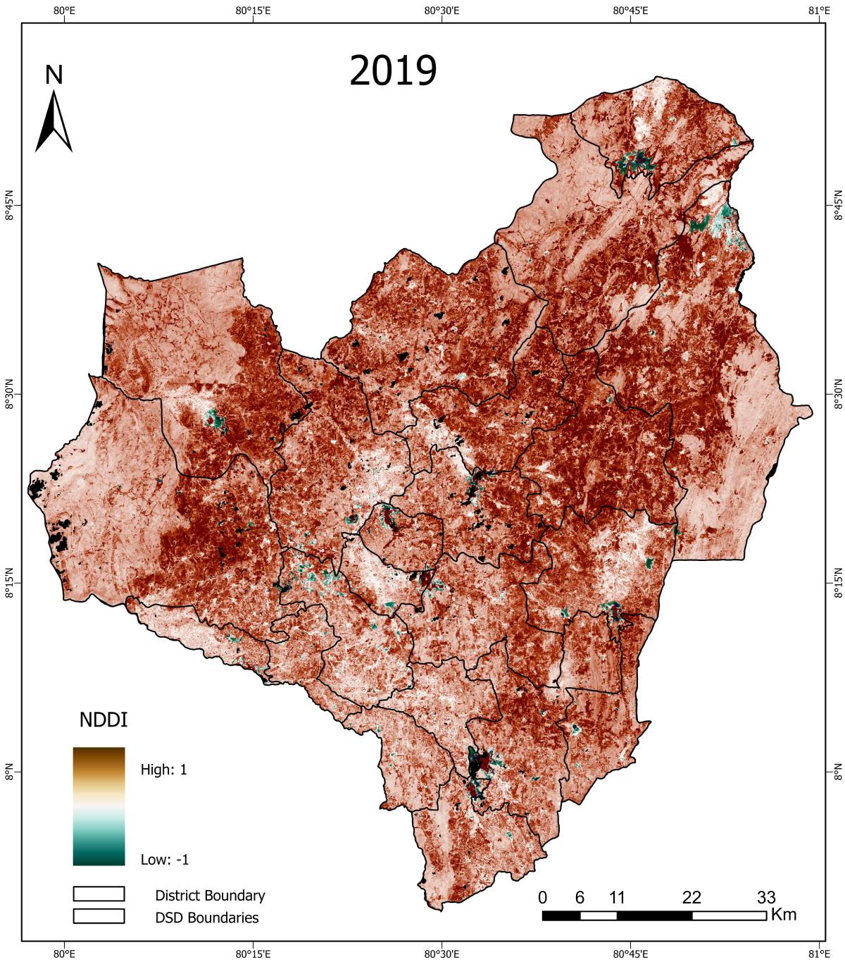
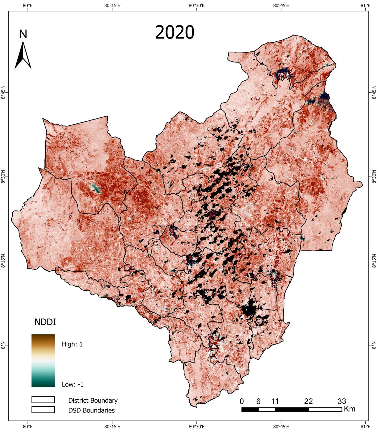
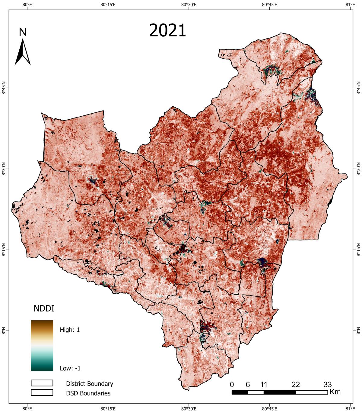
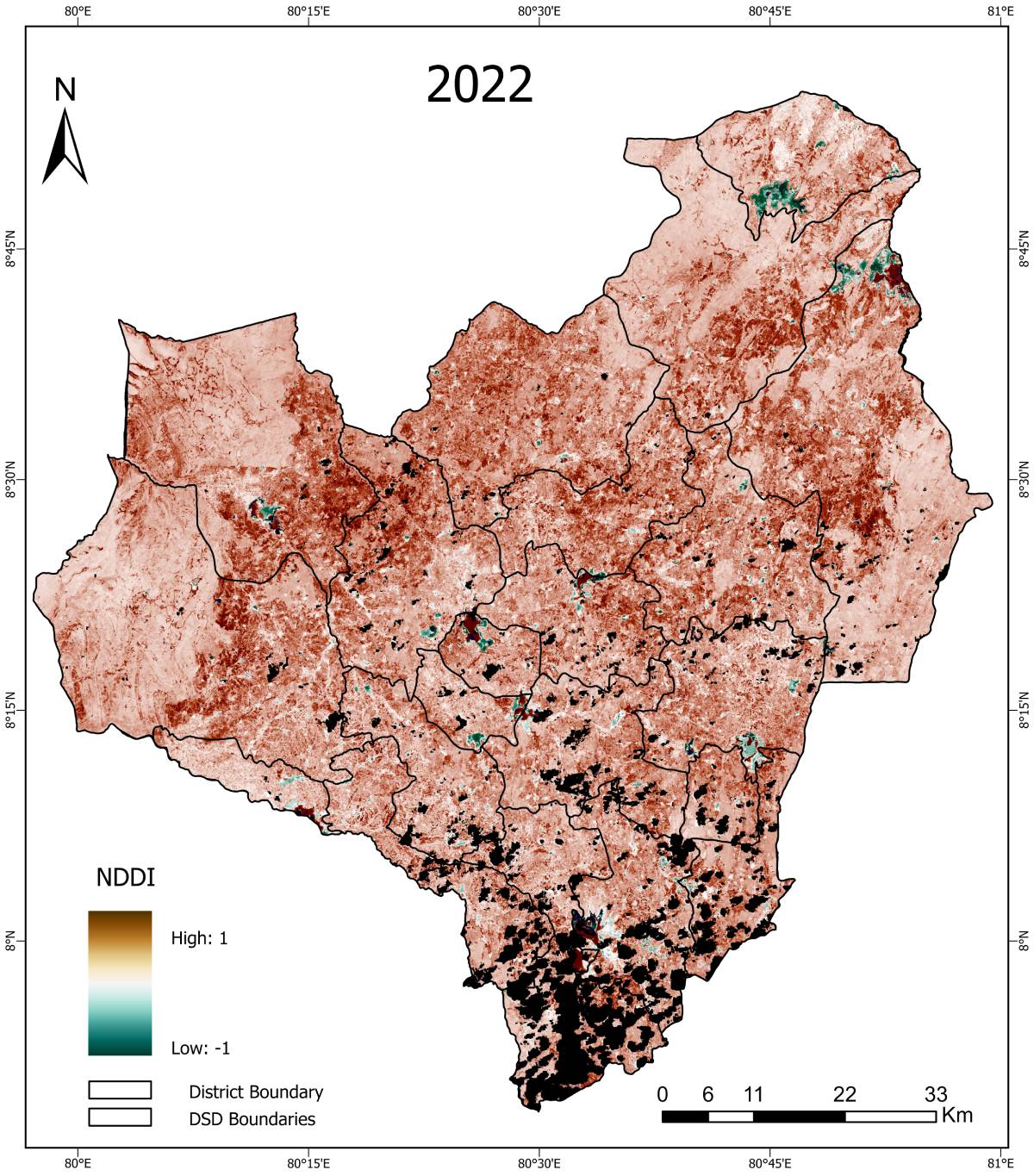
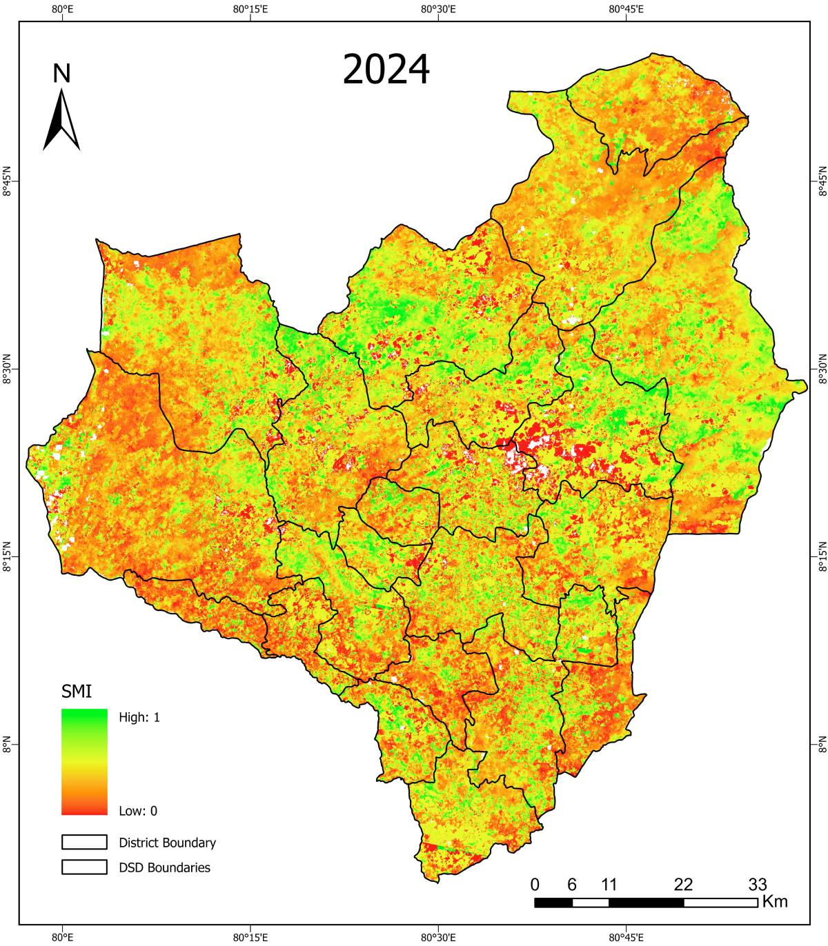
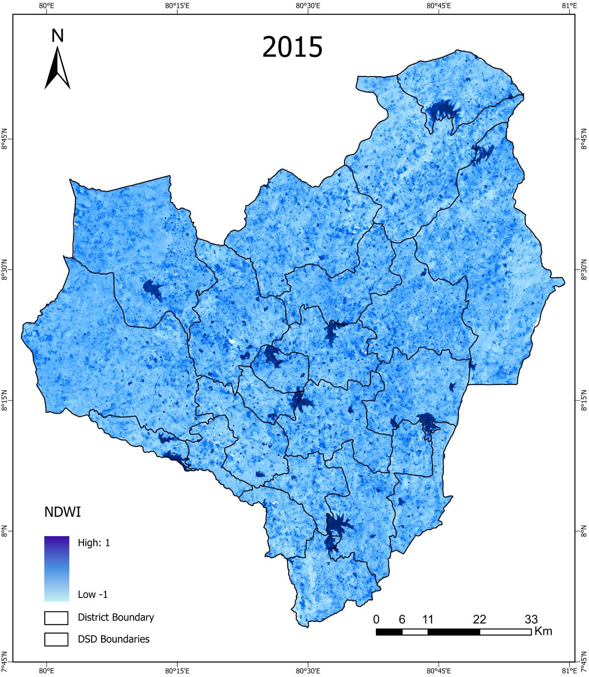
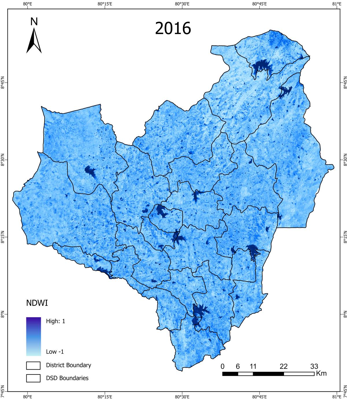
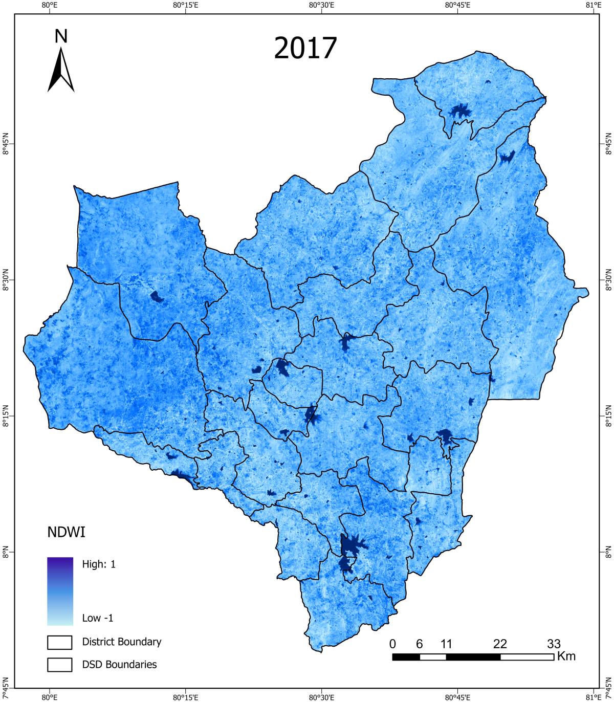
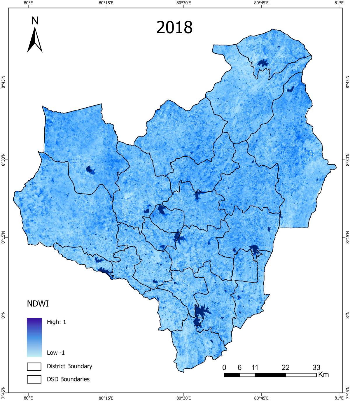
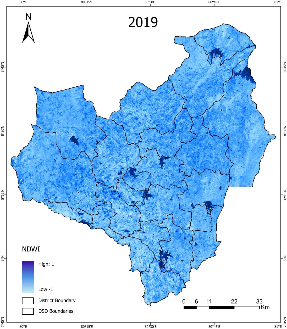
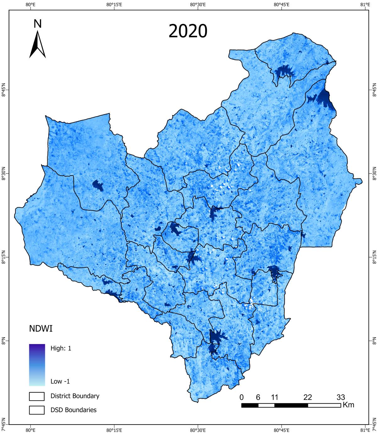
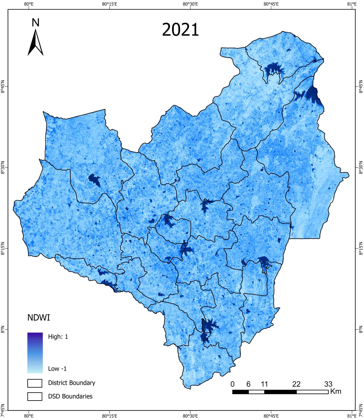
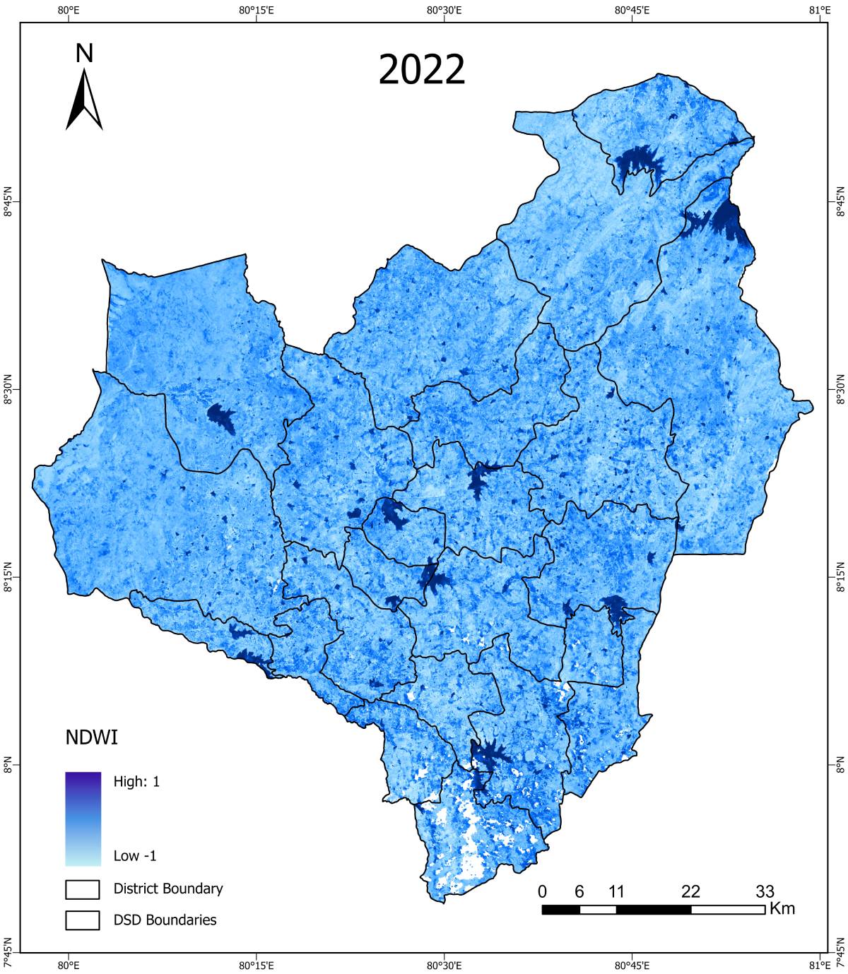
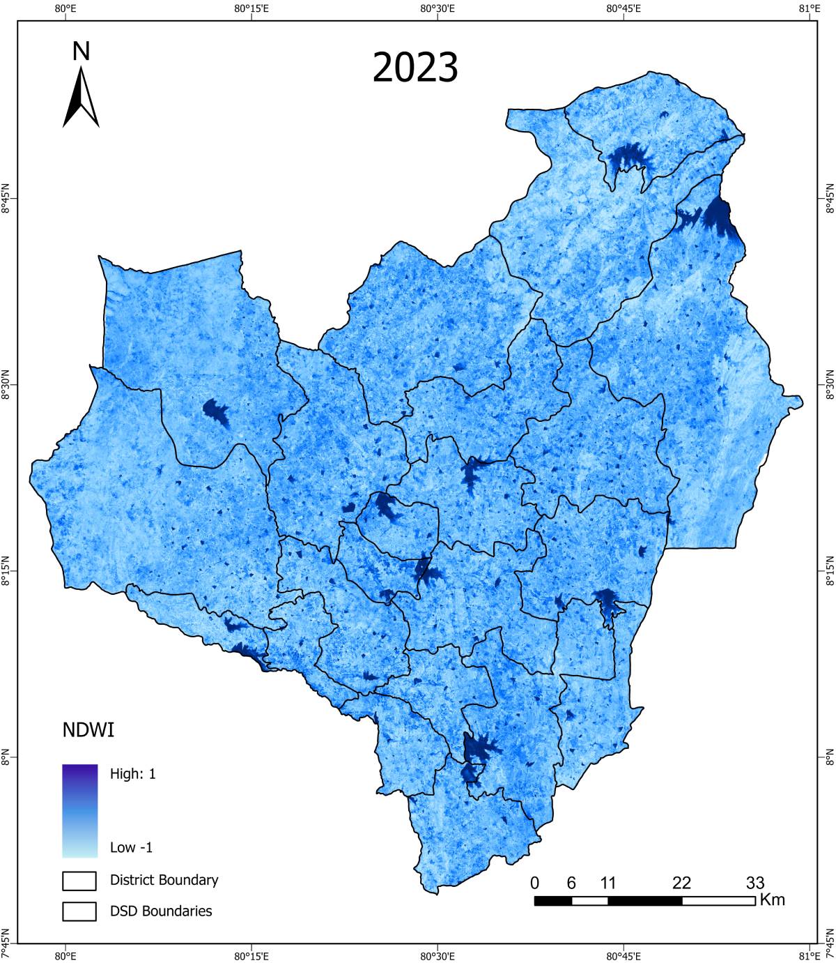
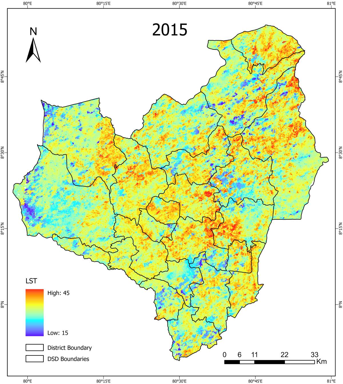
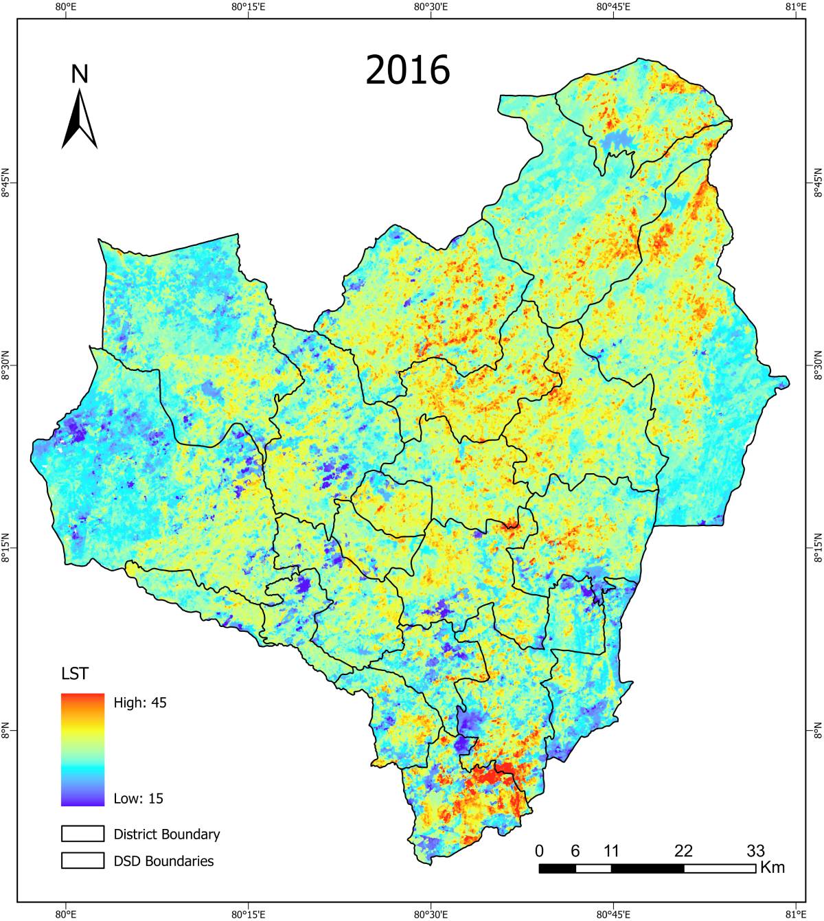
- Vegetation & drought index calculation (NDVI, EVI, SAVI, NDWI, NDDI, LST, SMI)
- Rainfall, soil, slope, and irrigation data integration
- Land use / land cover classification
- Derivation of biophysical indicators
- Reclassification and weighted overlay analysis (AHP-based)
- CSA suitability mapping for Maha & Yala seasons
Environmental & Biophysical Factors
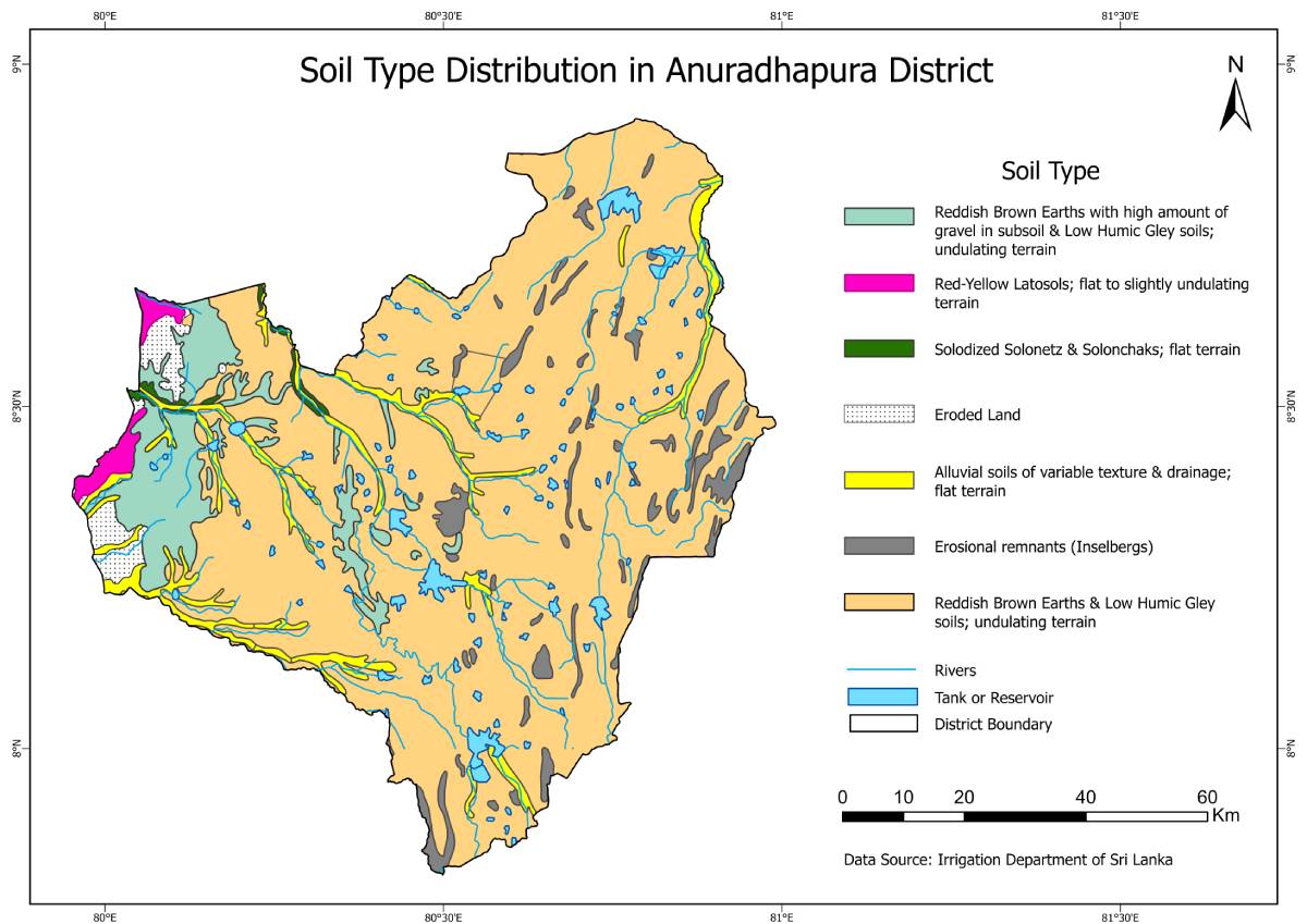
Soil Type Distribution
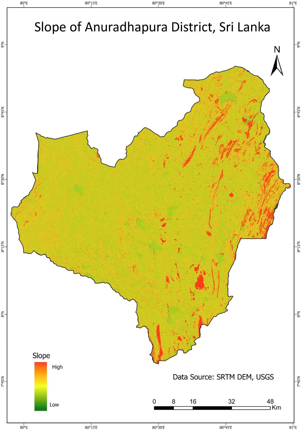
Slope Analysis
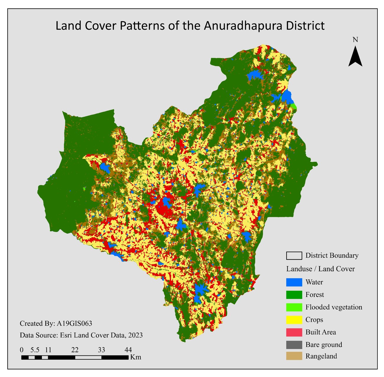
Land Use & Agricultural Landscape
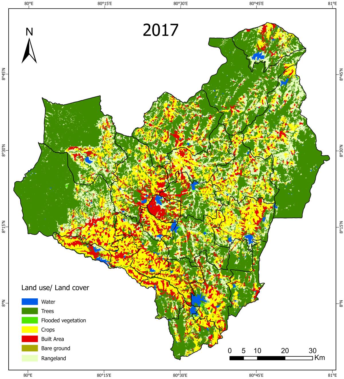
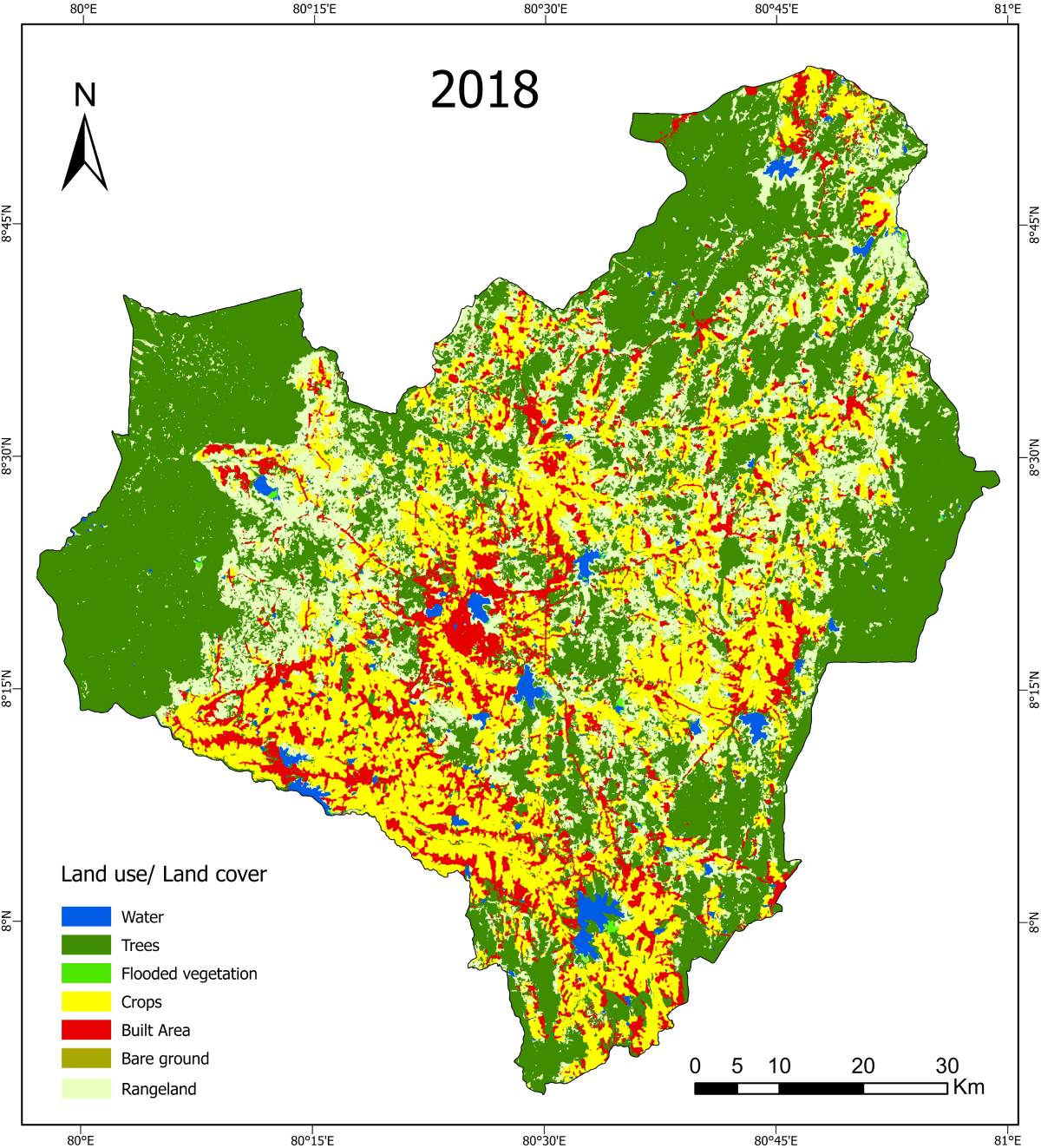
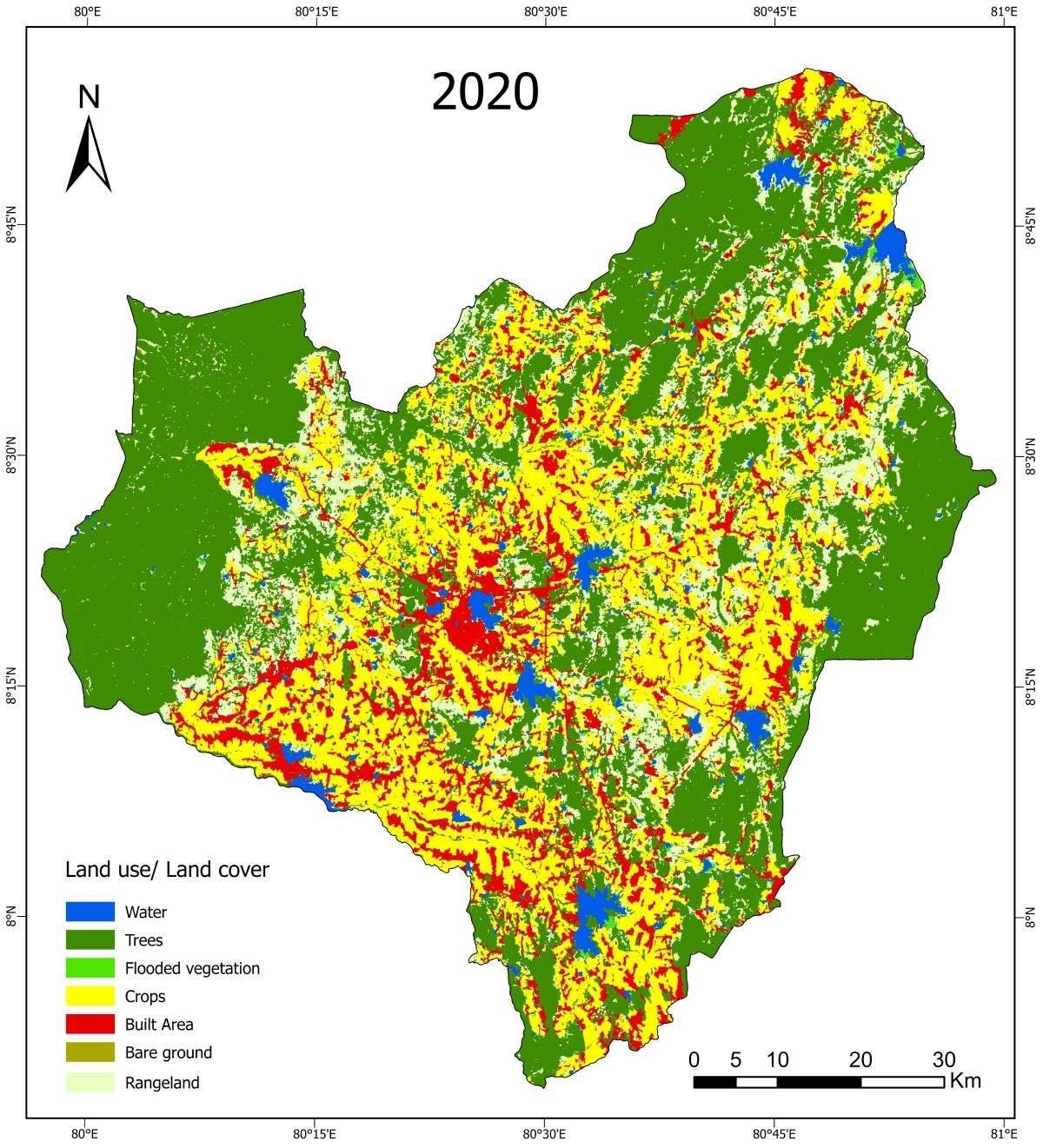
Land Use / Land Cover Maps


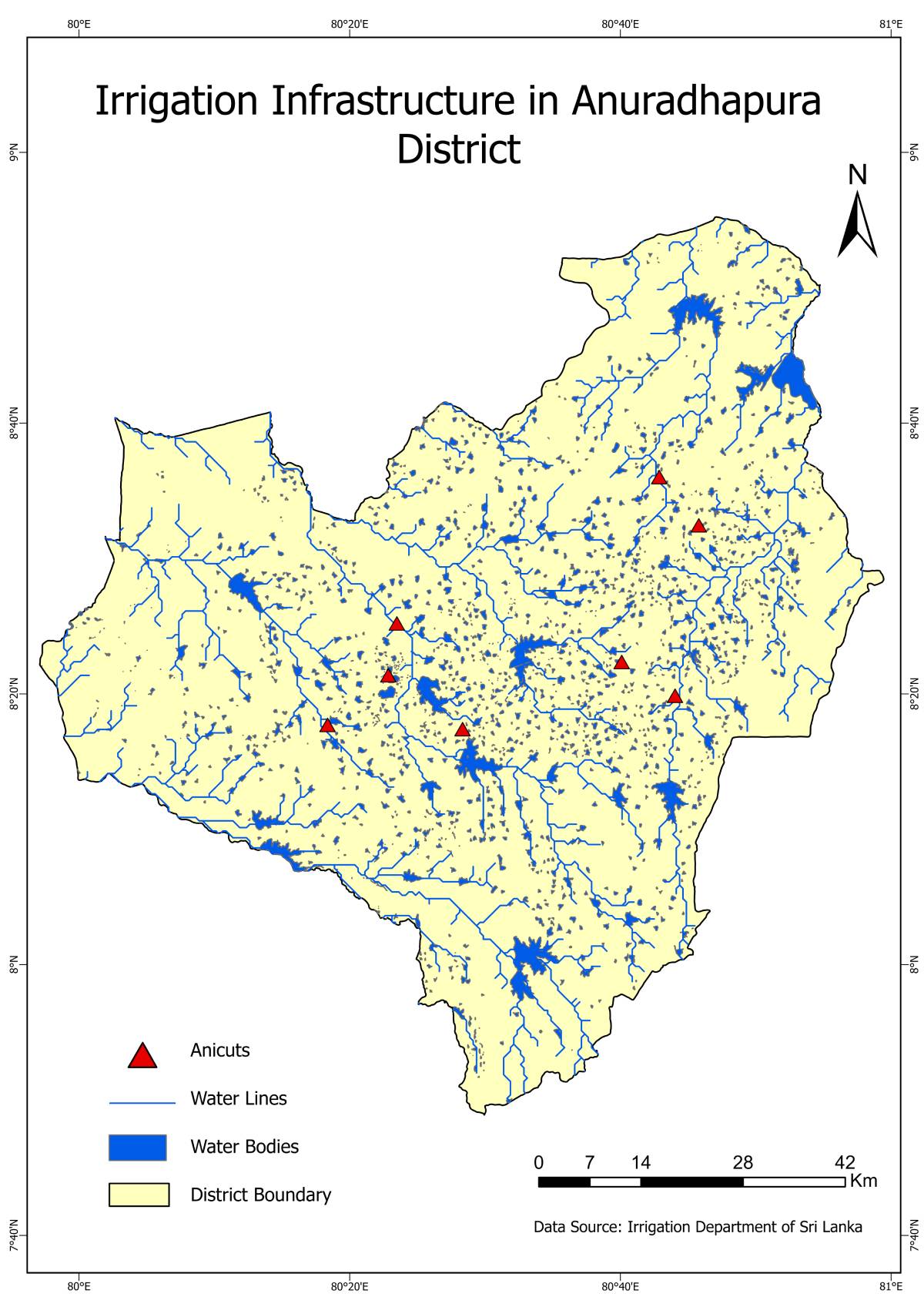
Irrigation & Water Infrastructure
Irrigation Network
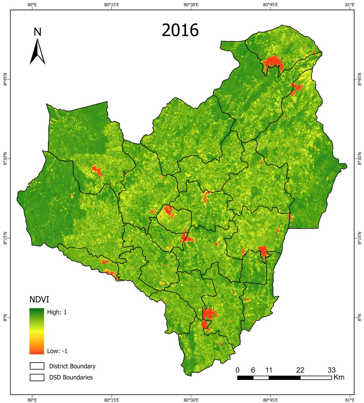
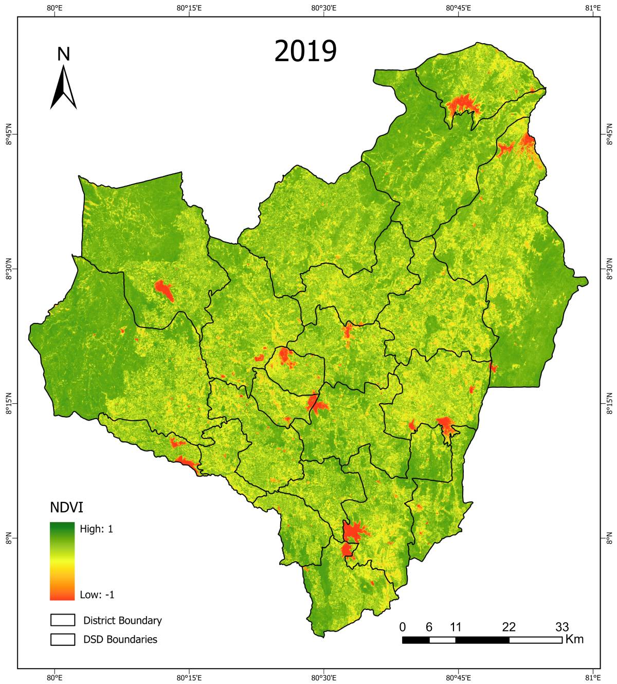
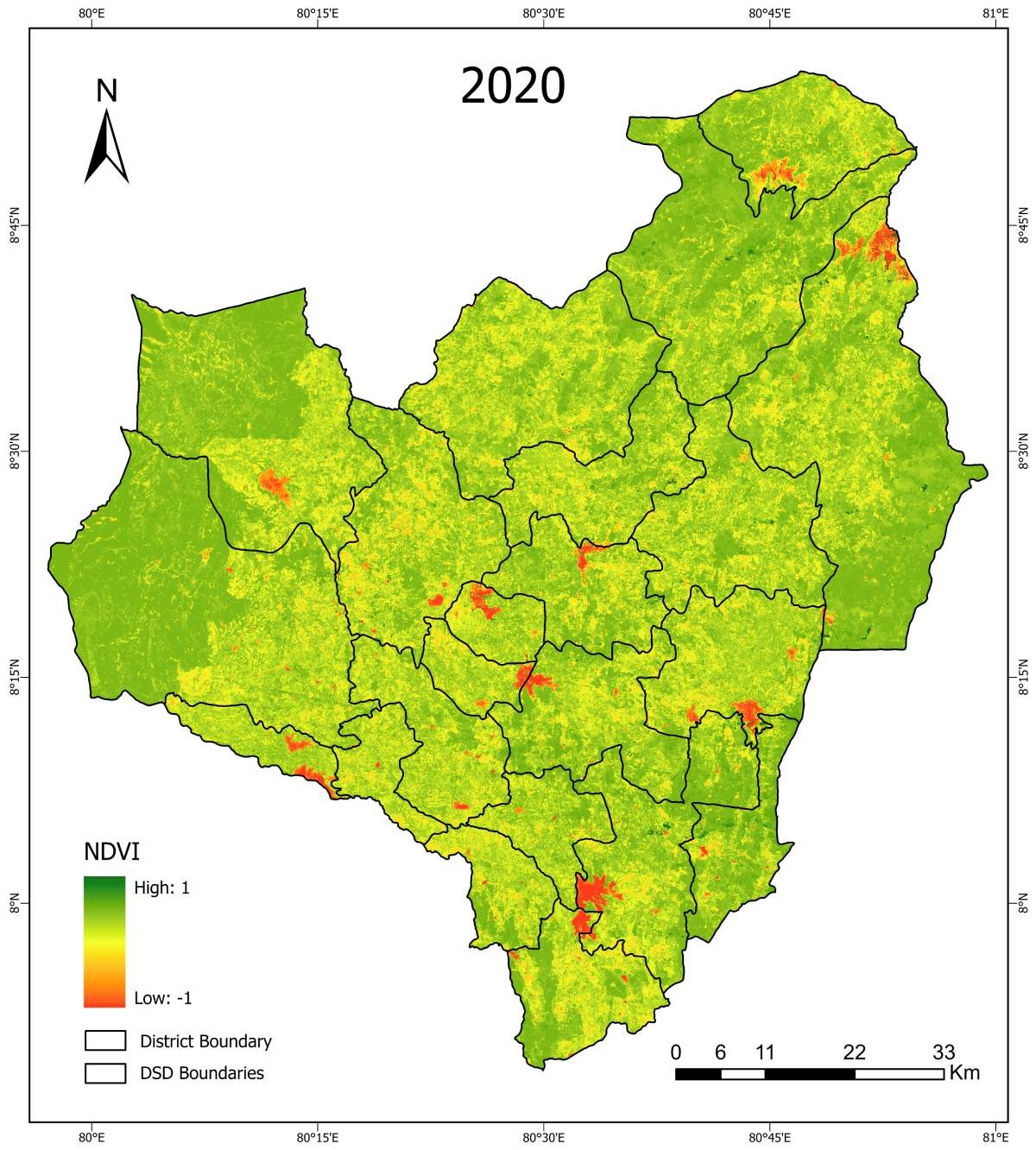
Drought & Vegetation Analysis
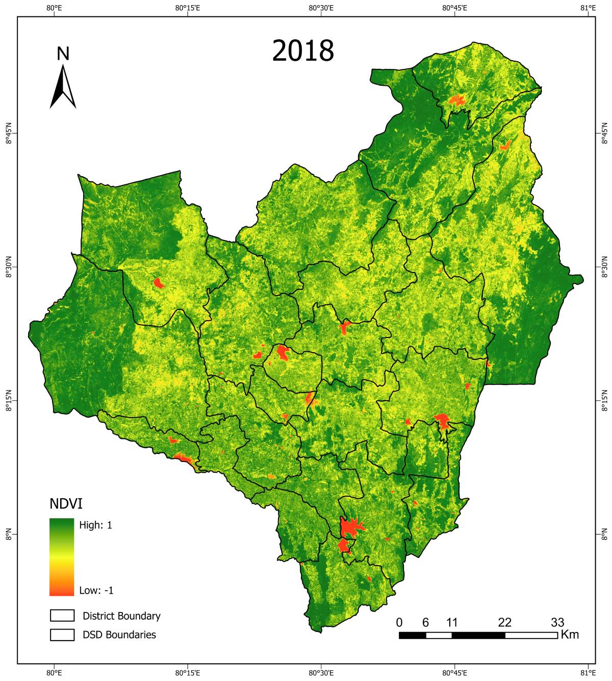
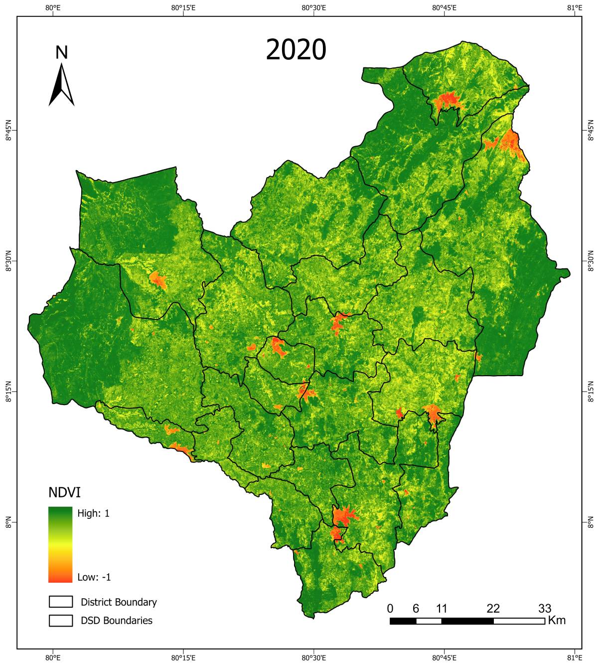
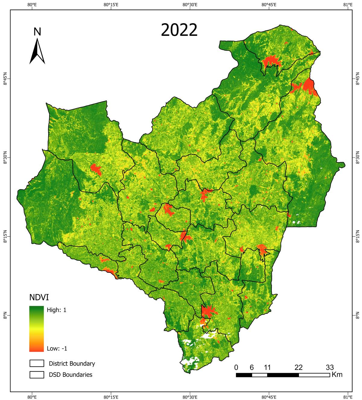
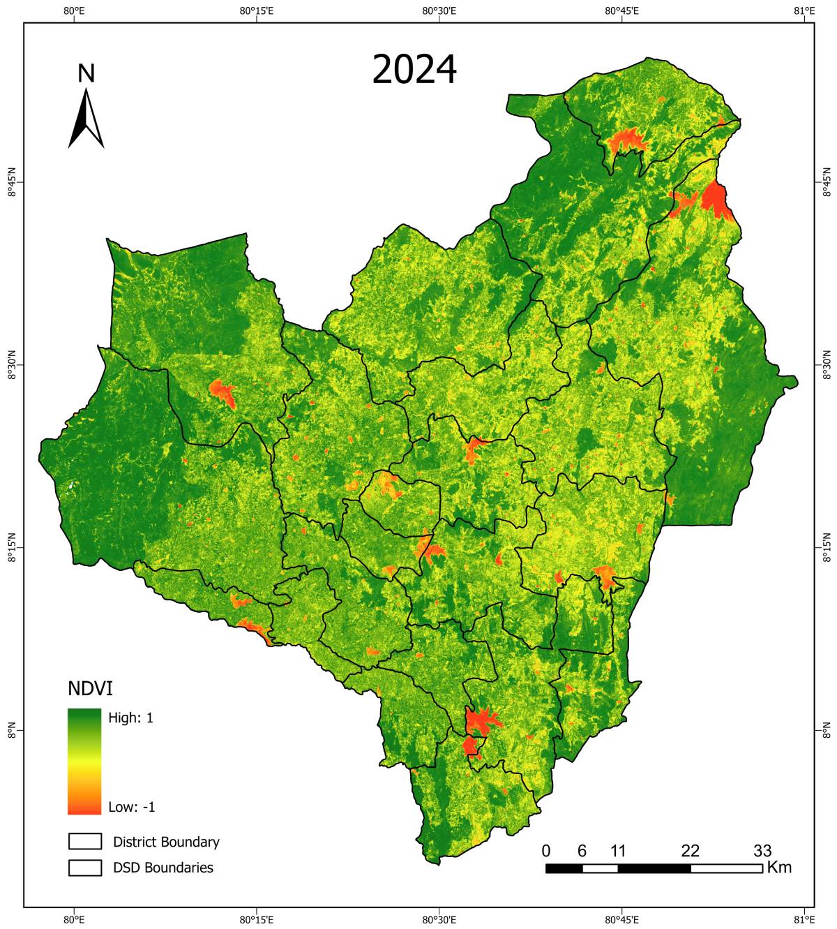
Maha Season (2015–2024)
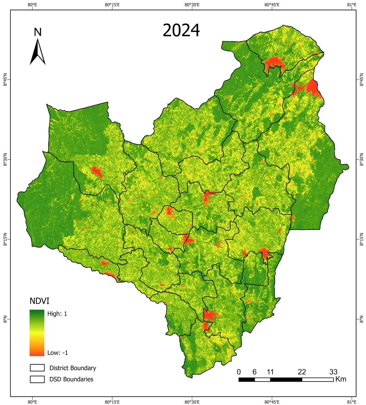
NDVI (Normalised Difference Vegetation Index) – Maha Season


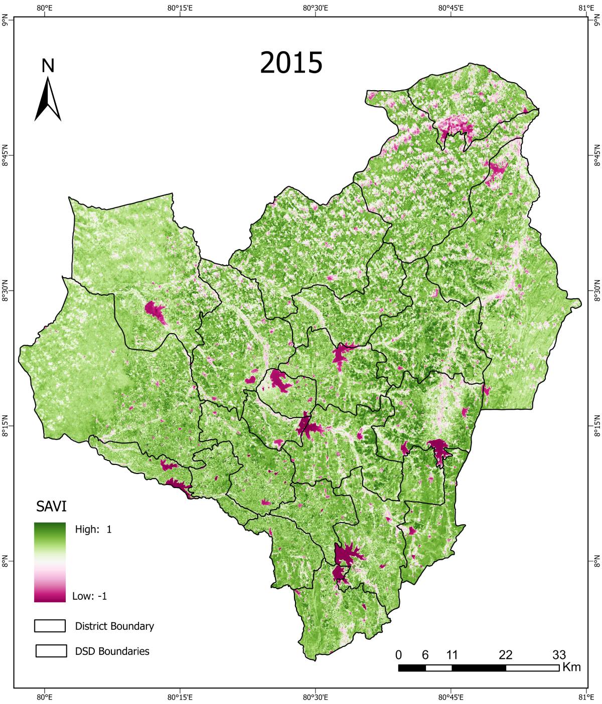
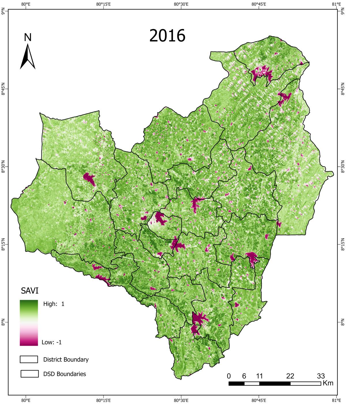
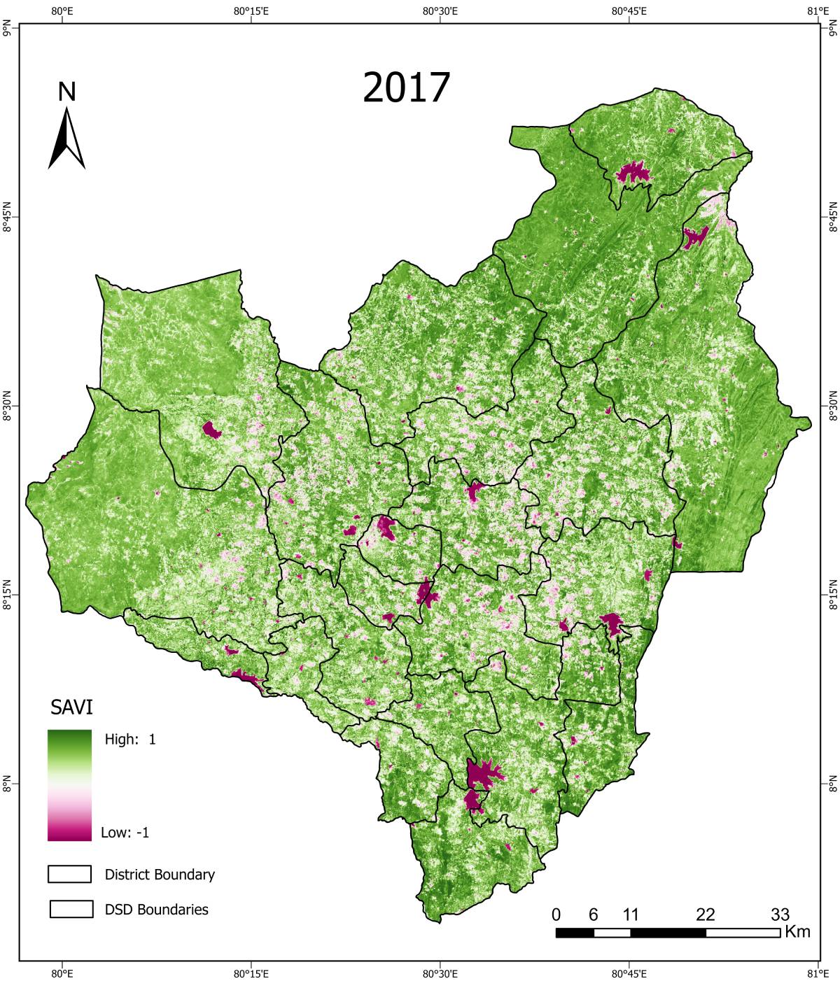
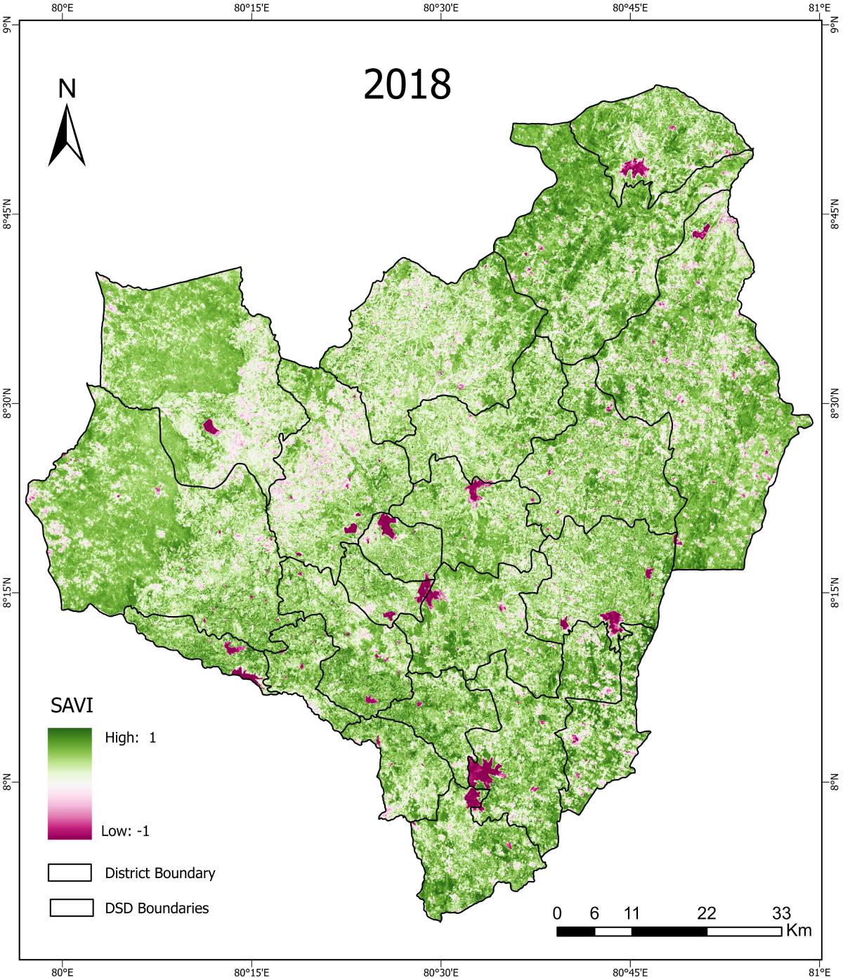
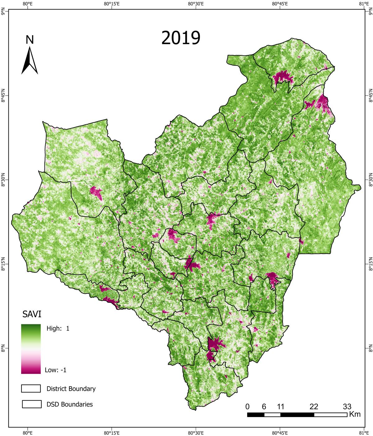
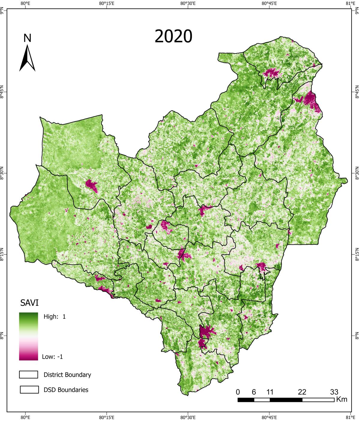
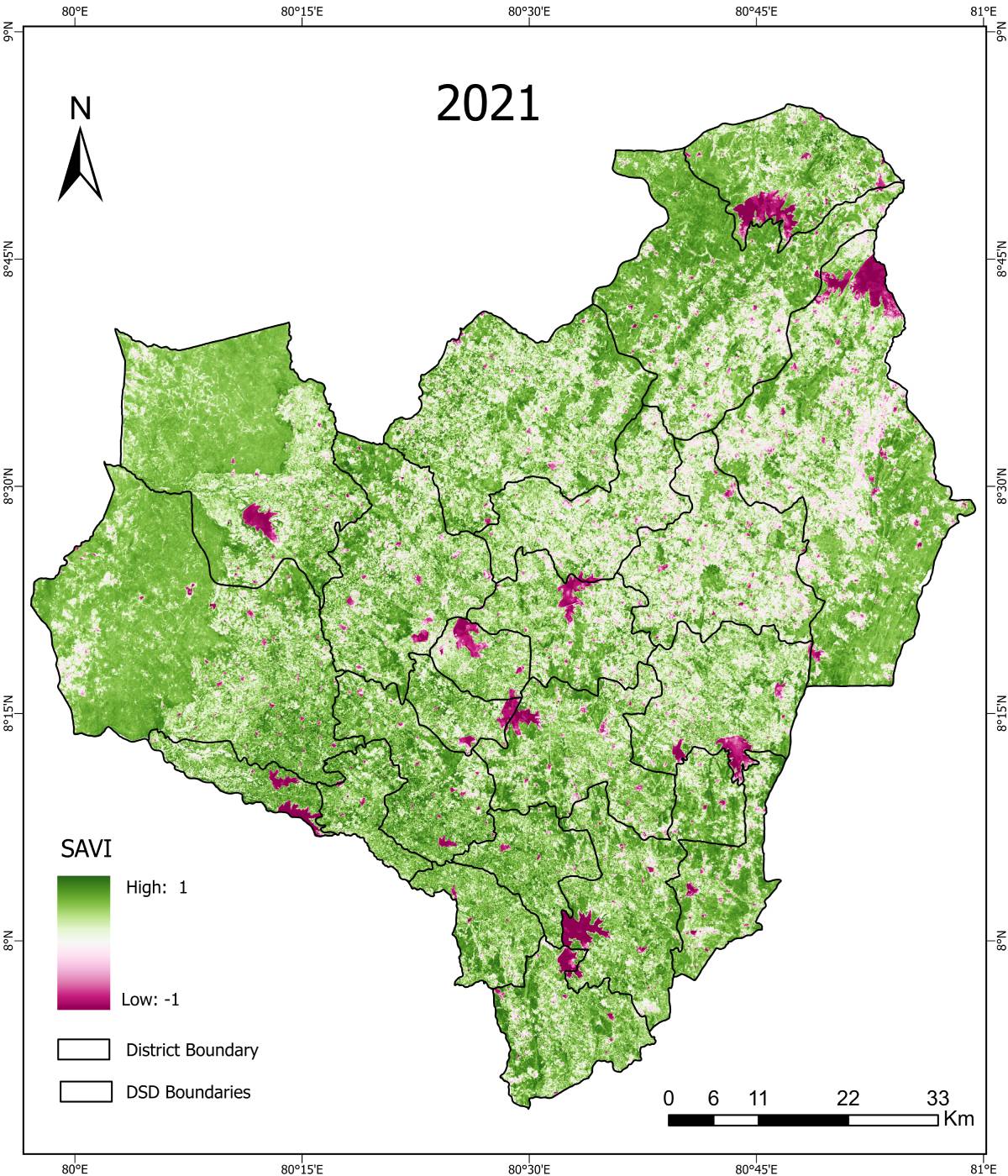
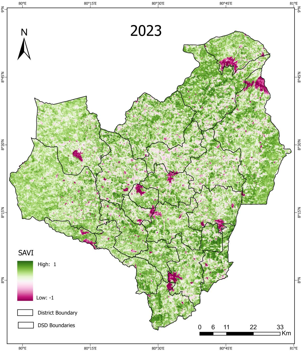
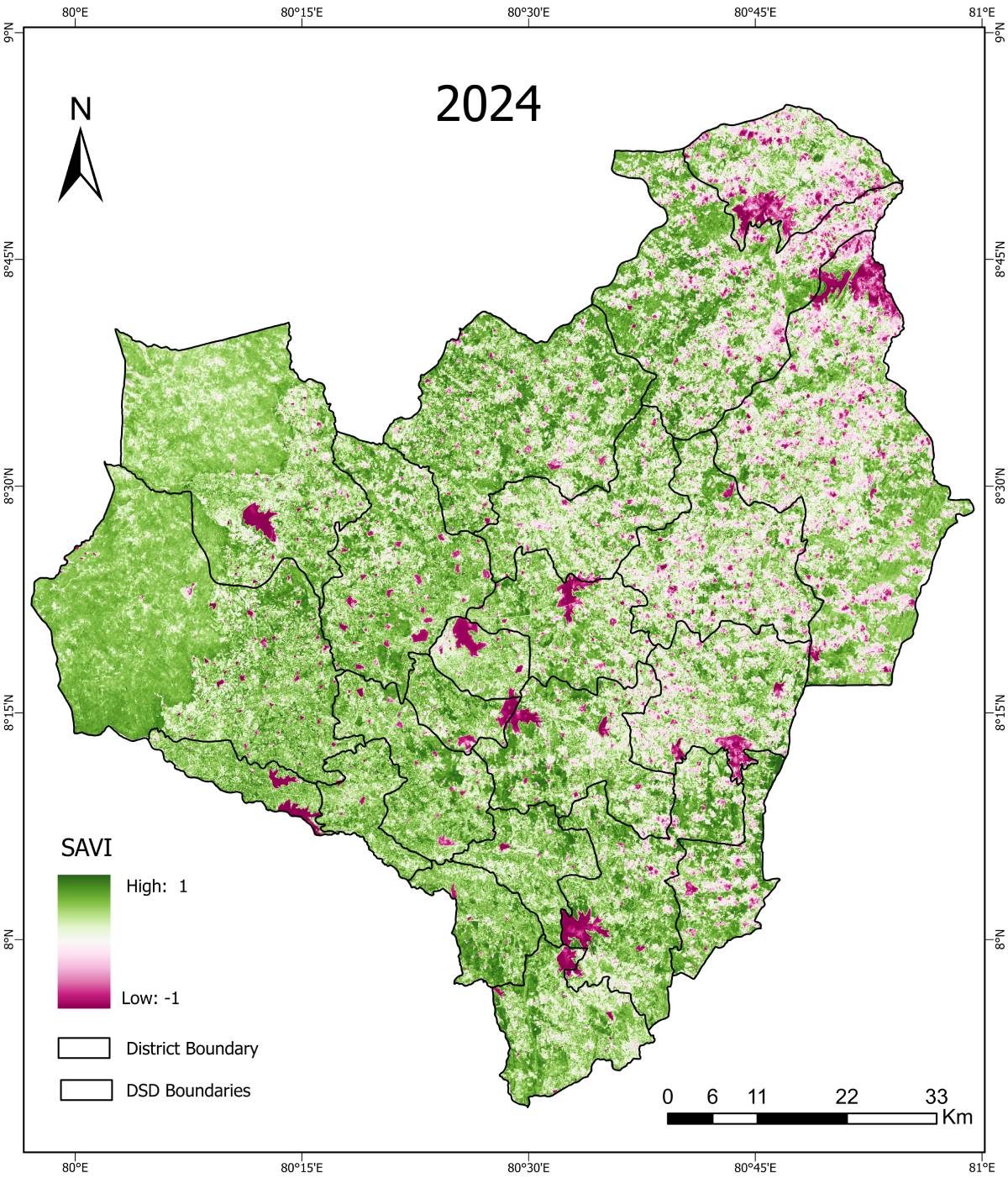
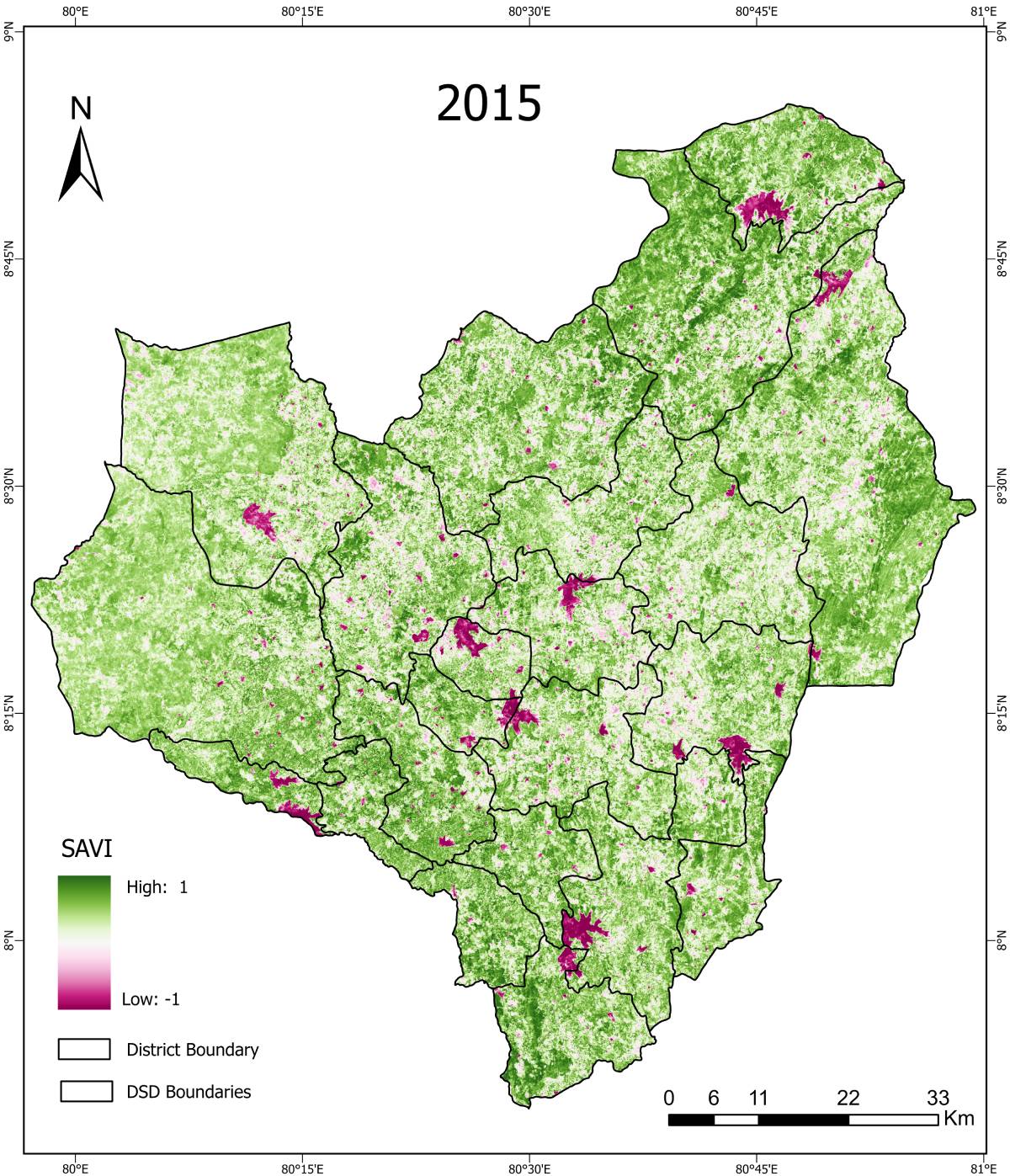
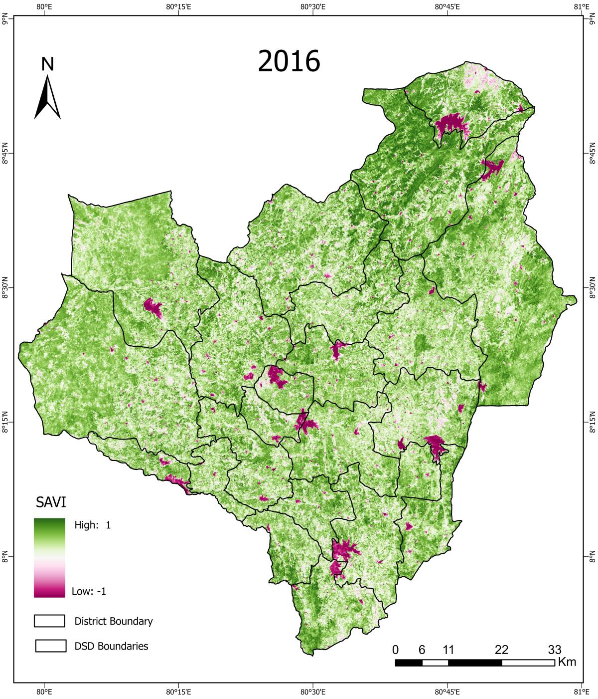
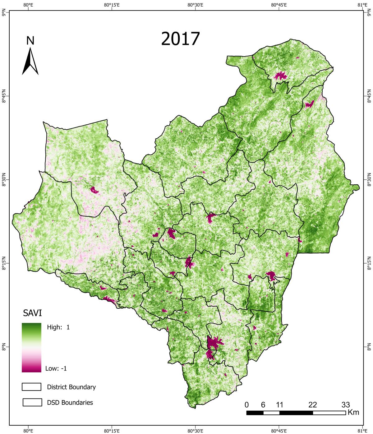
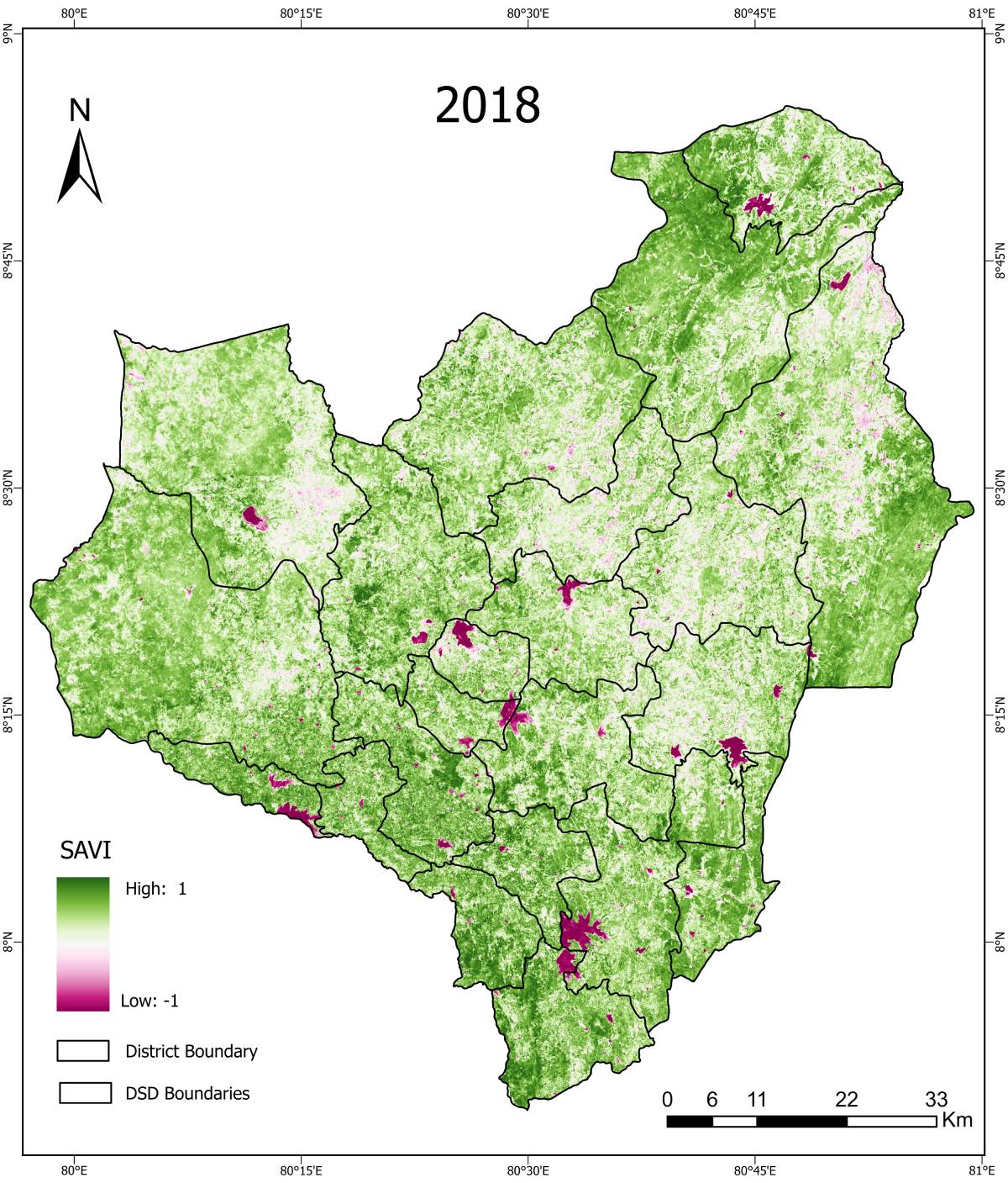
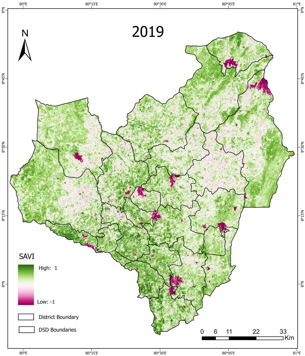
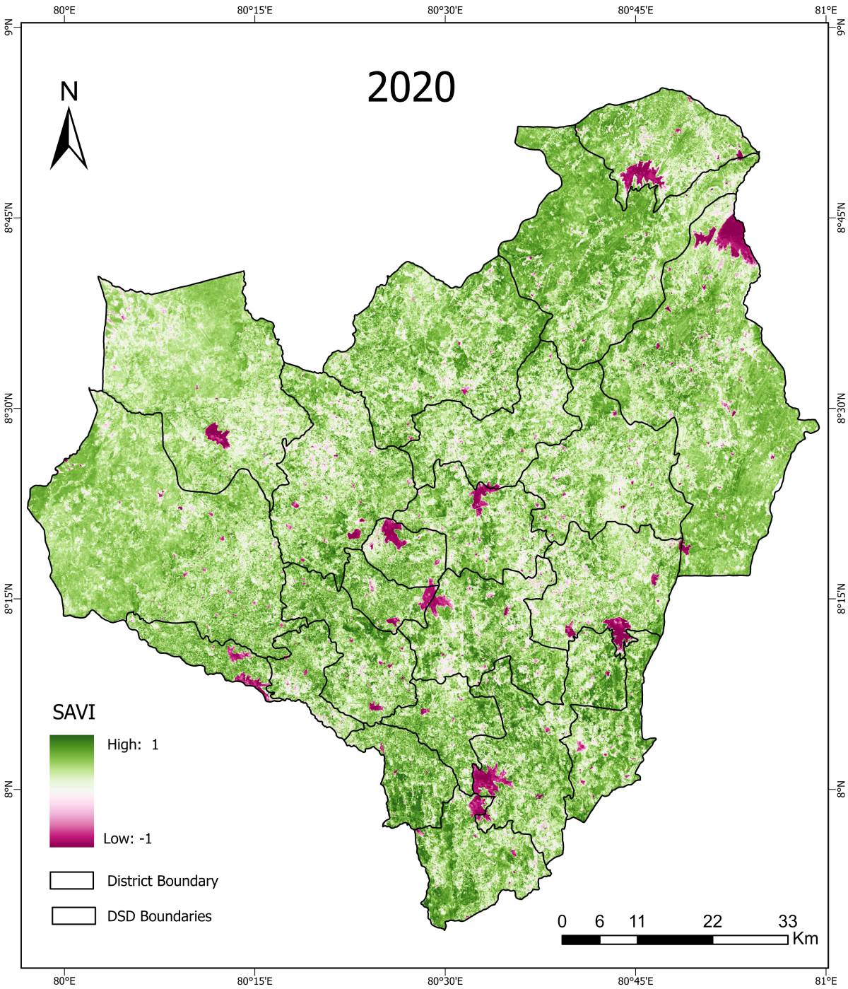
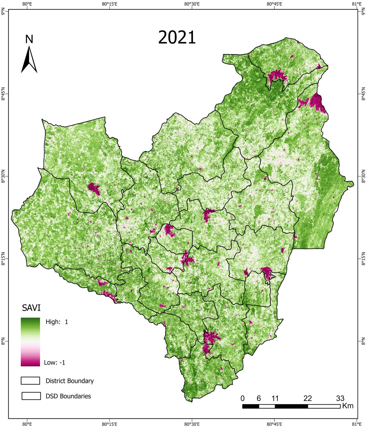
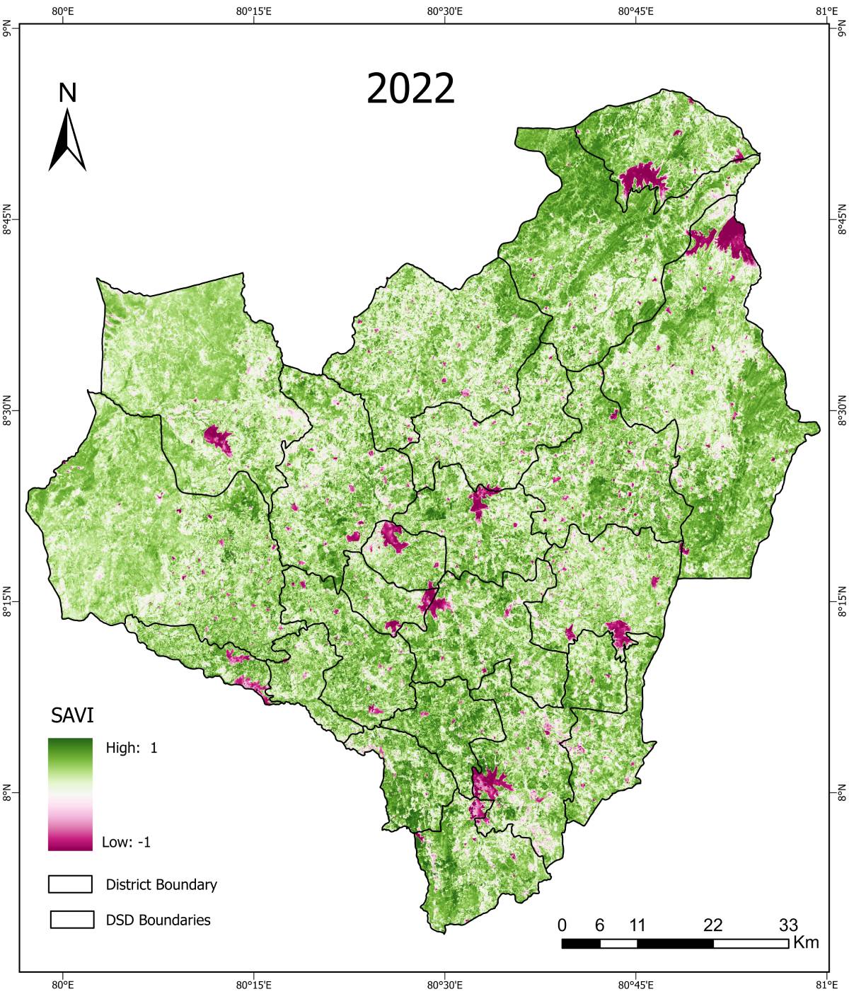
SAVI (Soil Adjusted Vegetation Index) – Maha Season

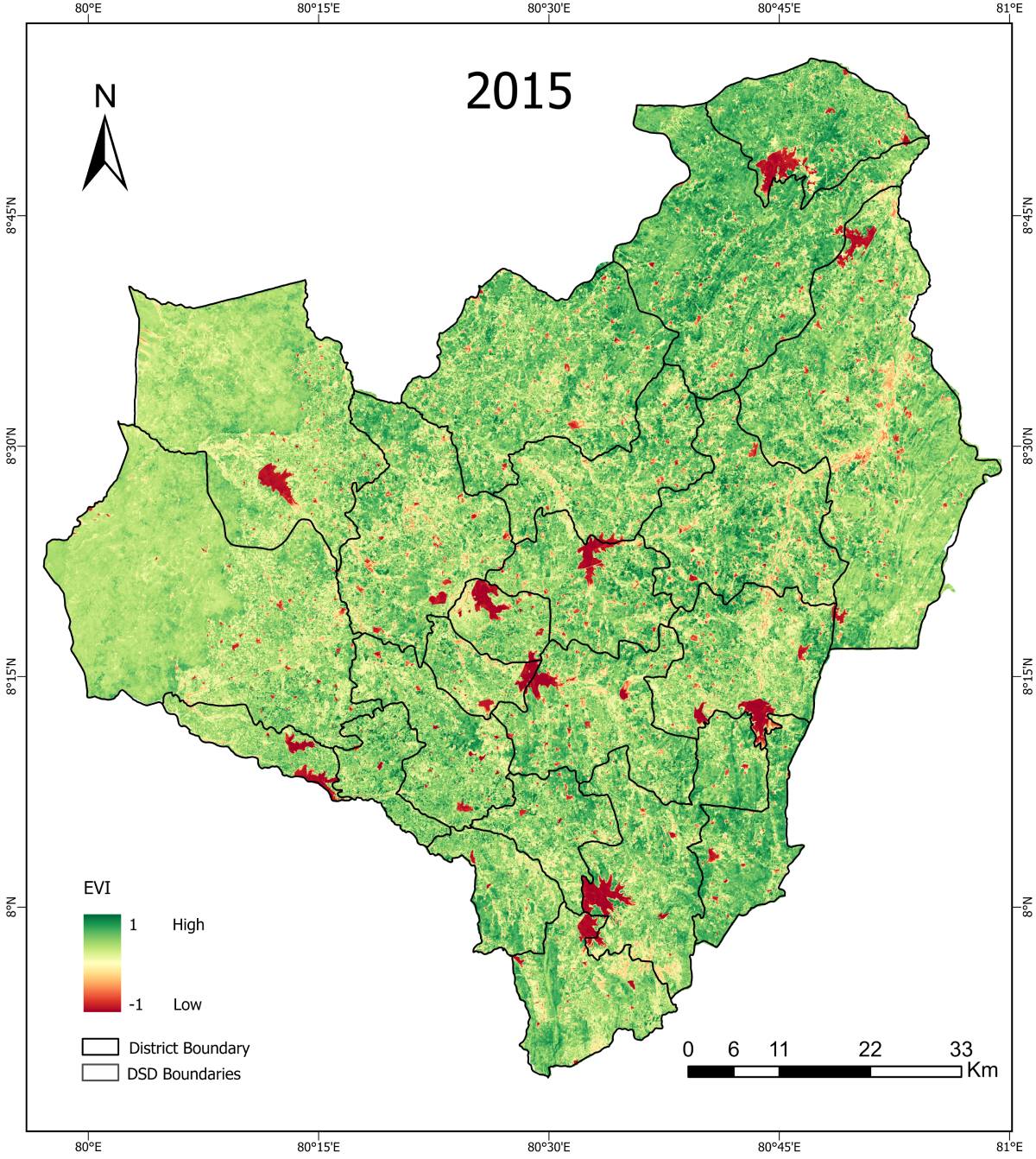
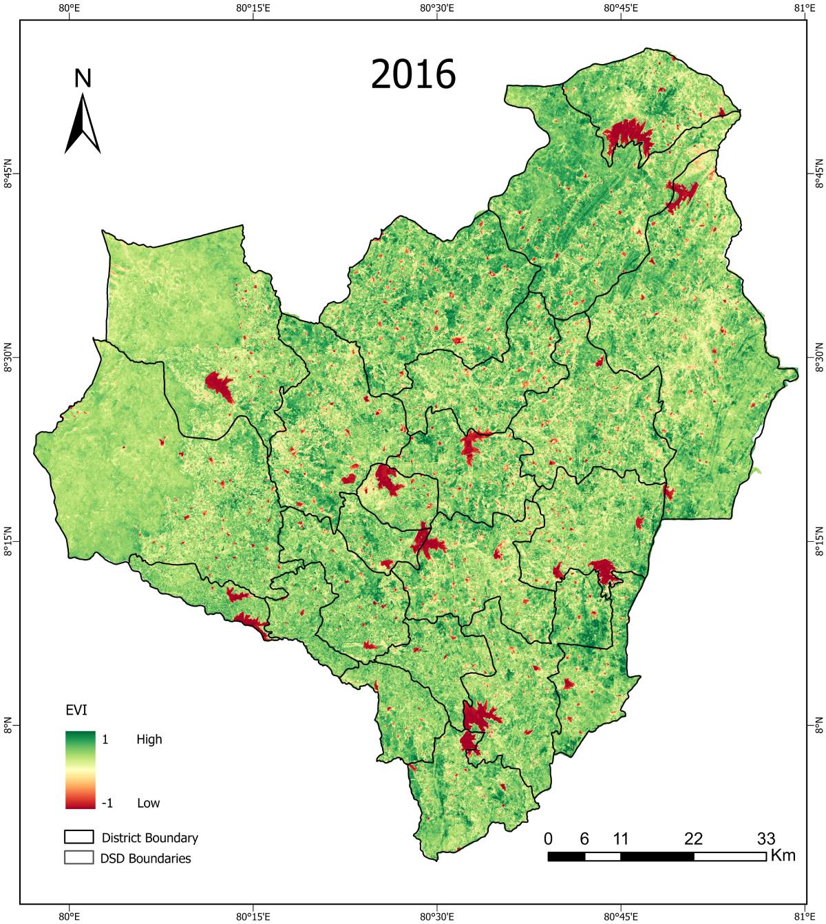
EVI (Enhanced Vegetation Index) – Maha Season

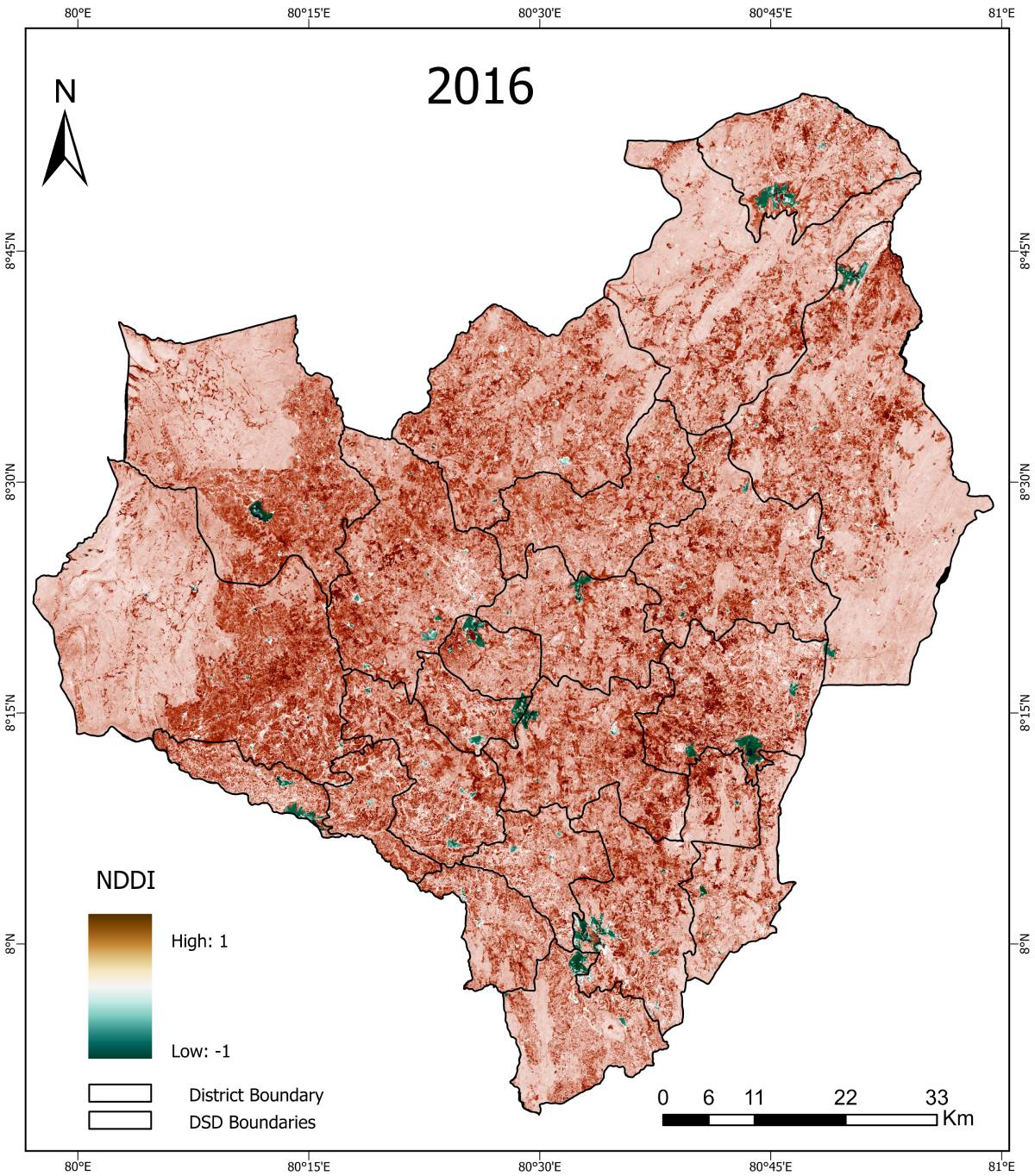
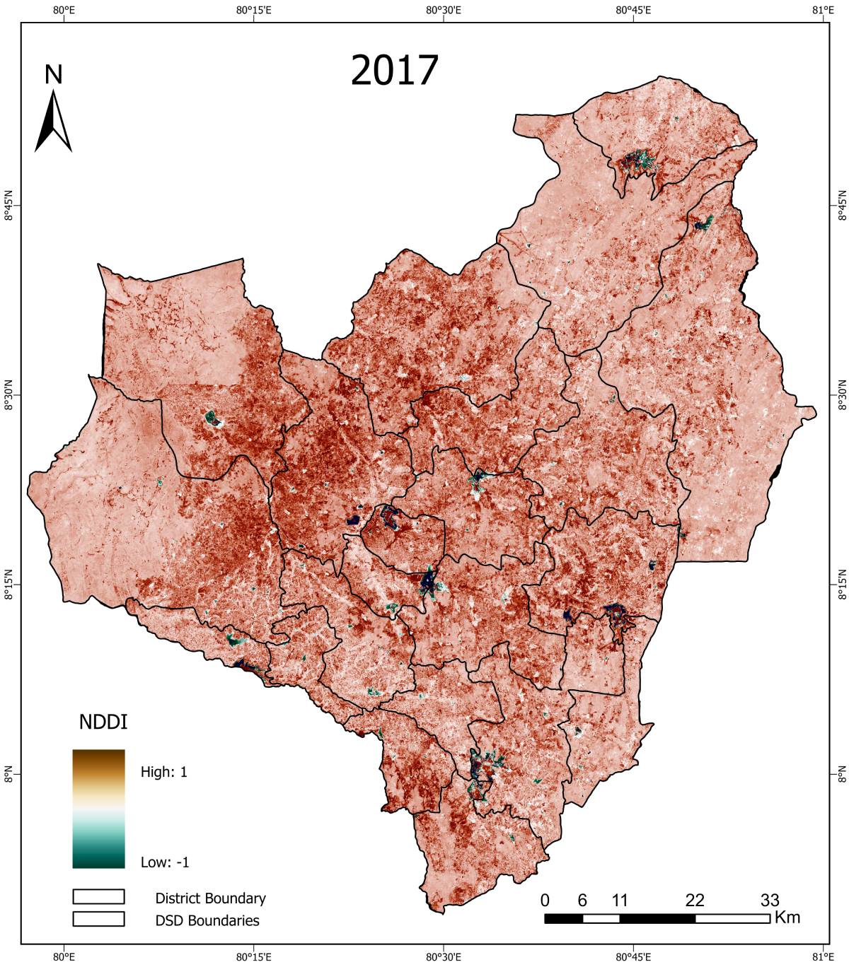
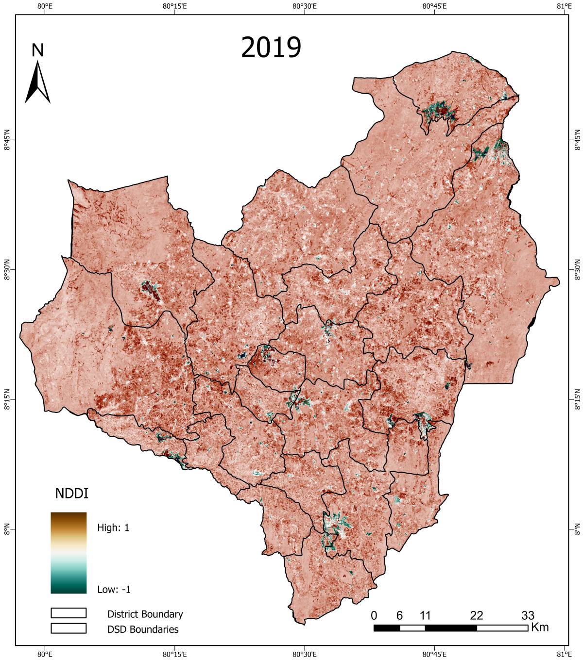
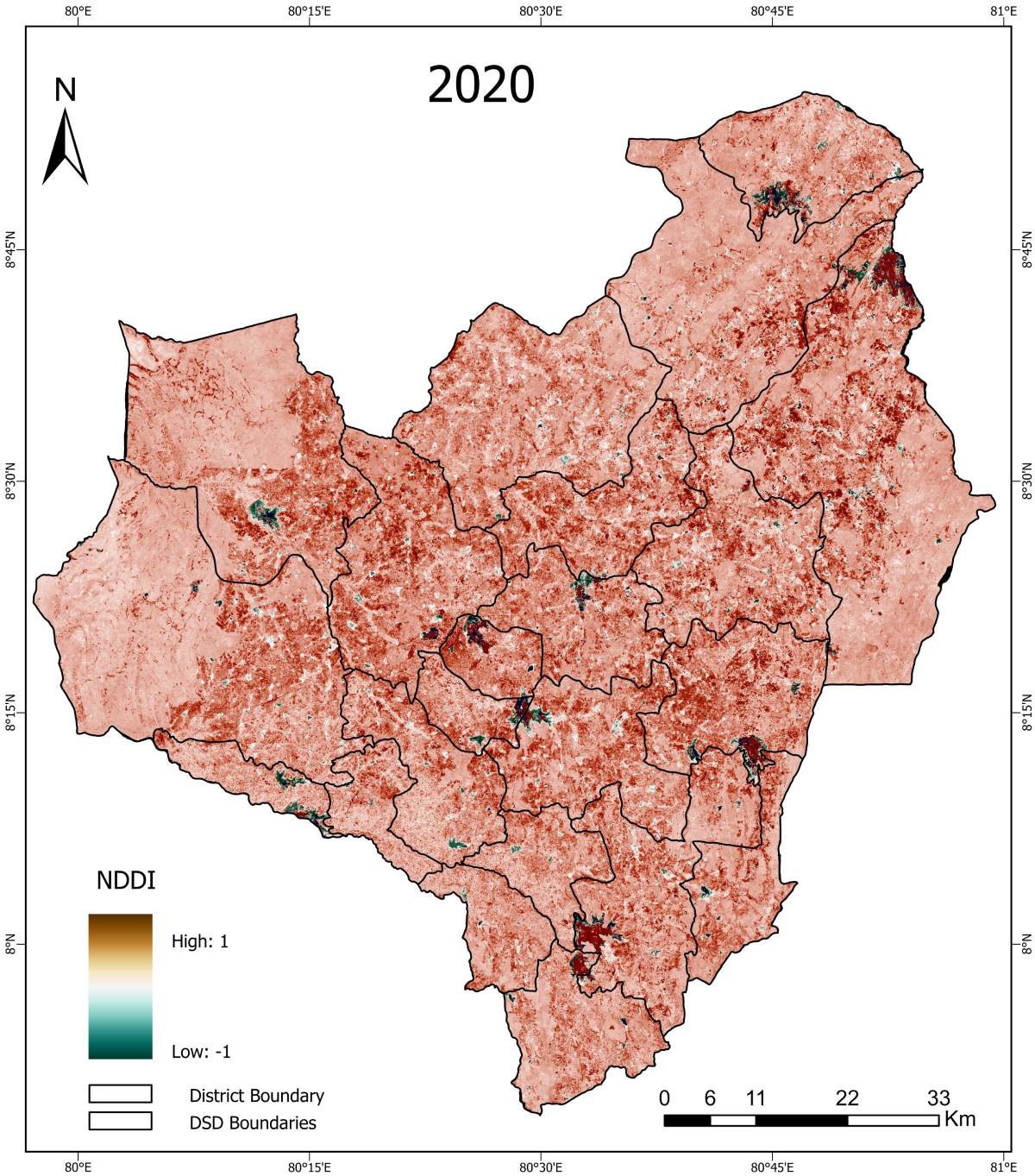
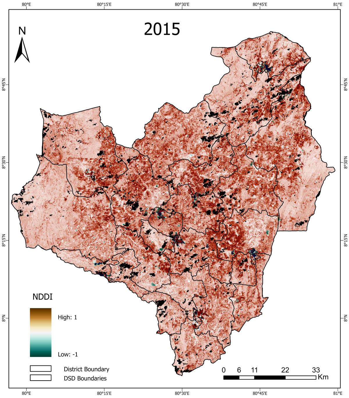
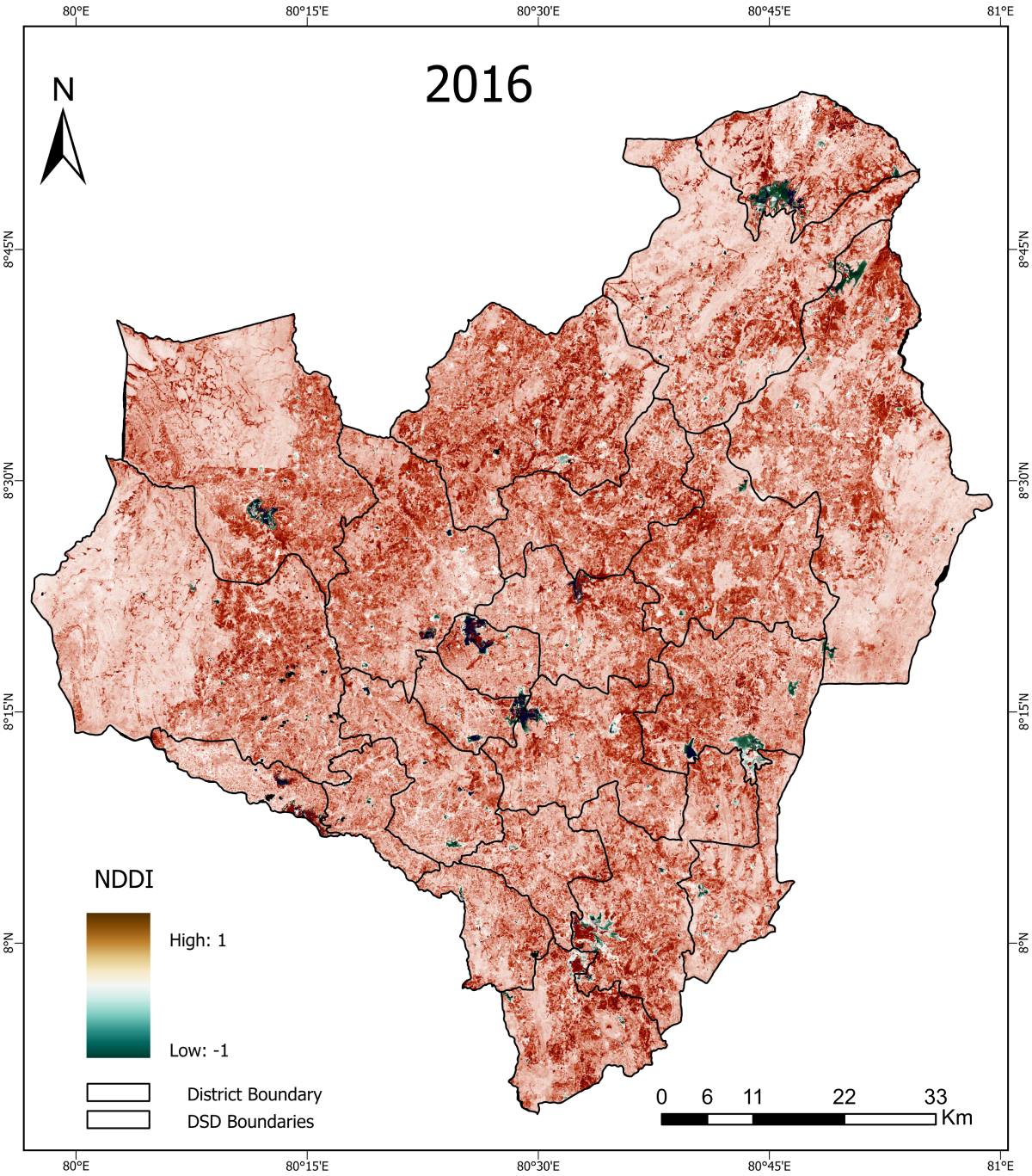
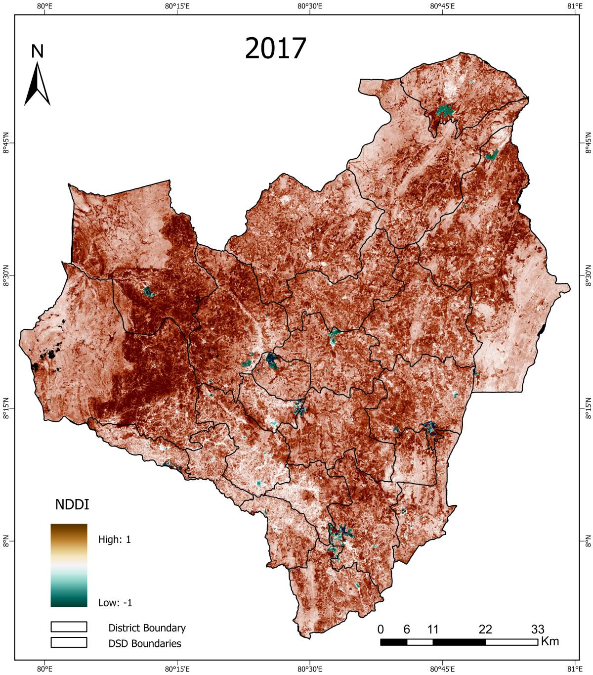
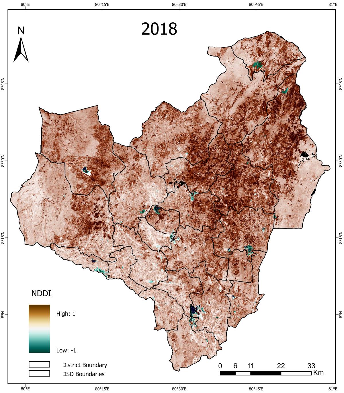
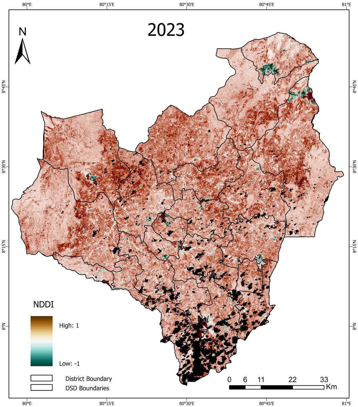
NDDI (Normalized Difference Drought Index) – Maha Season


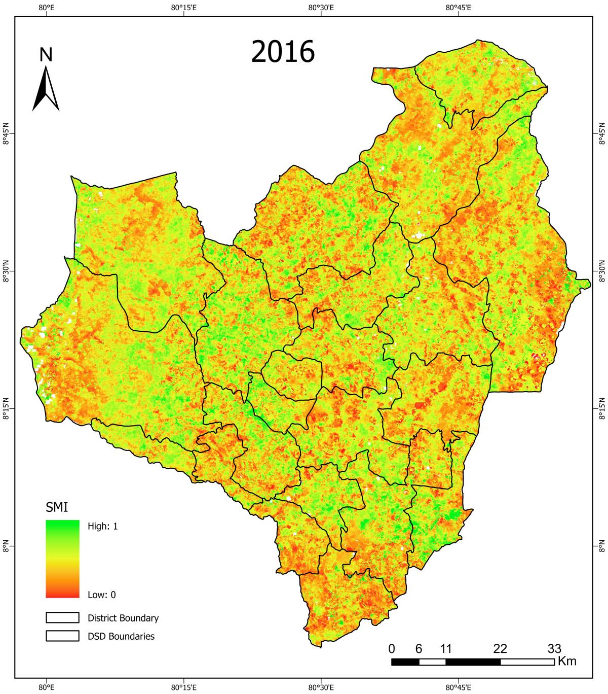
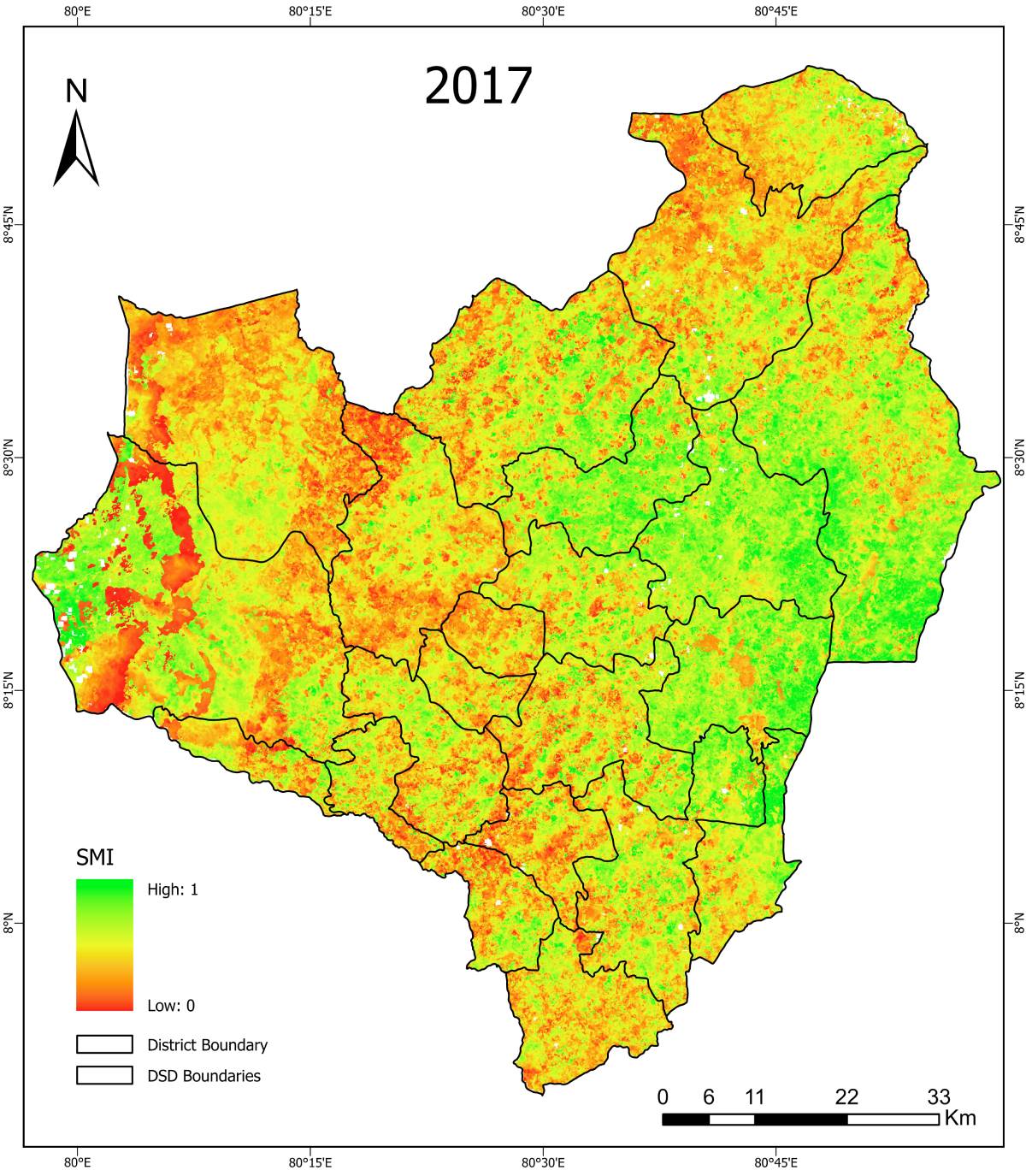
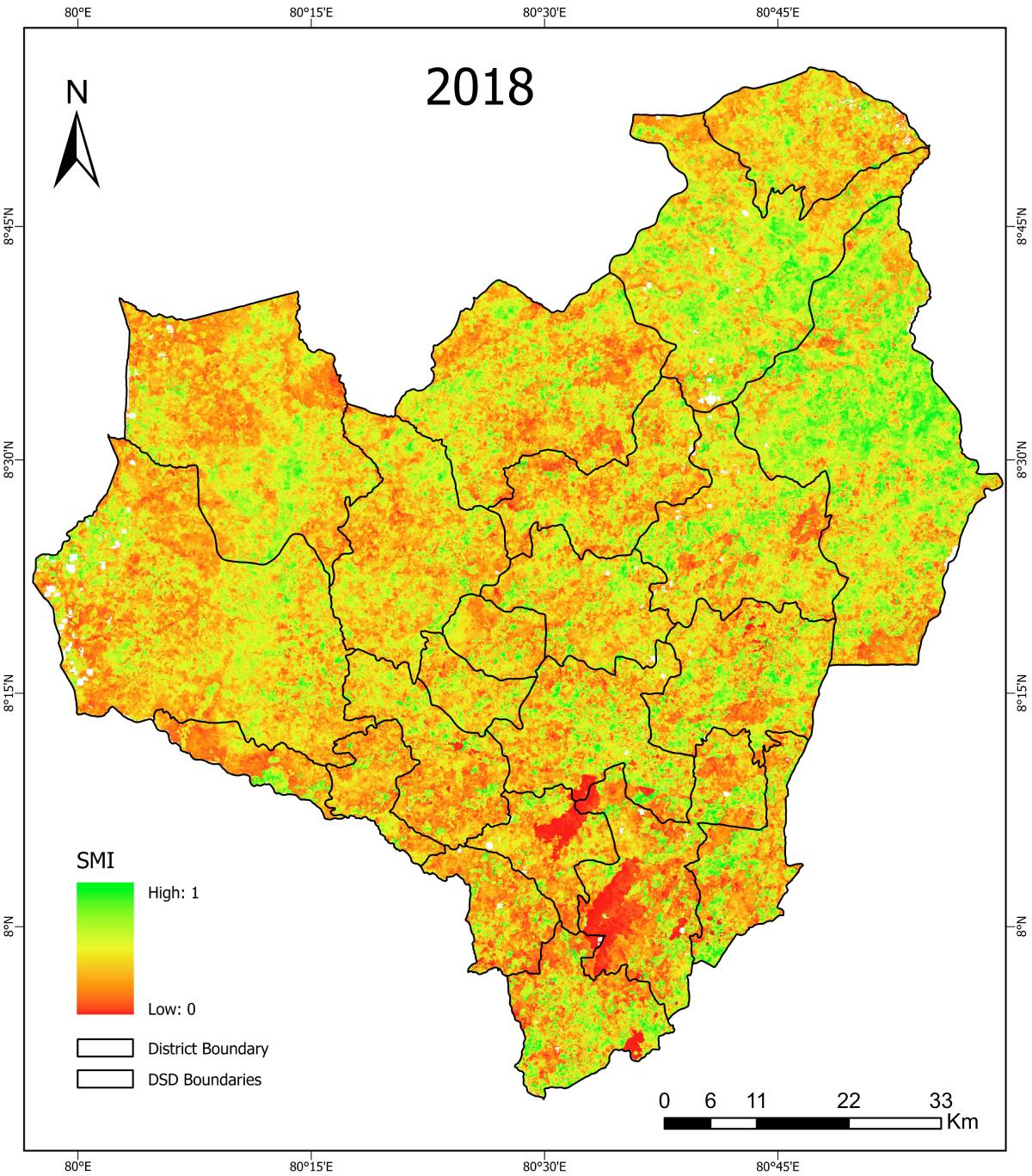
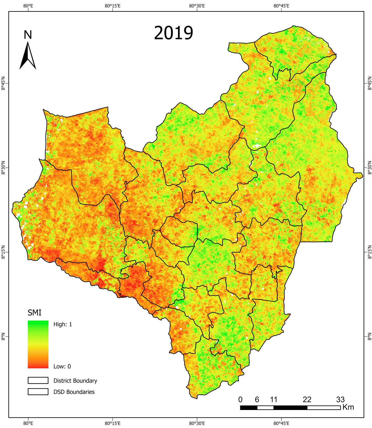
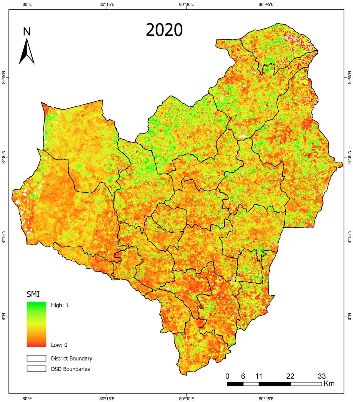
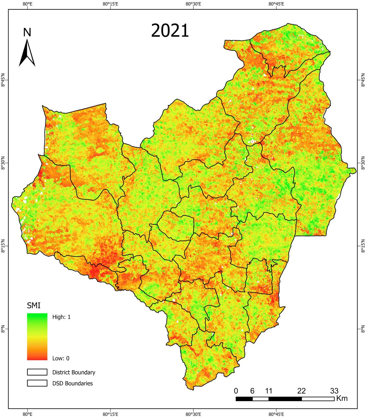
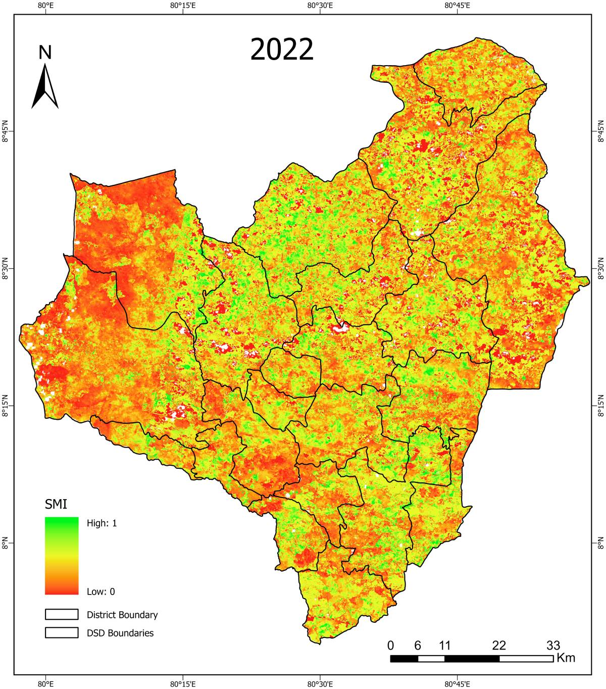
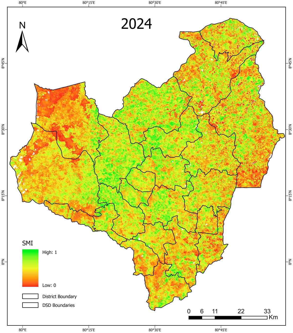
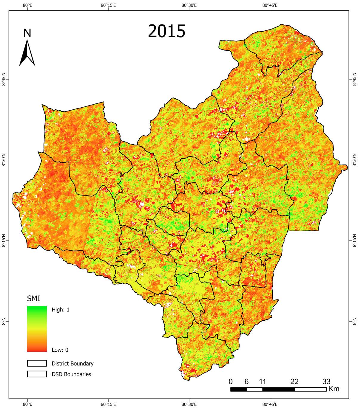
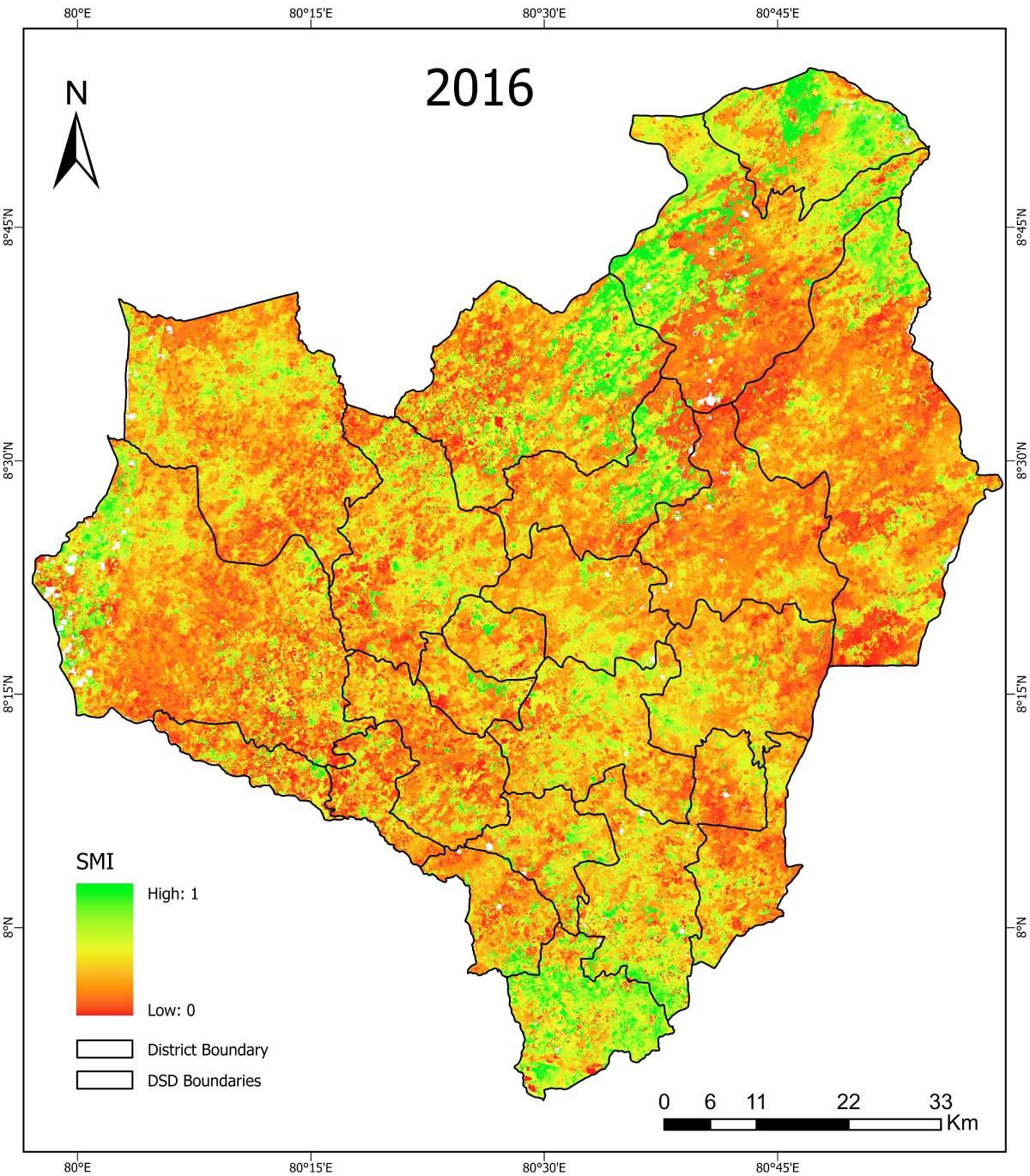
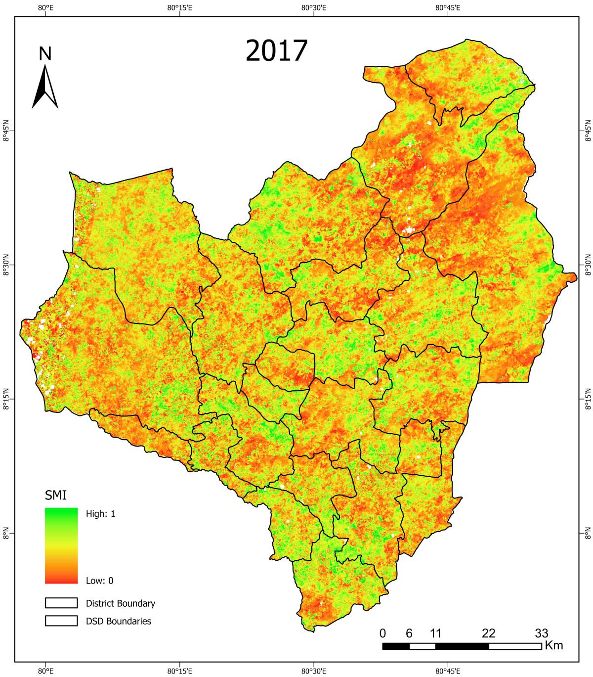
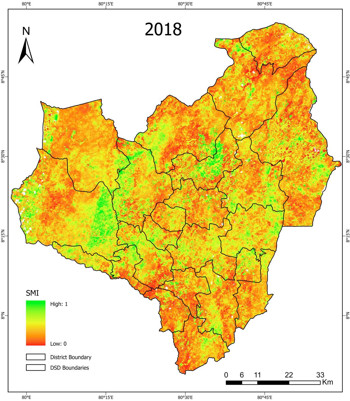
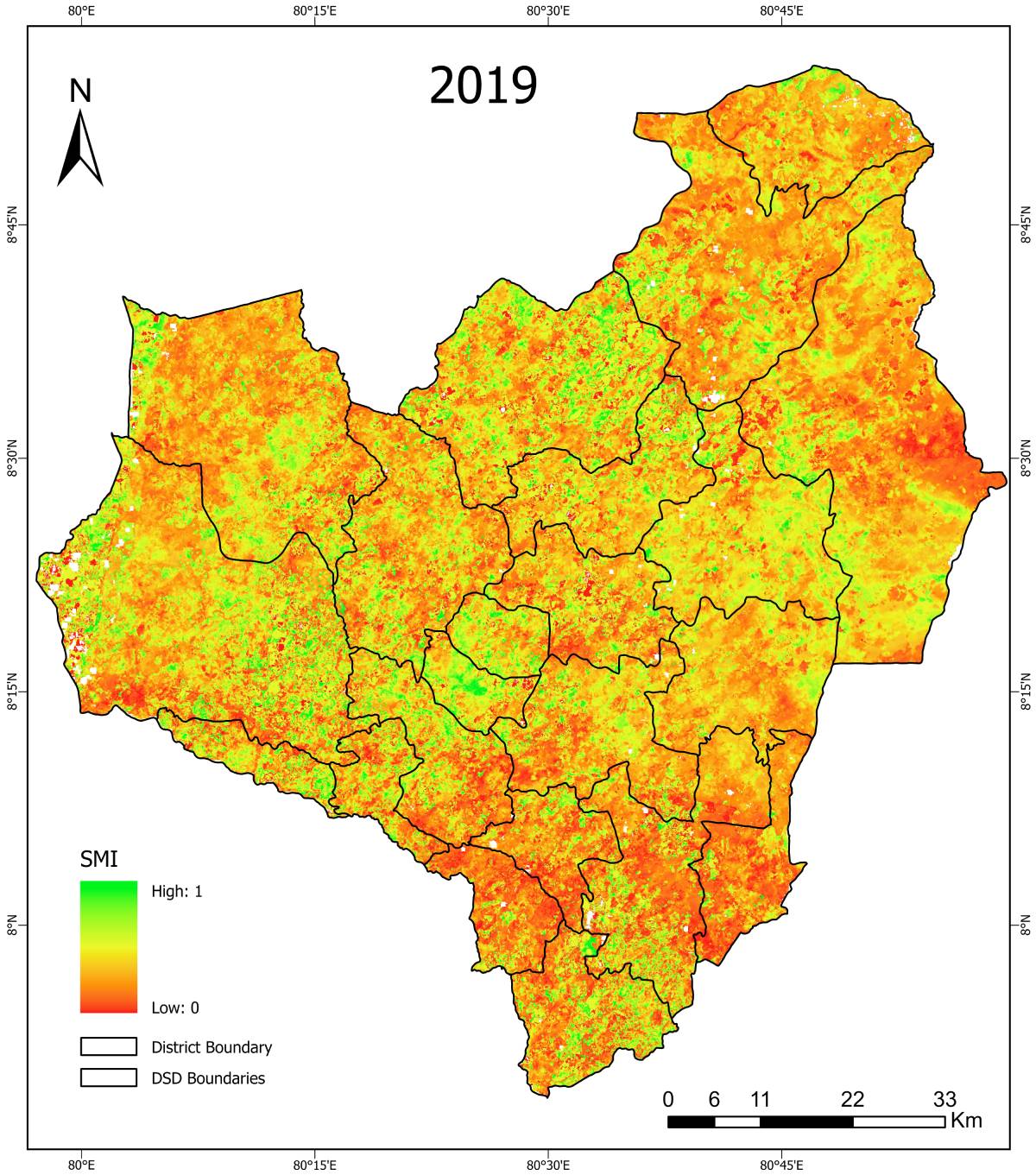
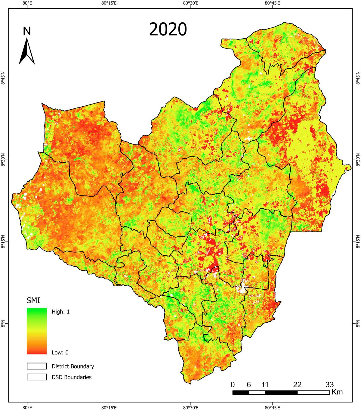
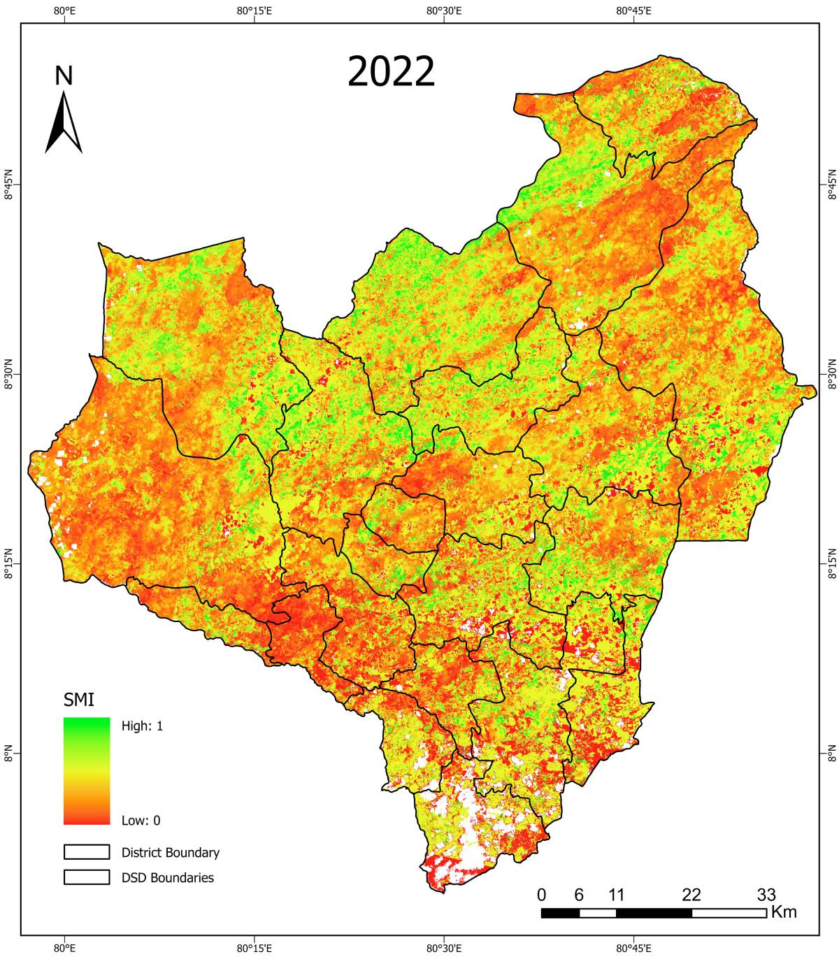
SMI (Soil Moisture Index) – Maha Season

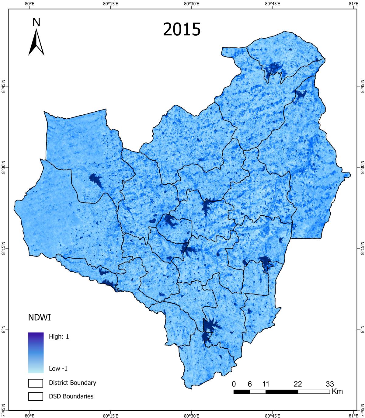
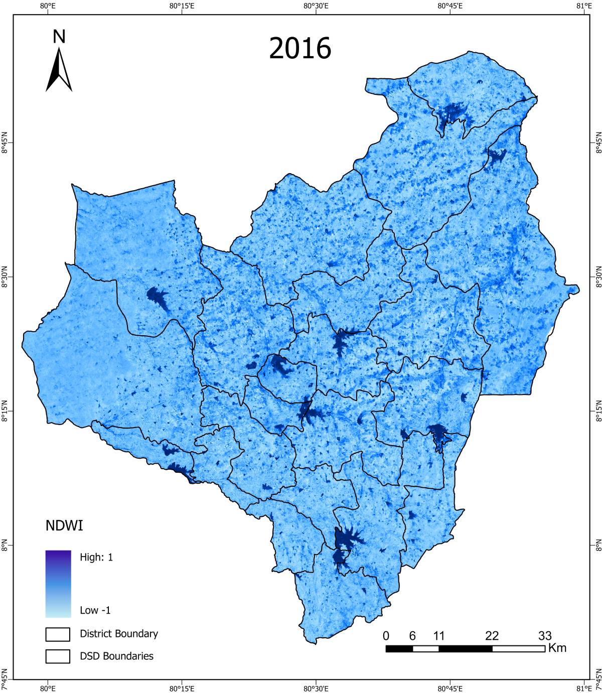
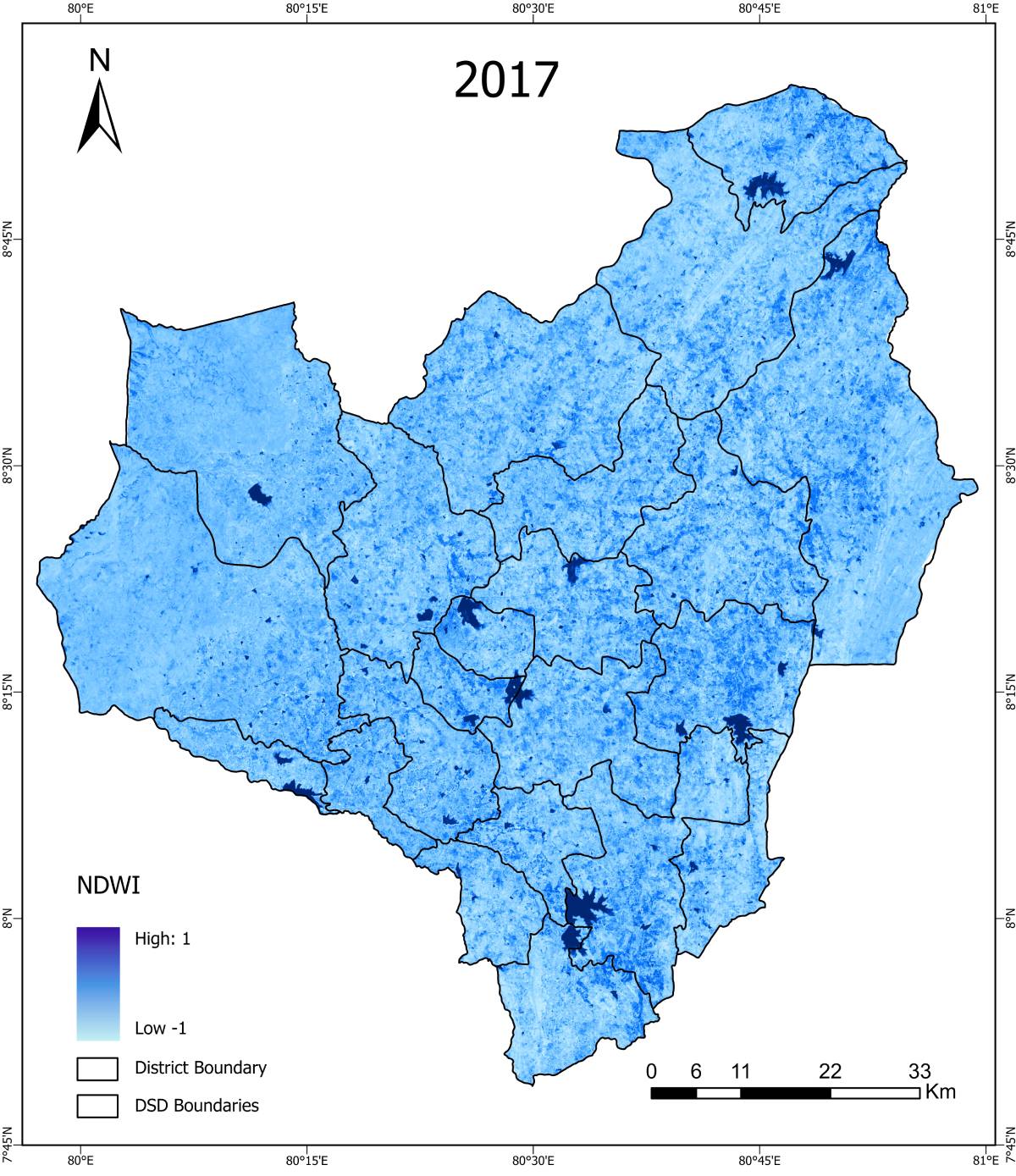
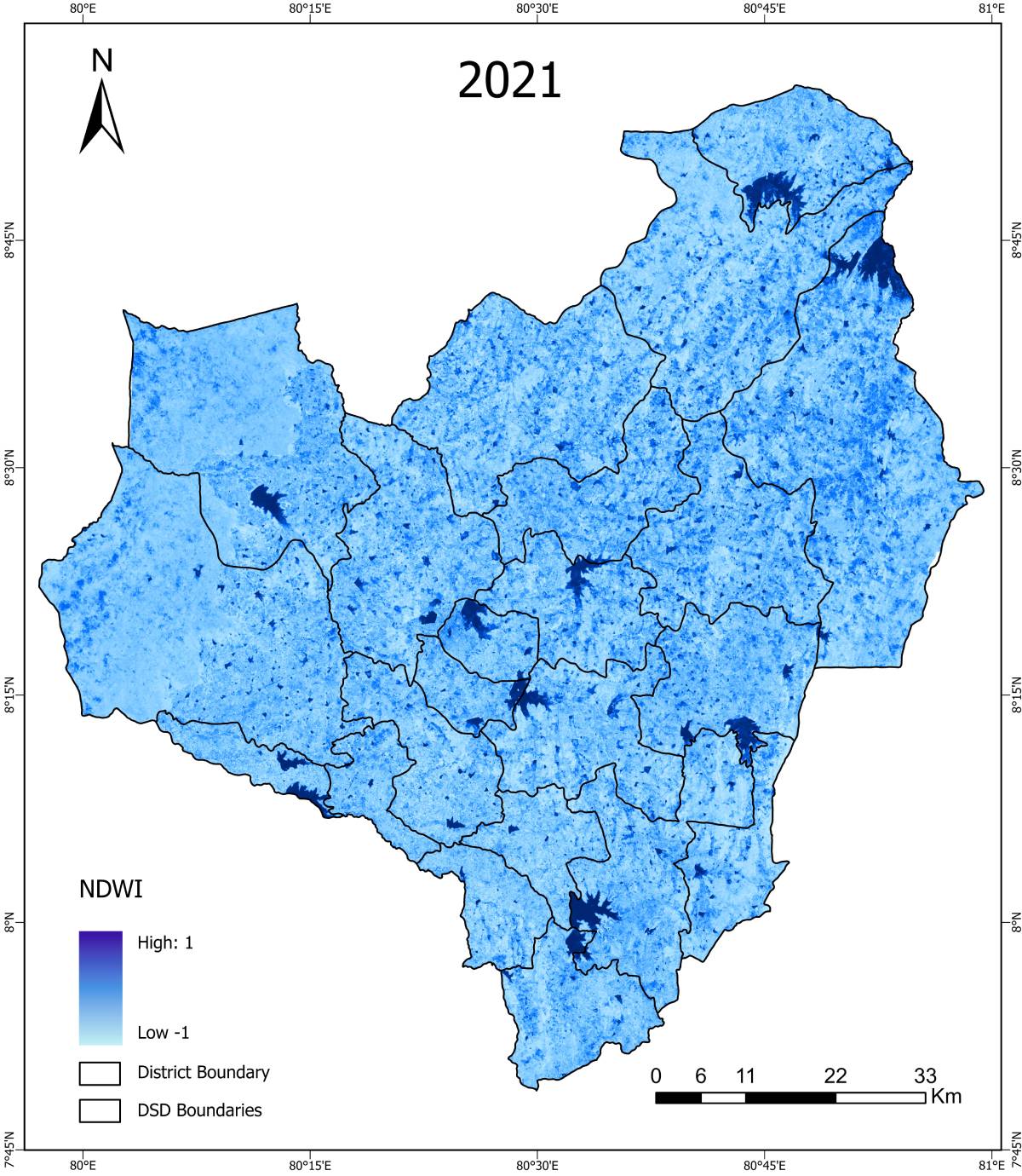
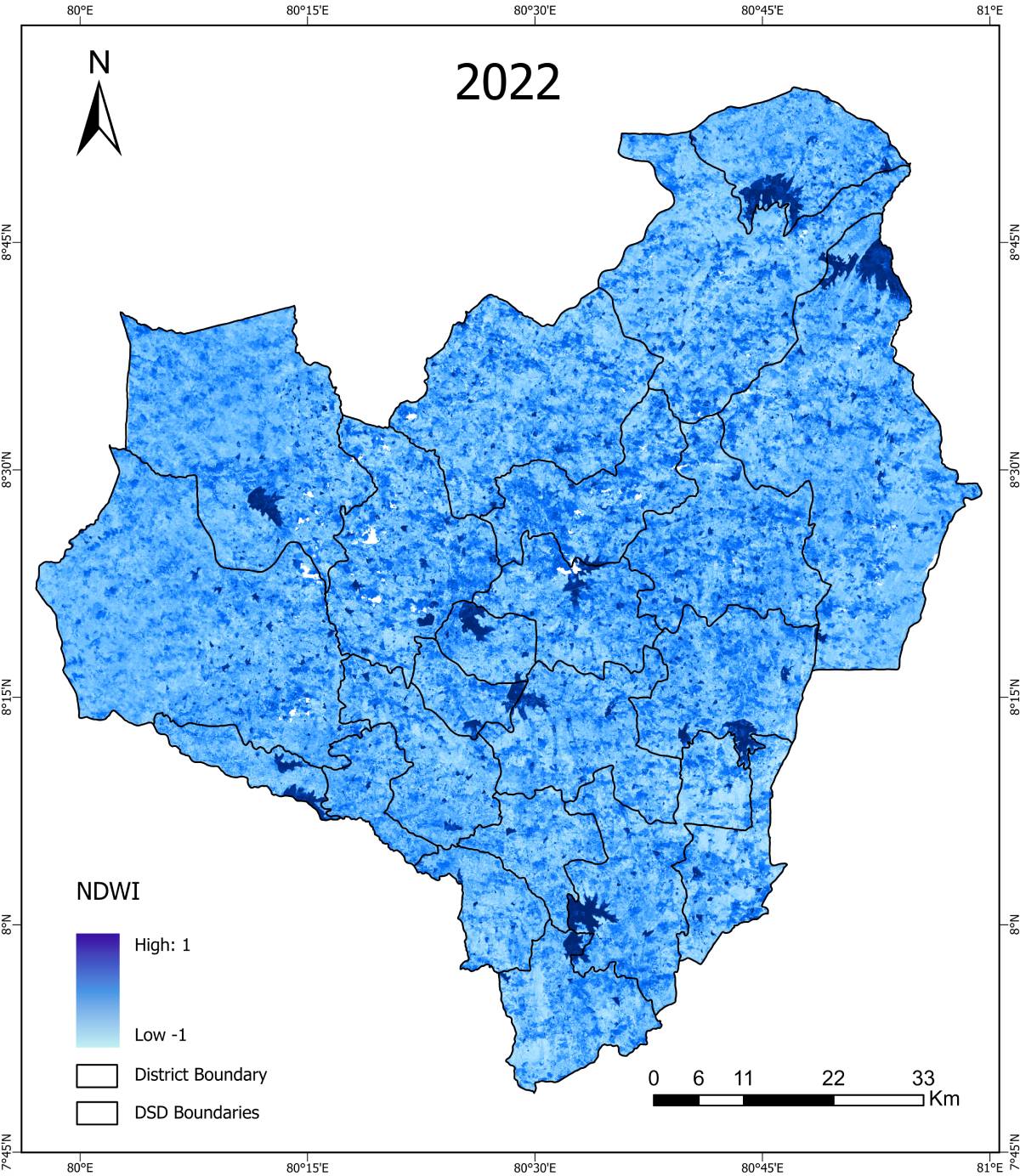
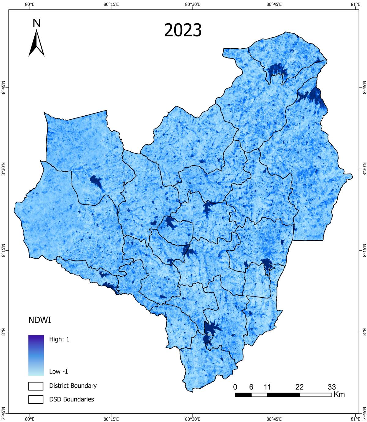
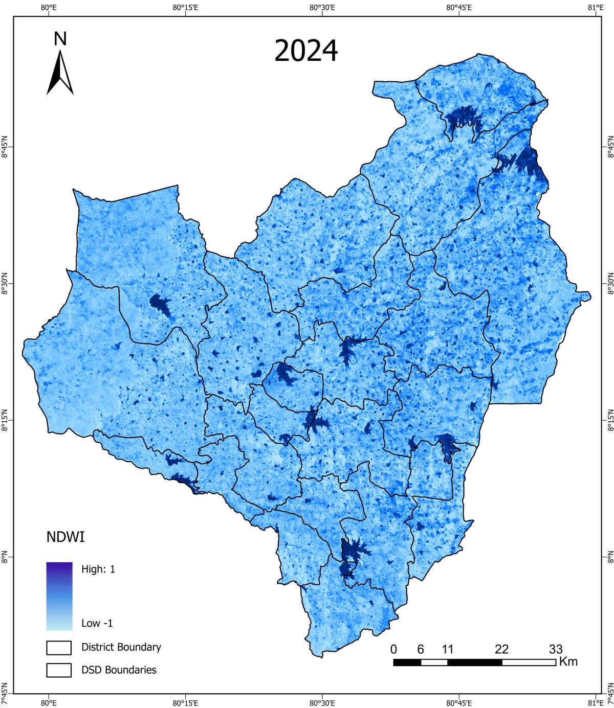
NDWI (Normalized Difference Water Index) – Maha Season


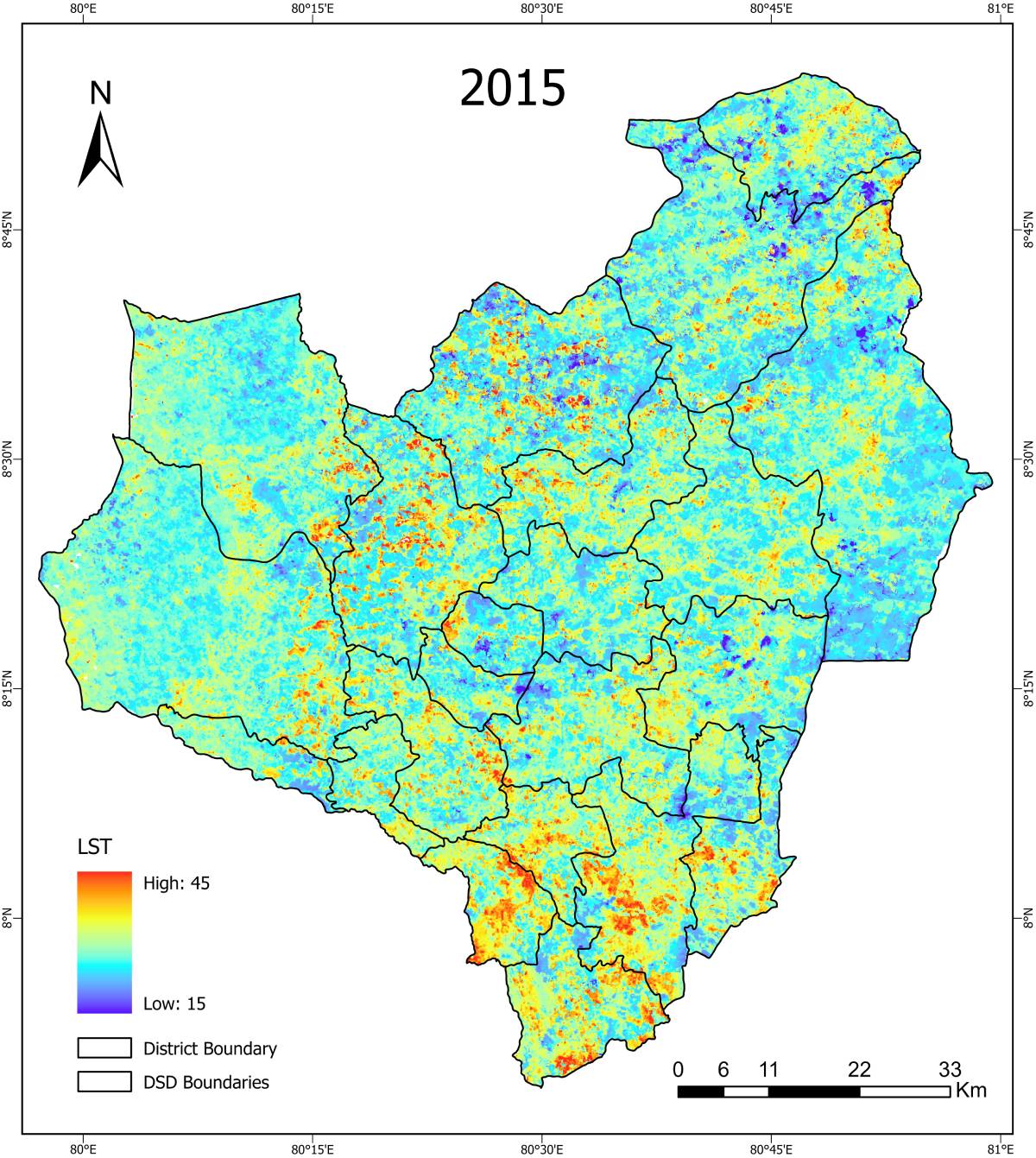
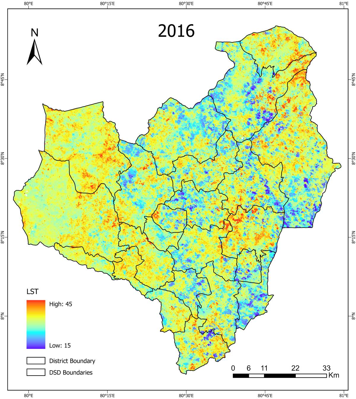
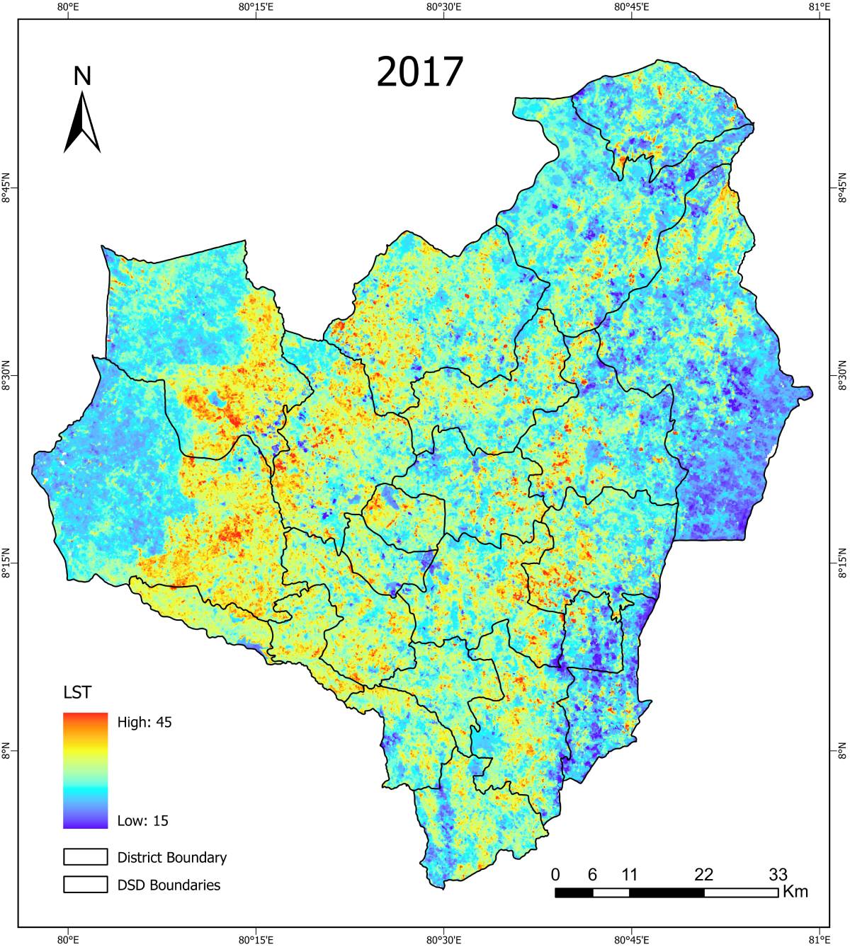
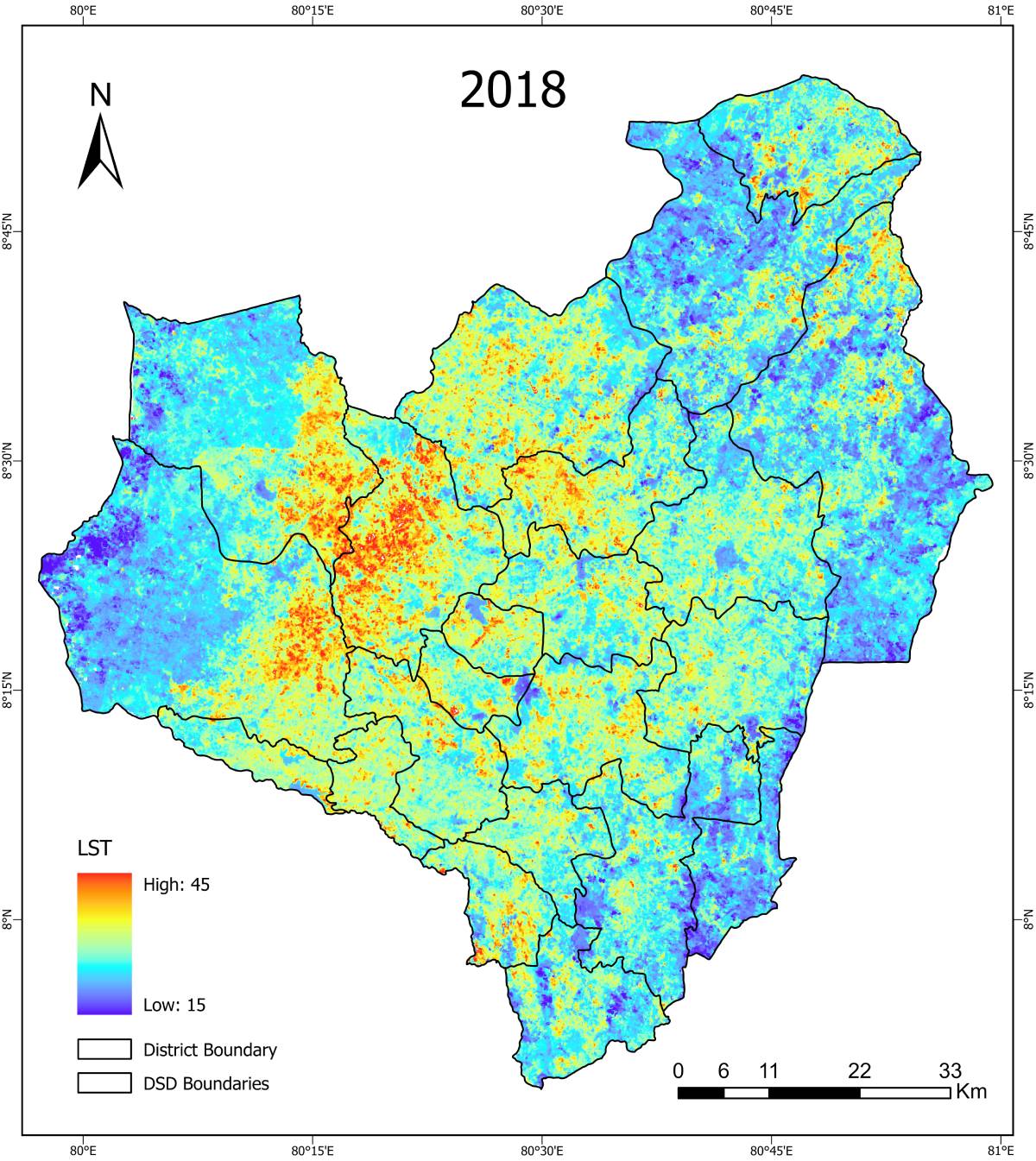
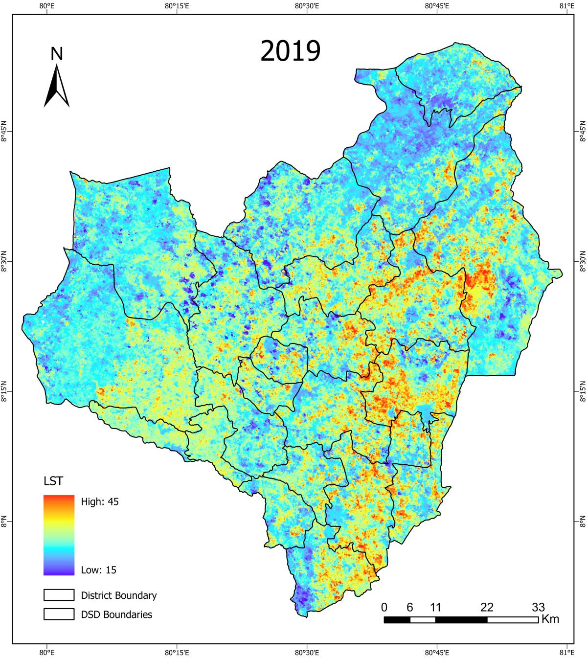
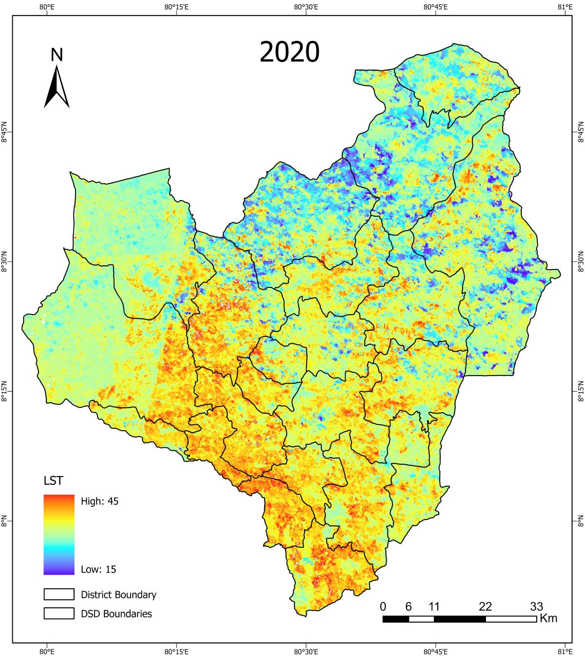
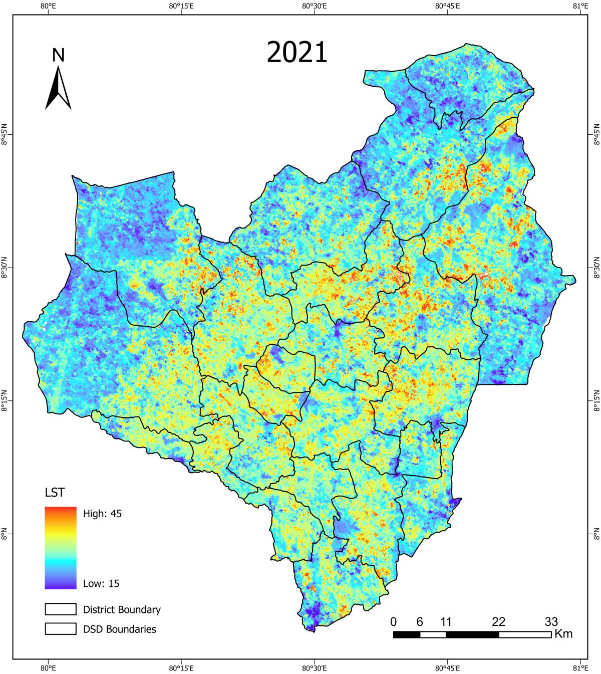
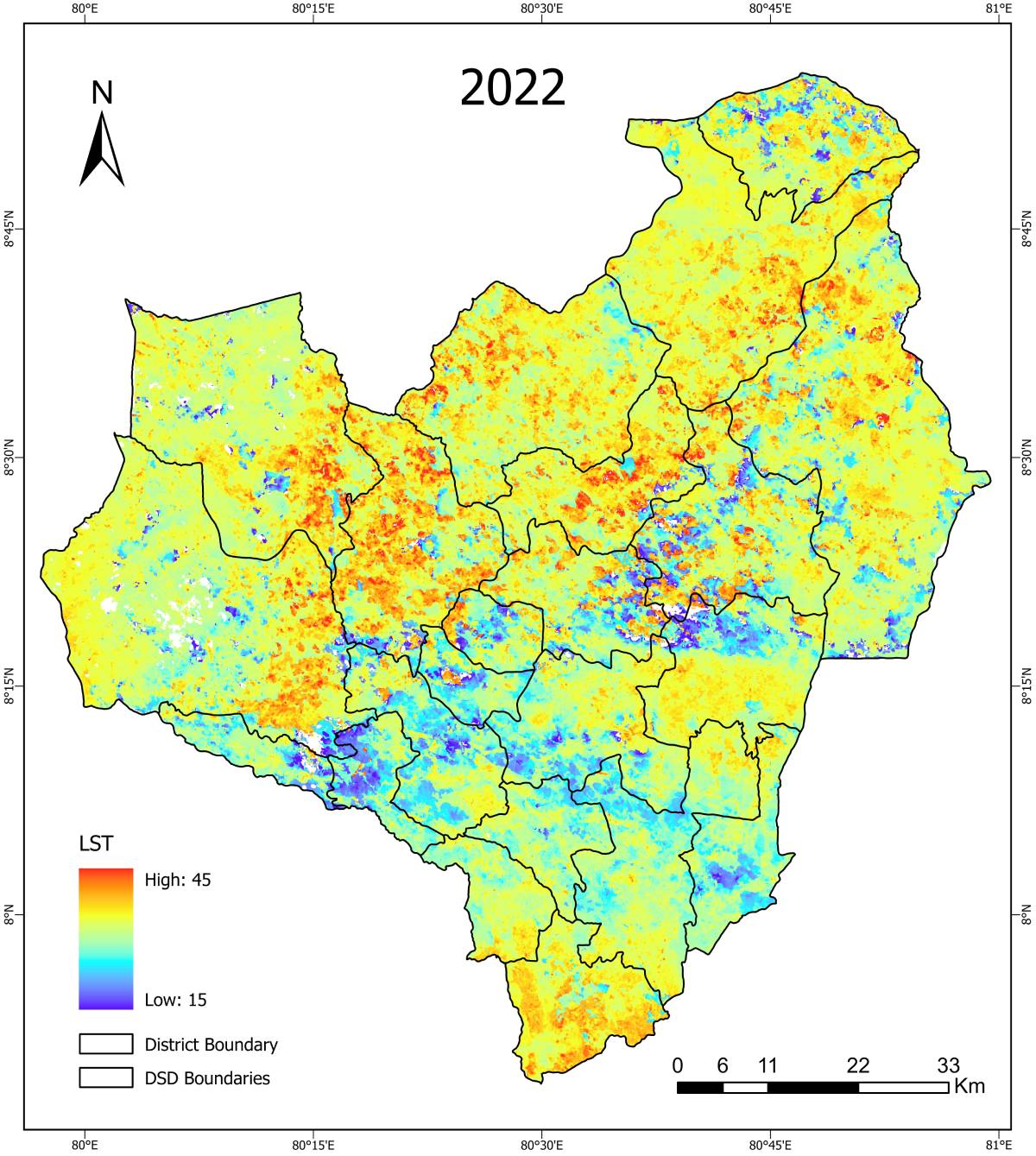
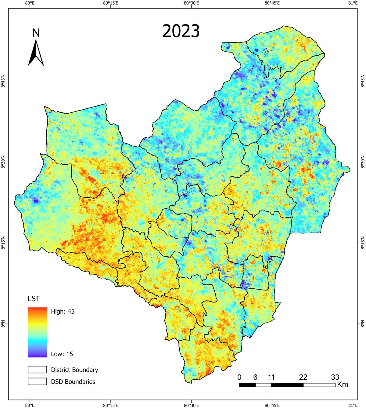
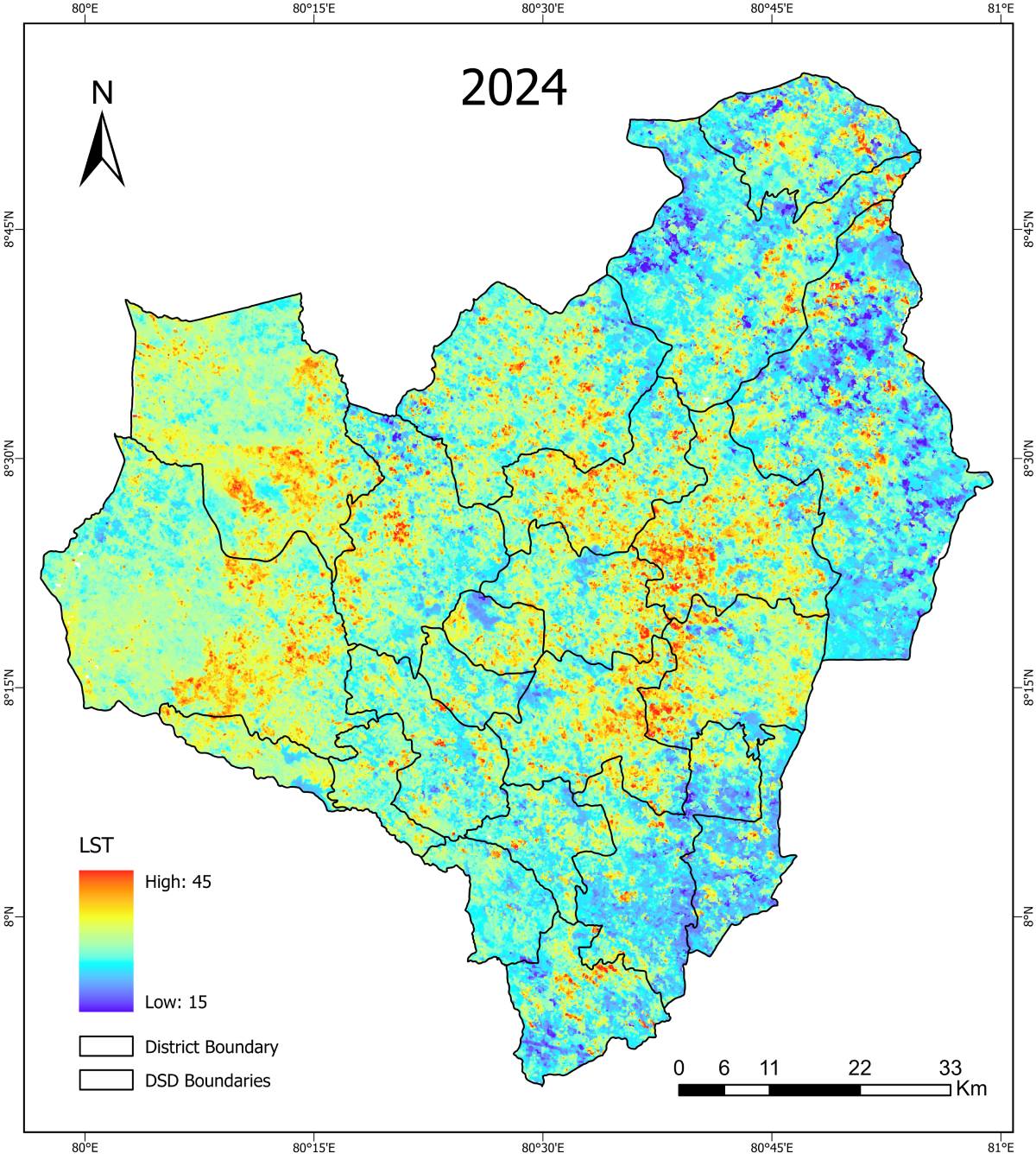
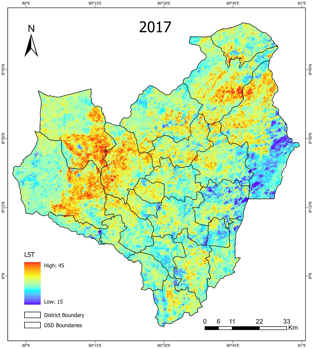
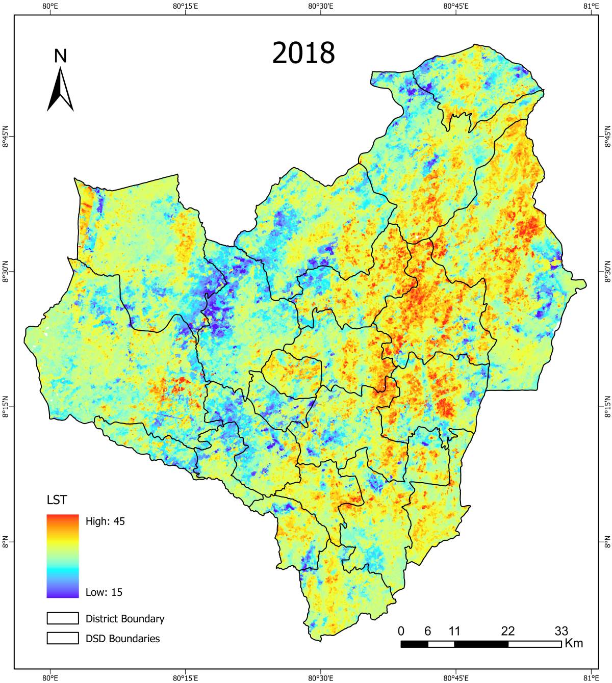
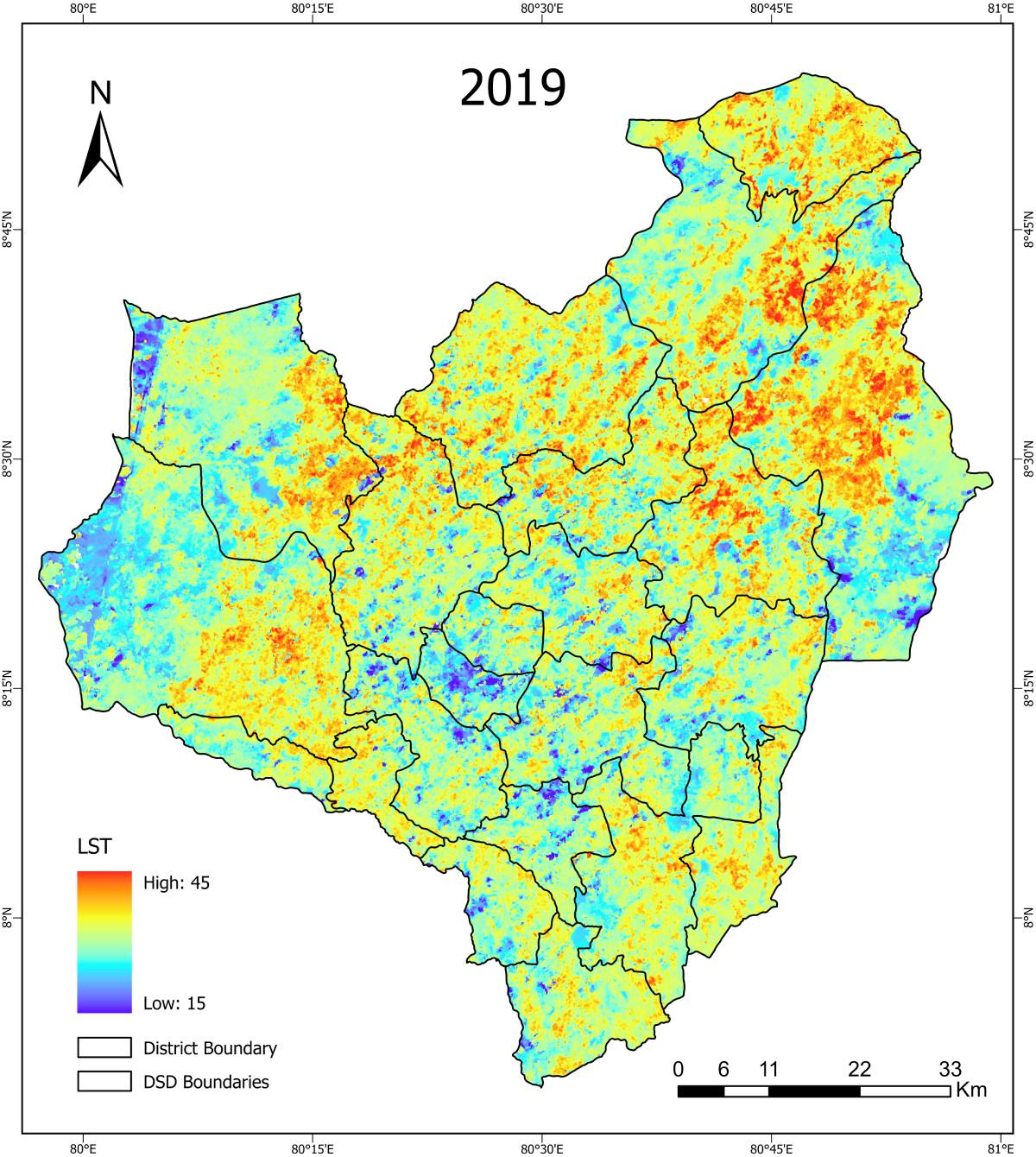
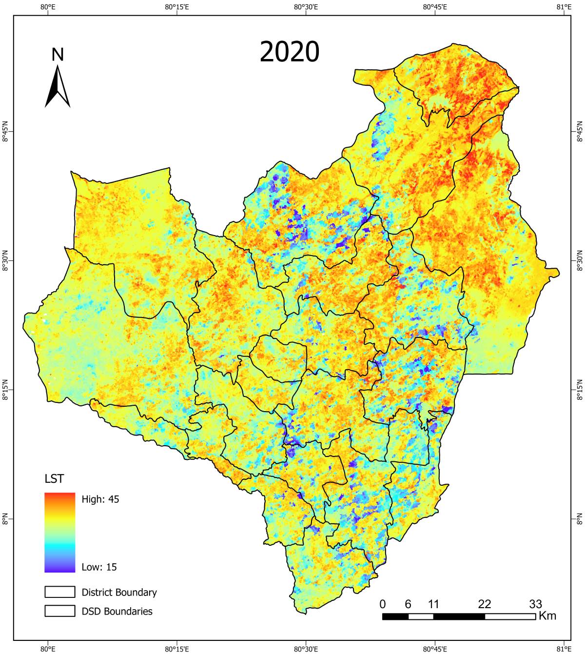
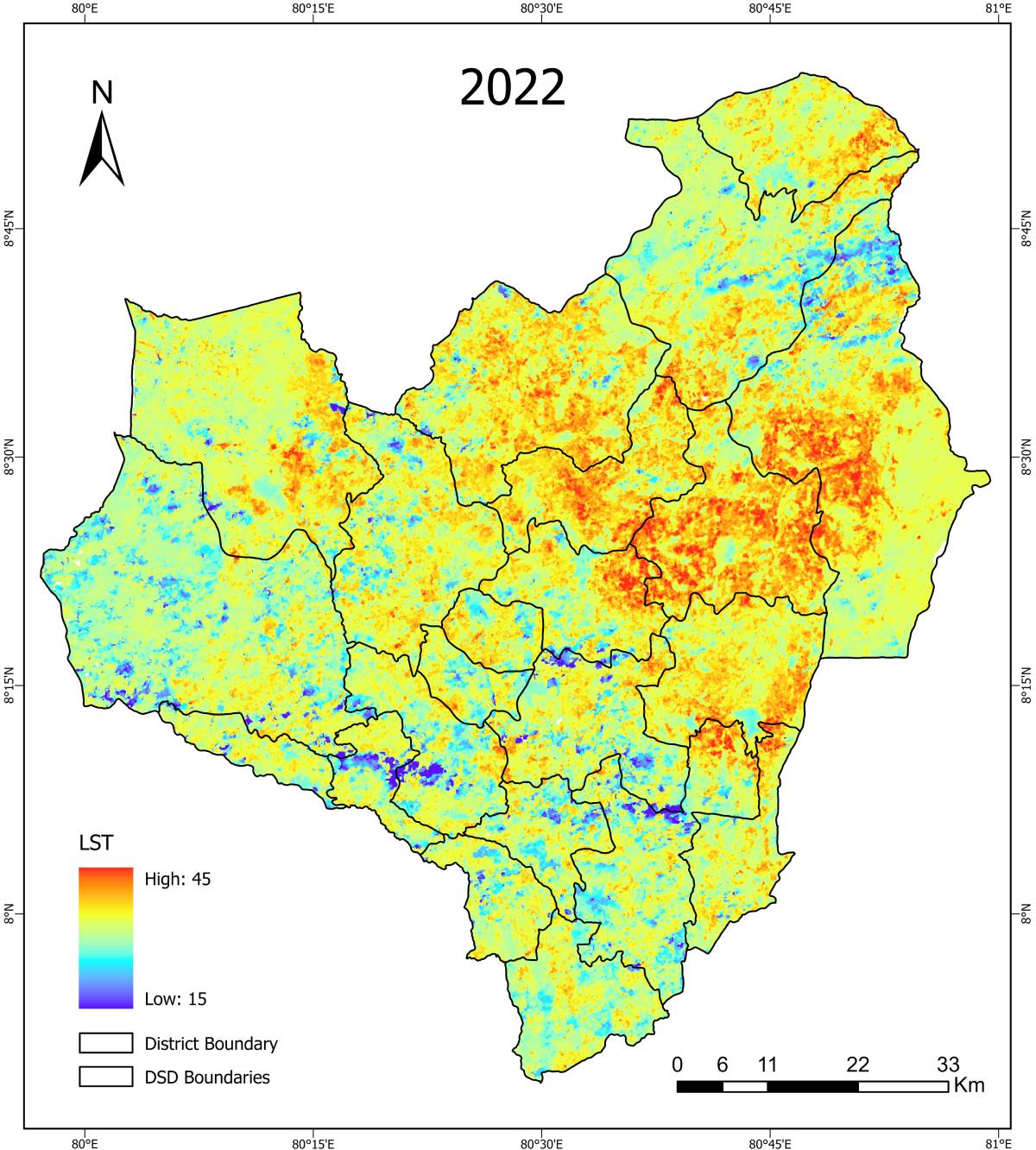
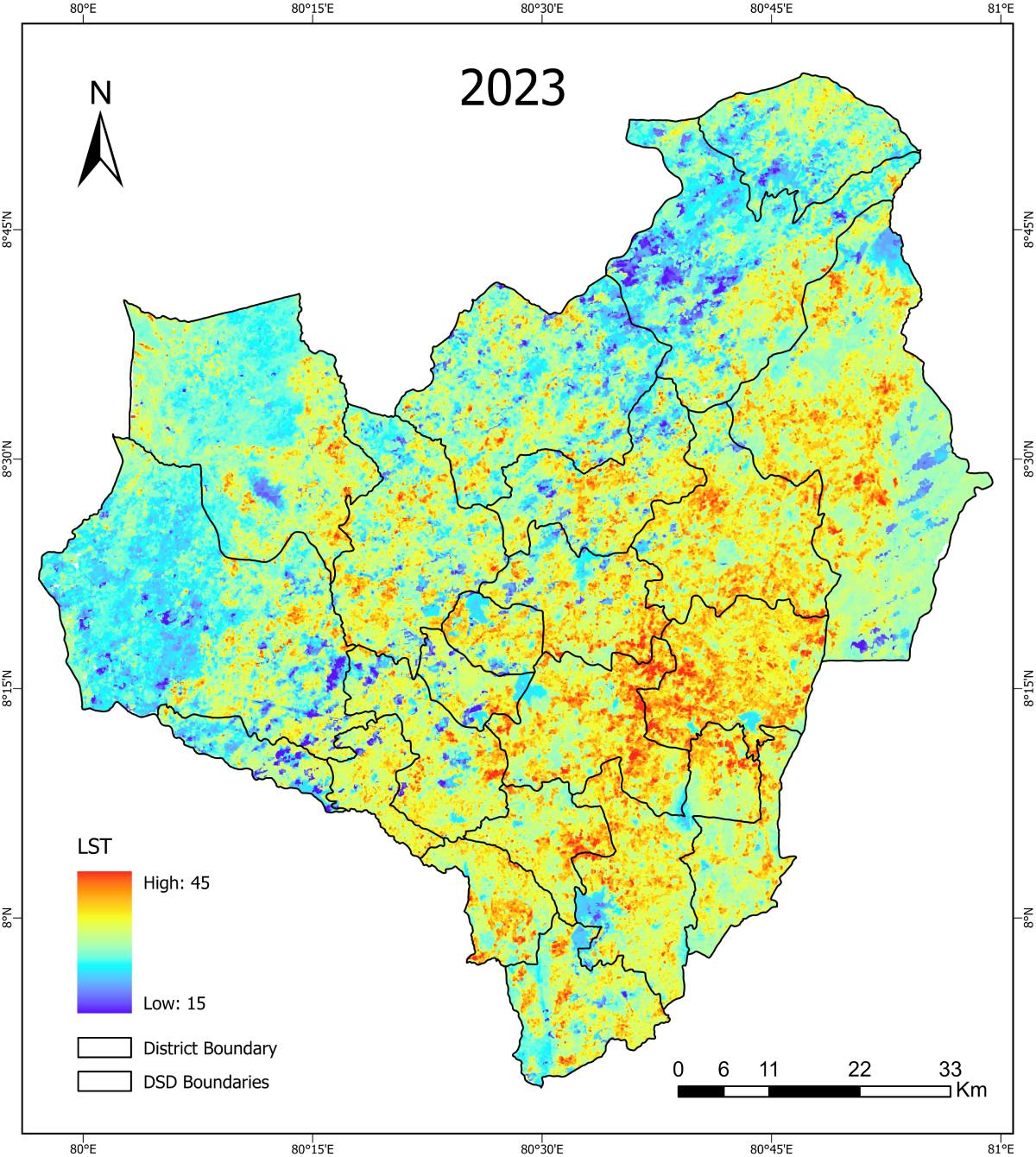
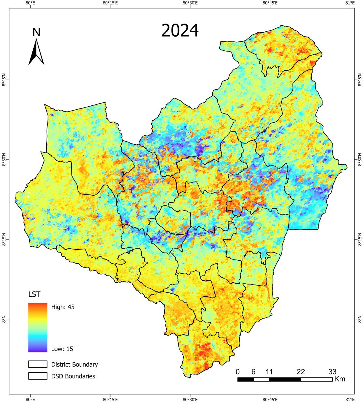
LST (Land Surface Temperature) – Maha Season
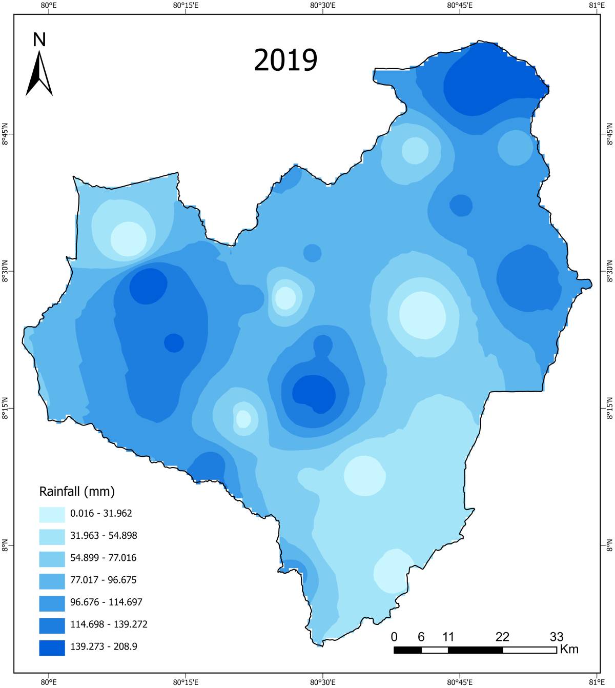
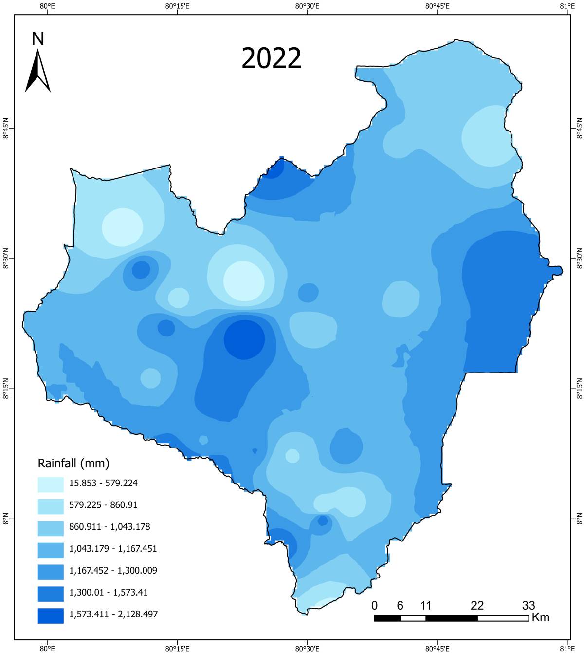
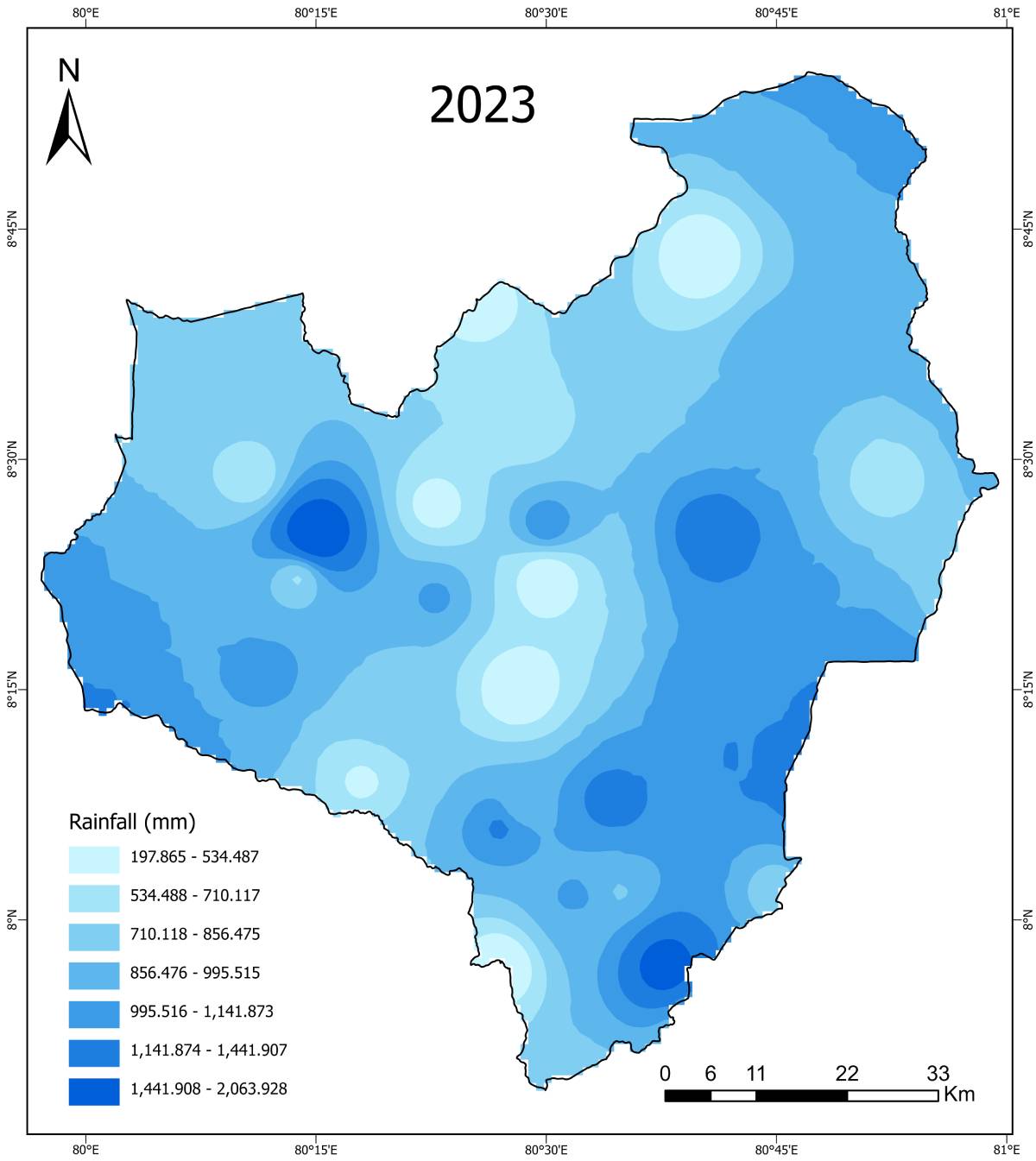
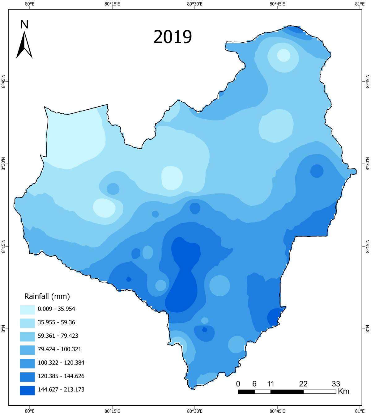
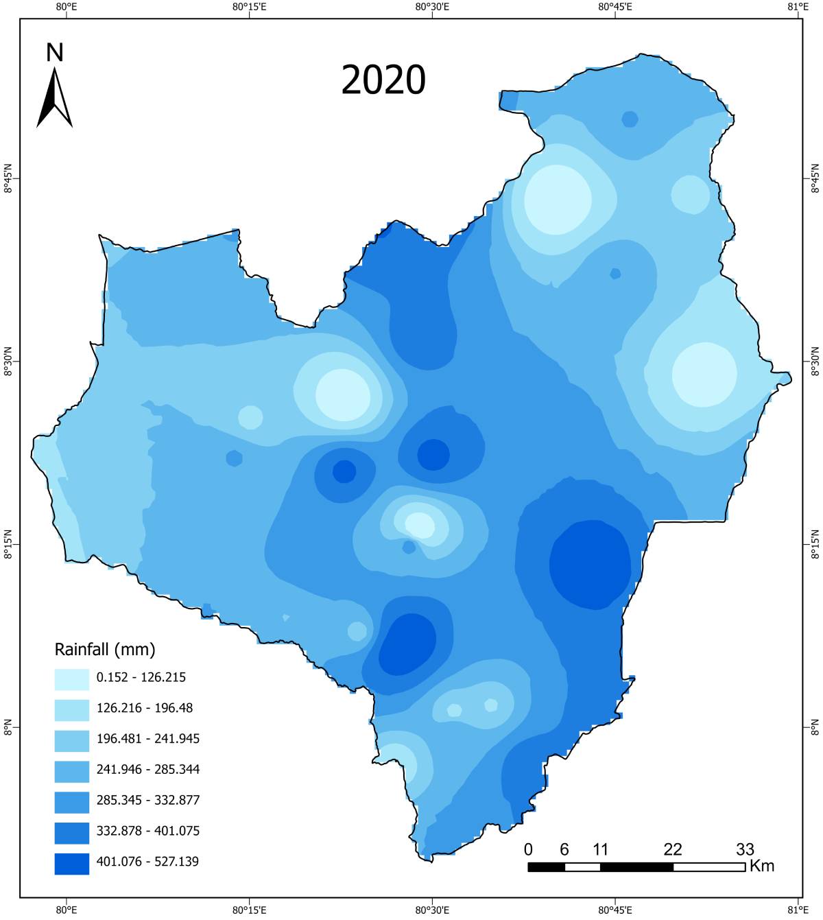
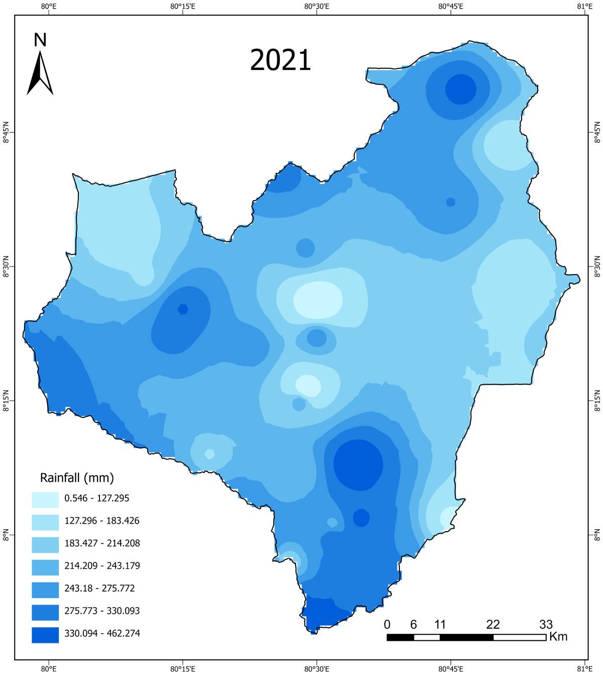
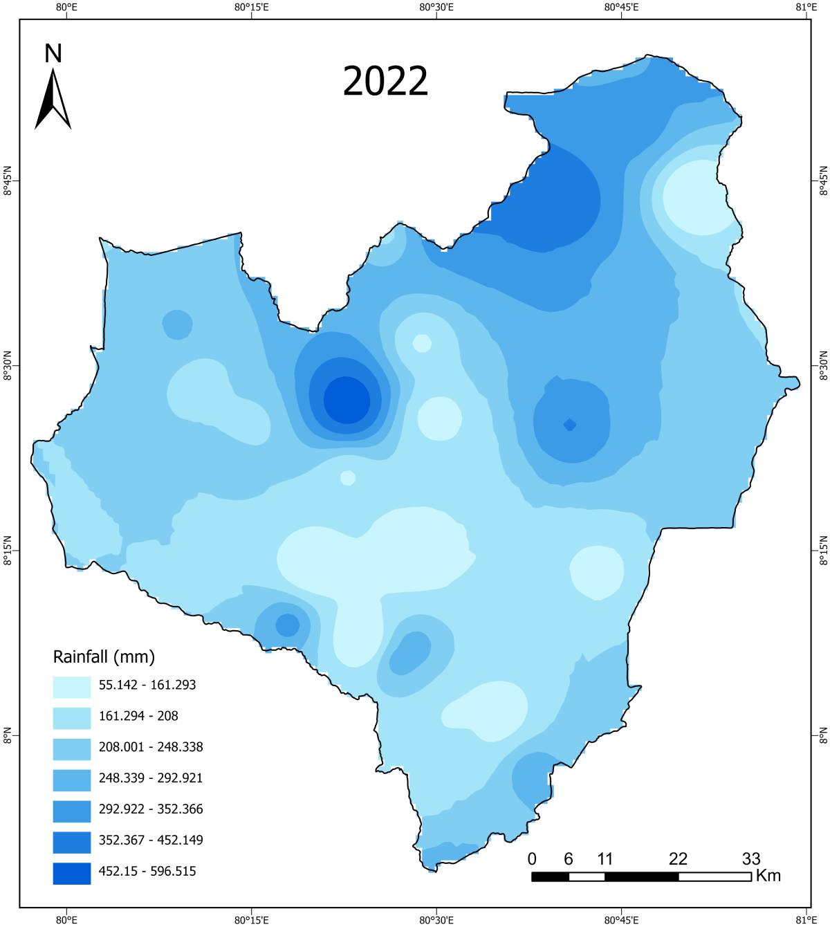
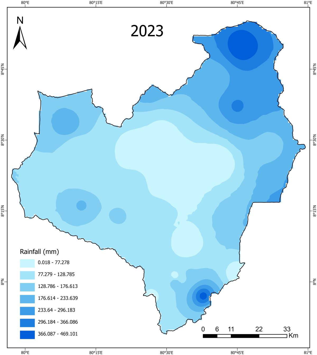
Rainfall (Maha Season)


Yala Season (2015–2024)
NDVI (Normalised Difference Vegetation Index) – Yala Season


SAVI (Soil-Adjusted Vegetation Index) – Yala Season
EVI (Enhanced Vegetation Index) – Yala Season


NDDI (Normalized Drought Difference Index) – Yala Season

SMI (Soil Moisture Index) – Yala Season


NDWI (Normalized Difference Water Index) – Yala Season

LST (Land Surface Temperature) – Yala Season

Rainfall (Yala Season)
Land Suitability & Multi-Criteria Decision Analysis (MCDA)
To identify Climate-Smart Agricultural suitability, all environmental, climatic, and infrastructural factors were standardized and reclassified into suitability classes. These reclassified layers were later integrated using an Analytical Hierarchy Process (AHP)–based weighted overlay approach in a GIS environment.
Reclassified Indices & Suitability Factors
Reclassified Vegetation & Drought Indices
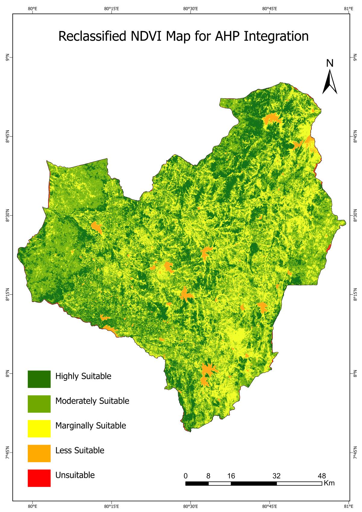
Reclassified NDVI
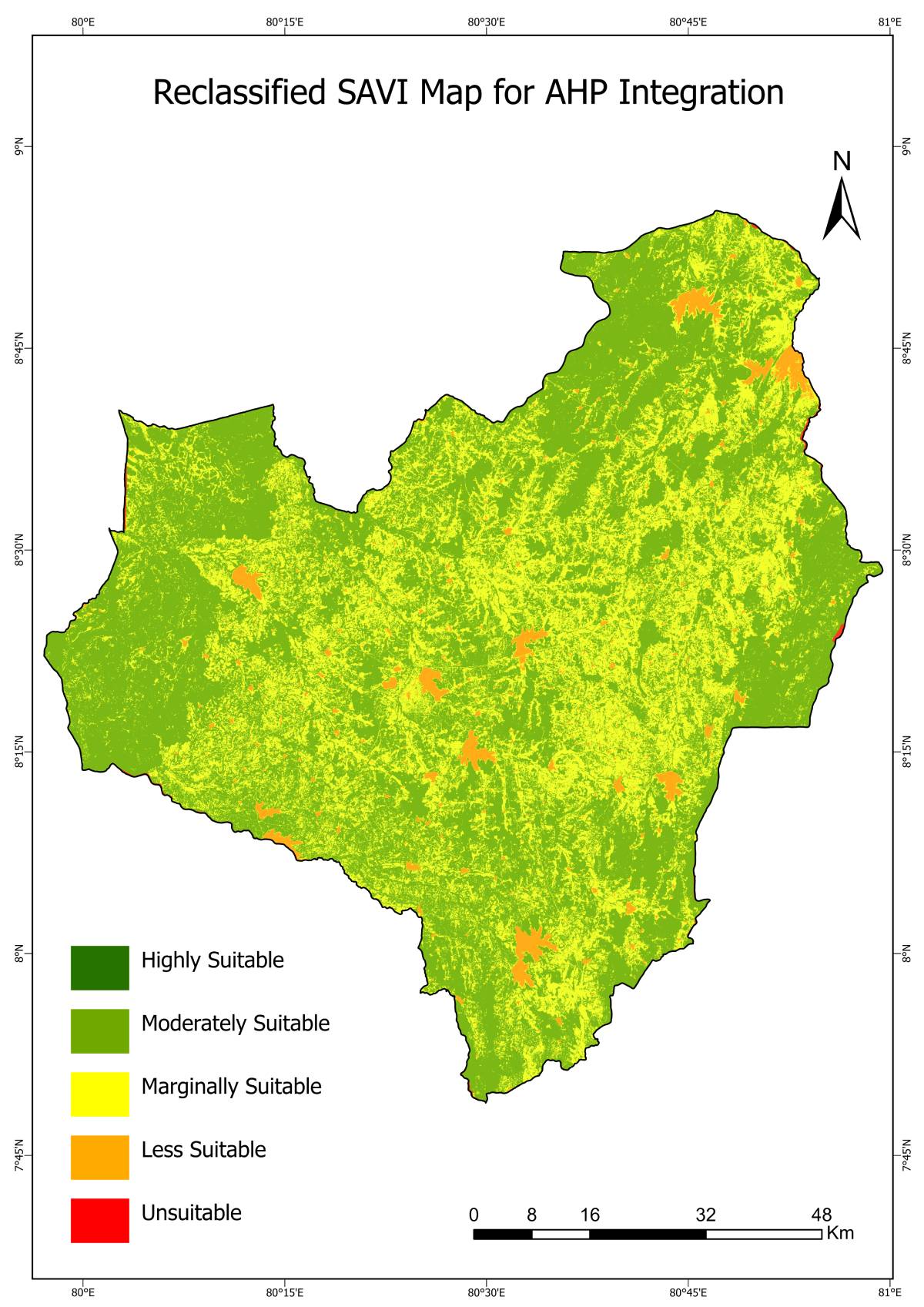
Reclassified SAVI
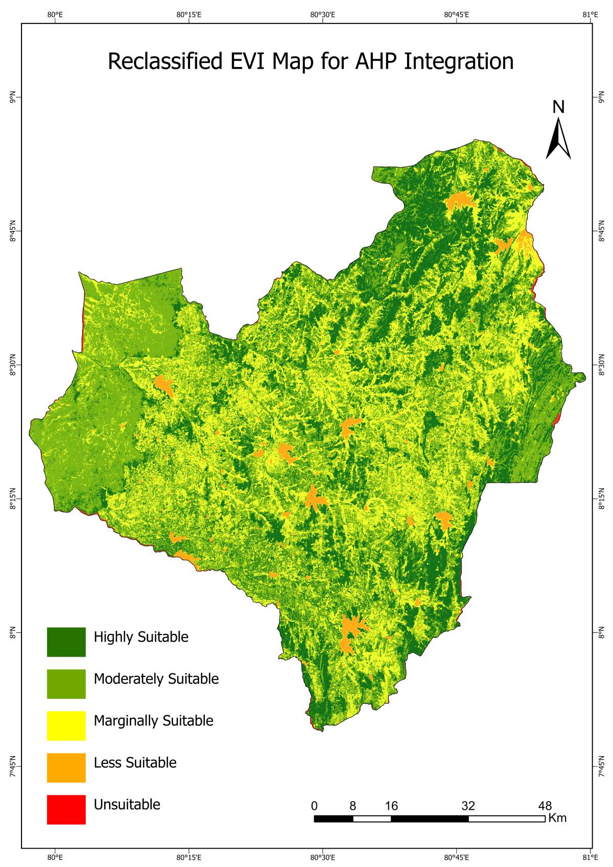
Reclassified EVI
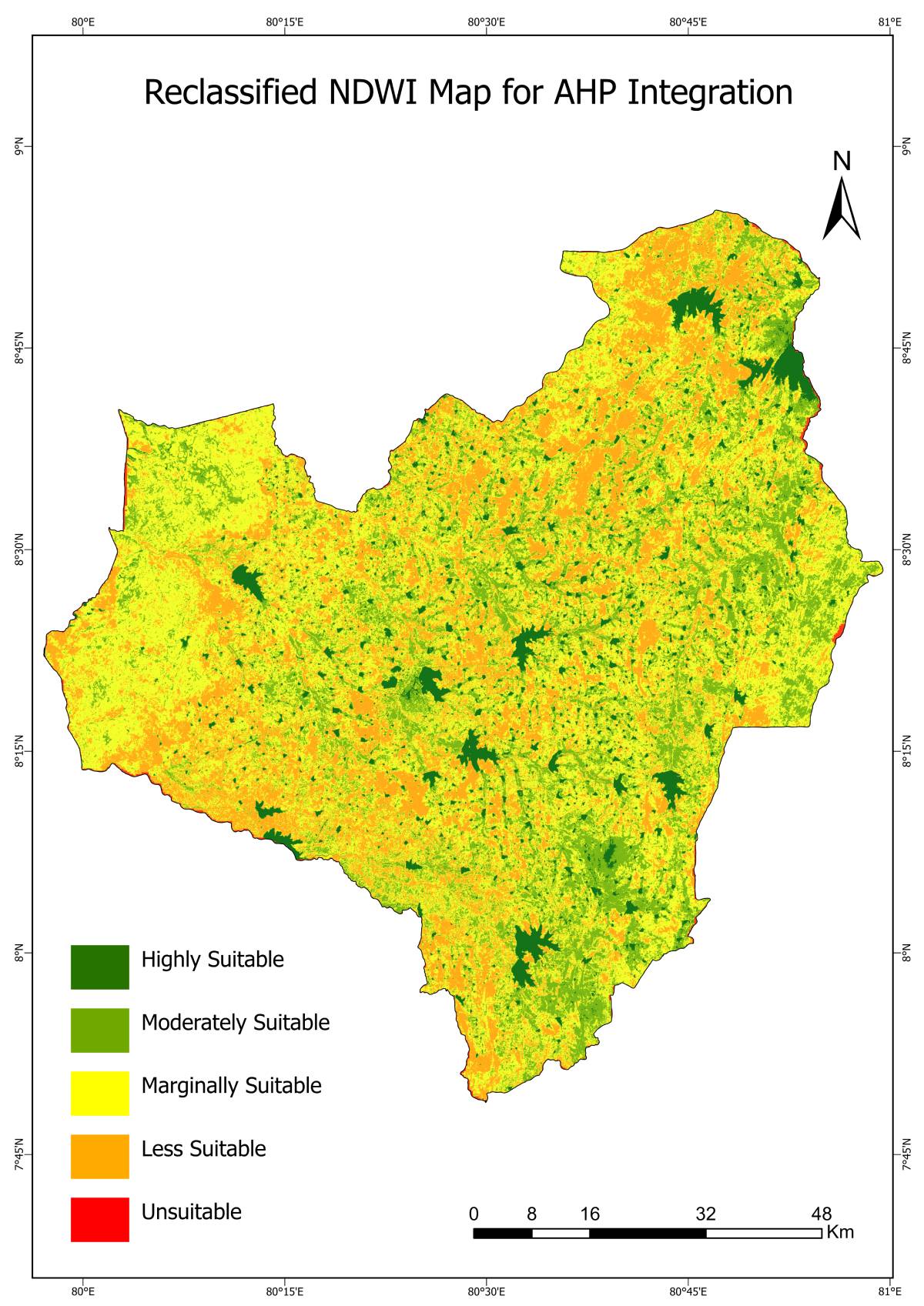
Reclassified NDWI
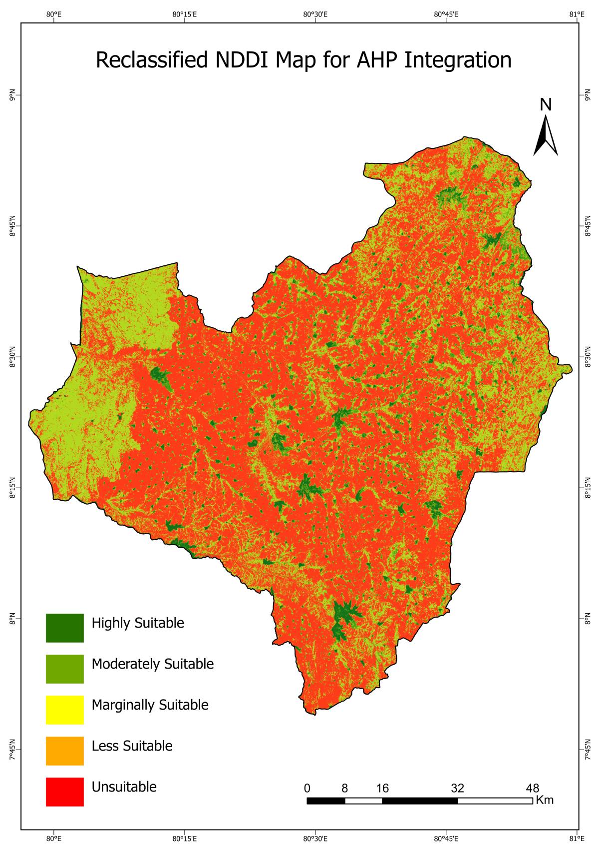
Reclassified NDDI
Reclassified Climate & Moisture Factors
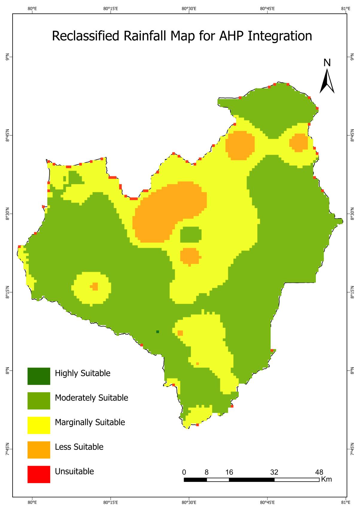
Reclassified Rainfall
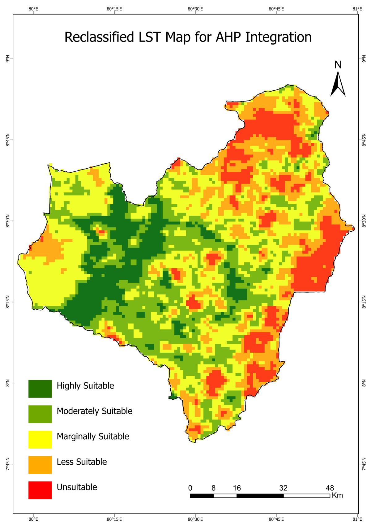
Reclassified Land Surface Temperature (LST)
Reclassified Soil Moisture Index (SMI)
Reclassified Land & Hydrological Factors
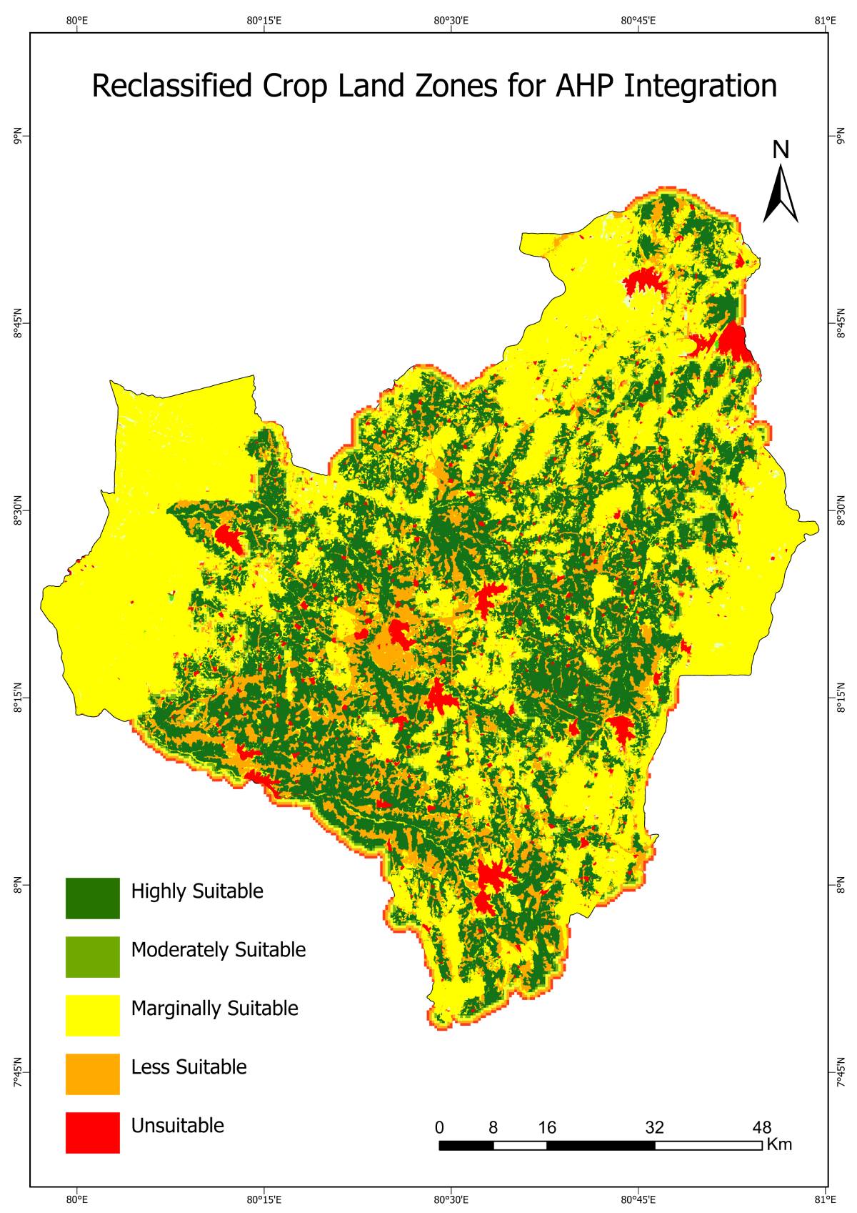
Reclassified Land Use
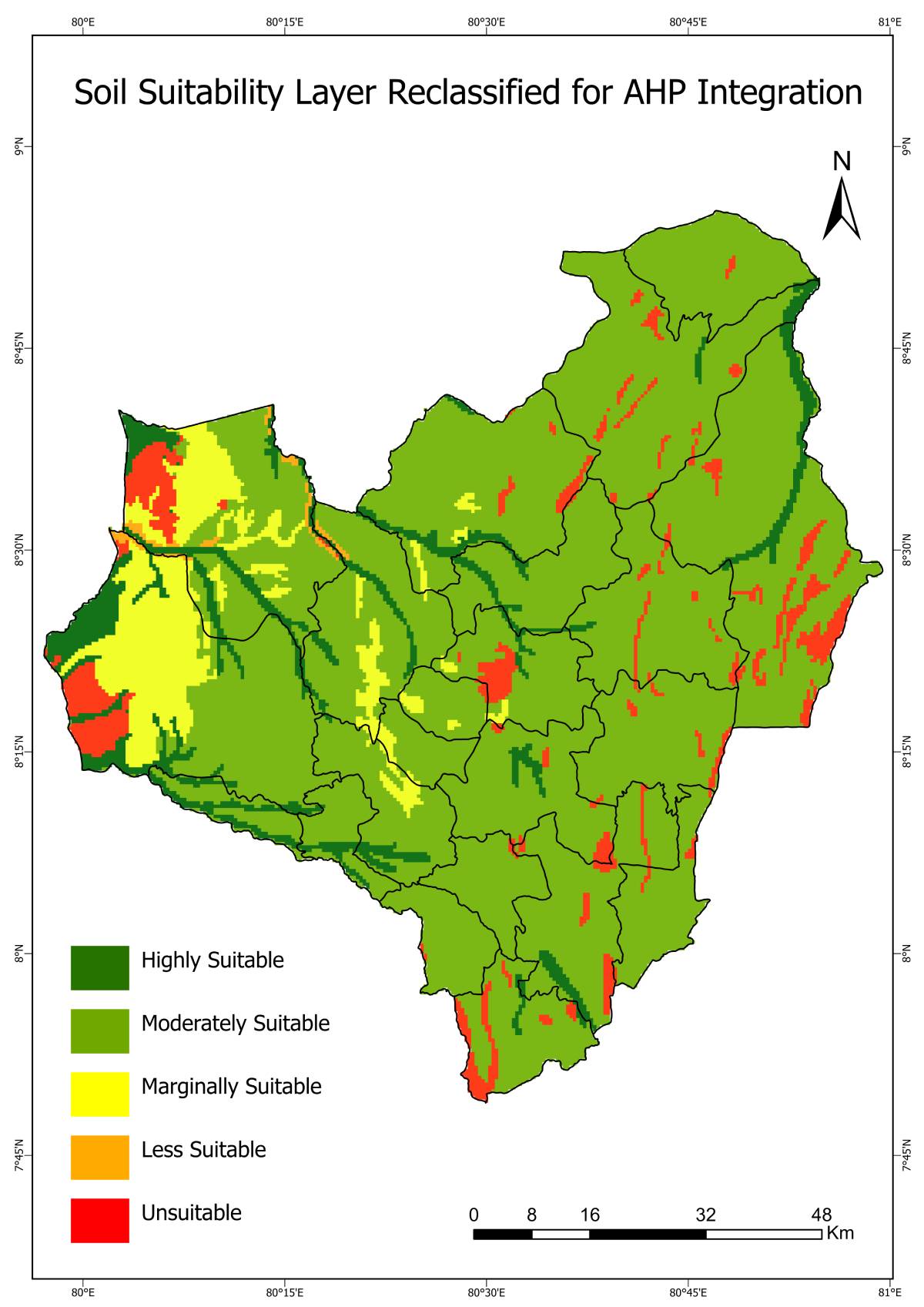
Reclassified Soil Suitability
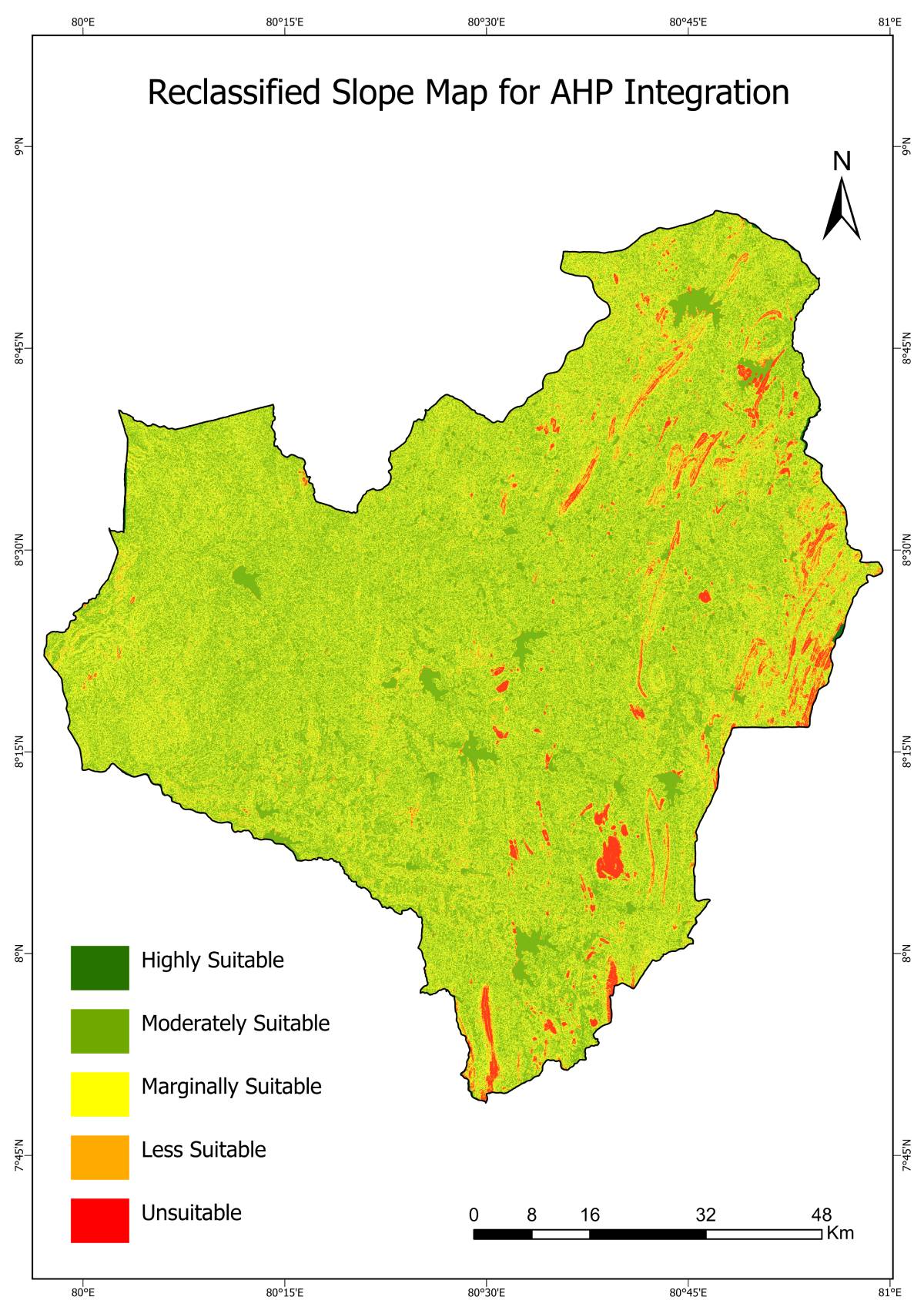
Reclassified Slope
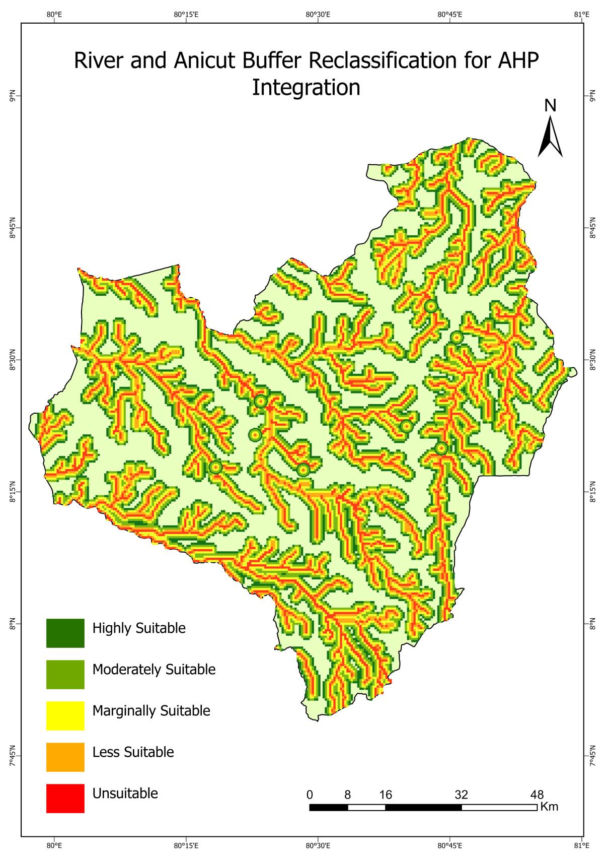
Reclassified River Buffer
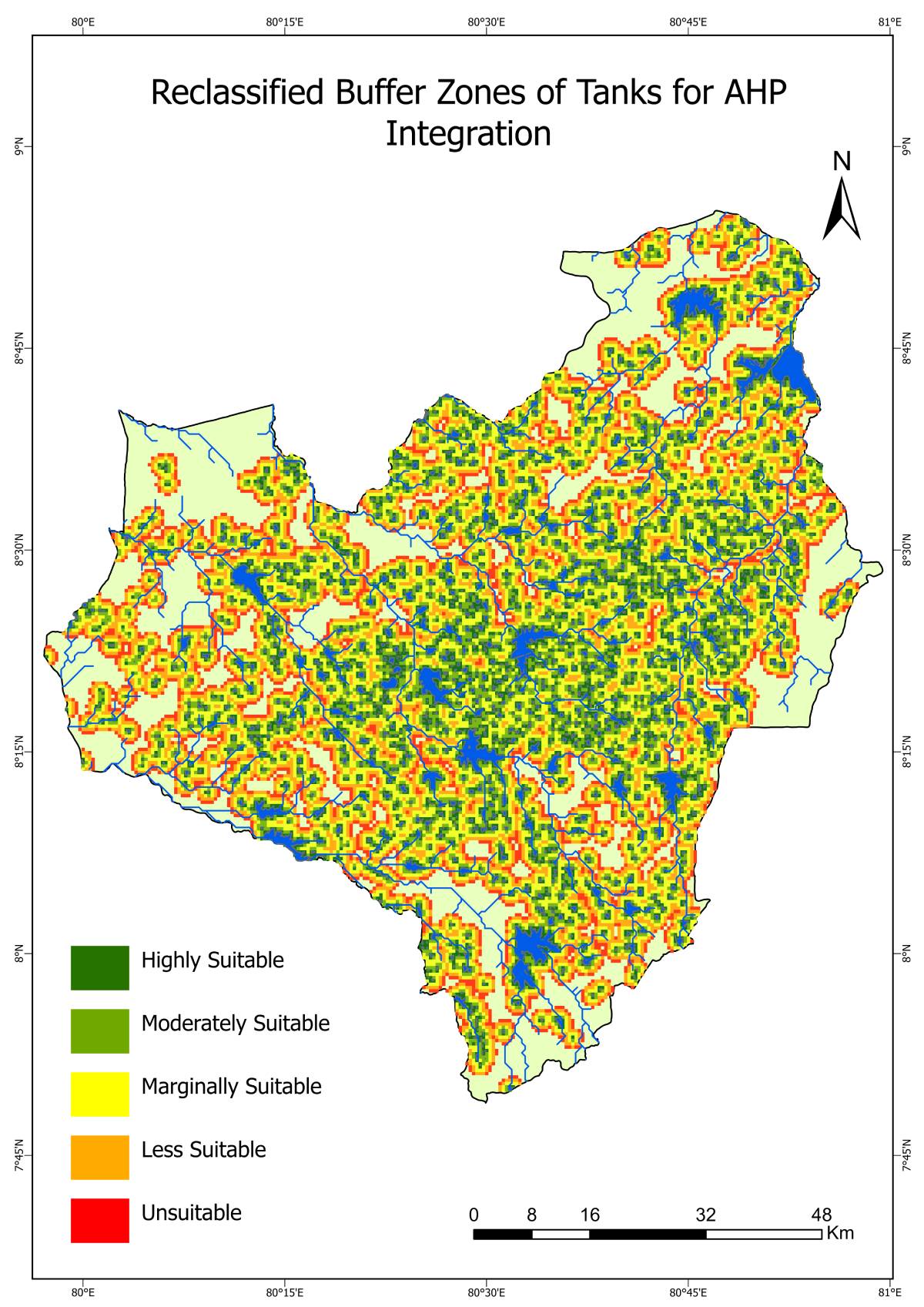
Reclassified Tank Proximity

Delineated CSA Zones (DSD) – Maha & Yala Seasons
DSD: Galenbidunuwewa
DSD Boundary
Maha Season
Yala Season
DSD: Kahatagasdigiliya
DSD Boundary

Maha Season
Yala Season

DSD: Kabithigollawa
DSD Boundary
Maha Season
Yala Season
DSD: Medawachchiya
DSD Boundary
Maha Season
Yala Season
DSD: Mihinthale
DSD Boundary
Maha Season
Yala Season
DSD: Nachchadoowa
DSD Boundary
Maha Season
Yala Season
DSD: Nochchiyagama
DSD Boundary
Maha Season
Yala Season
DSD: Padaviya
DSD Boundary
Maha Season
Yala Season
DSD: Palagala
DSD Boundary
Maha Season
Yala Season
DSD: Rajanganaya
DSD Boundary
Maha Season
Yala Season
DSD: Rambewa
DSD Boundary
Maha Season
Yala Season
DSD: Thalawa
DSD Boundary
Maha Season
Yala Season
DSD: Thirappane
DSD Boundary
Maha Season
Yala Season
DSD: Ipalogama
DSD Boundary
Maha Season
Yala Season
DSD: N. Palatha East
DSD Boundary
Maha Season
Yala Season
DSD: N. Palatha Central
DSD Boundary

Maha Season

Yala Season

DSD: Galnewa
DSD Boundary
Maha Season
Yala Season
DSD: Horowpothana
DSD Boundary
Maha Season

Yala Season

DSD: Kekirawa
DSD Boundary
Maha Season

Yala Season

DSD: Maha Vilachchiya
DSD Boundary
Maha Season

Yala Season

DSD: Palugaswewa
DSD Boundary

Maha Season

Yala Season

DSD: Thambuttegama
DSD Boundary

Maha Season

Yala Season

Key Observations
- Drought stress is high in specific Maha and Yala seasons, while irrigated areas remain resilient.
- Irrigation, land cover, and elevation strongly affect CSA suitability.
- Some divisions consistently show high suitability; others are vulnerable during dry seasons.
- Water availability, soil moisture, slope, and temperature drive agricultural resilience.
- CSA zoning enables targeted irrigation, adaptive cropping, and climate-resilient planning.
- Promote drought-tolerant crops, micro-irrigation, and regularly update CSA maps.
Skills & Tools Demonstrated
- Software & Platforms: Google Earth Engine (GEE), ArcGIS Pro 3.0.3, MS Excel
- Remote Sensing & Satellite Analysis: Landsat 8/9, Sentinel-2, multi-temporal analysis
- Vegetation & Drought Indices: NDVI, EVI, SAVI, NDWI, NDDI, SMI, LST
- GIS-Based Multi-Criteria Decision Analysis (MCDA) & AHP: Weighted overlay, raster reclassification, slope and soil suitability mapping
- Spatial Analysis & Mapping: Buffers, reclassification, land suitability mapping
- Climate & Soil Data Analysis: Rainfall, soil type, irrigation access
- Climate-Smart Agriculture (CSA) Planning & Zoning
Conclusion
CSA suitability zones were mapped using GIS and remote sensing, highlighting seasonal variability in agricultural potential and drought sensitivity. The maps serve as a practical tool for guiding climate-smart interventions and enhancing resilience to drought.