LiDAR-based 3D Mapping and Comparison with Conventional 3D GIS
Project Overview
This project demonstrates the generation of high-resolution 3D maps
using airborne LiDAR point cloud data and compares them with conventional
3D maps created using standard ArcGIS techniques. The study highlights
improvements in elevation accuracy, object representation, and volume
estimation achieved through LiDAR data.
Study Area
The study area is located at the Oregon State University campus,
Corvallis, Oregon, USA. The area includes buildings, vegetation,
and terrain features suitable for 3D visualization and comparison
between LiDAR-based and conventional 3D maps.
Data Sources
Airborne LiDAR point cloud data (.LAS format)
Oregon Department of Geology and Mineral Industries (DOGAMI)
OpenTopography LiDAR data repository
Methodology
Downloading airborne LiDAR data in .LAS format
Creating LAS datasets in ArcGIS Desktop 10.8 (ArcMap)
Analyzing LAS statistics and visualizing point clouds
Generating surface models and converting raster data to TIN
3D visualization and editing using ArcGIS ArcScene
Comparing LiDAR-based 3D maps with conventional 3D maps
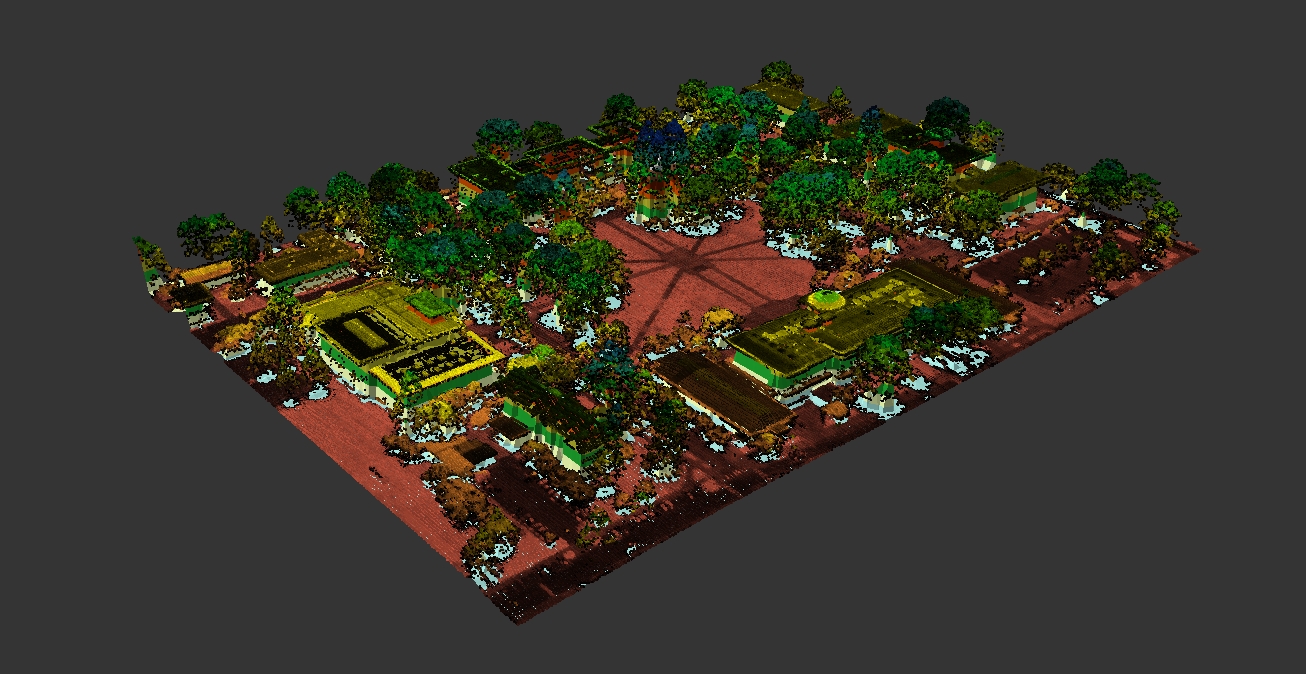
3D Map Generated Using LiDAR Data
The LiDAR-based 3D map accurately represents terrain, buildings,
and vegetation with correct height and volume. Tree canopy structure
and building shapes are clearly visible, providing a realistic
three-dimensional visualization.
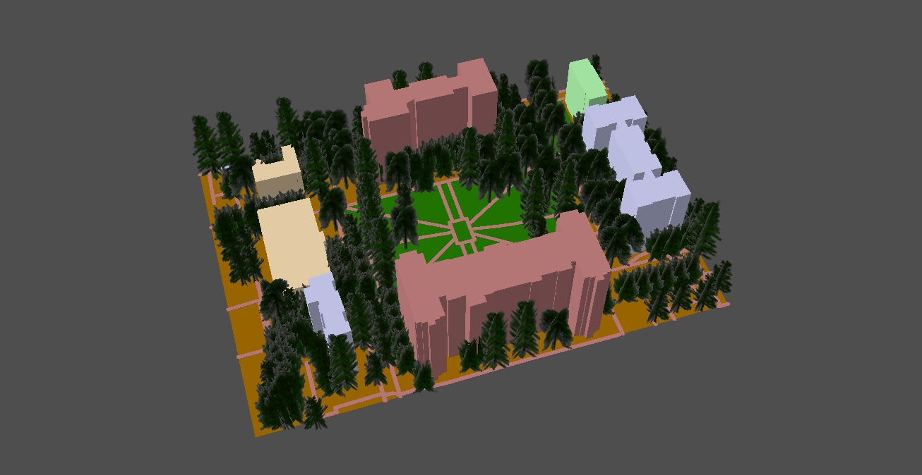
Normal 3D Map Created Using ArcGIS
The conventional 3D map created using standard ArcGIS methods shows
generalized elevation surfaces. Compared to the LiDAR-based map,
object shapes and volume representation are less accurate.
LiDAR vs Normal 3D Map – Visual Comparison
The video demonstrates a direct visual comparison between the
LiDAR-based 3D map and the conventional 3D map. Differences in
elevation accuracy, building geometry, vegetation structure,
and overall realism are clearly observable.
Tools & Skills
ArcGIS Desktop 10.8 (ArcMap)
ArcGIS ArcScene
LiDAR point cloud processing
3D visualization and volume analysis
Conclusion
This project highlights the advantages of LiDAR data for accurate
3D mapping and spatial analysis. Compared to conventional 3D GIS
techniques, LiDAR-based mapping provides superior realism and
reliability, supporting advanced visualization and decision-making
in GIS applications.