Monthly Average Rainfall Animation
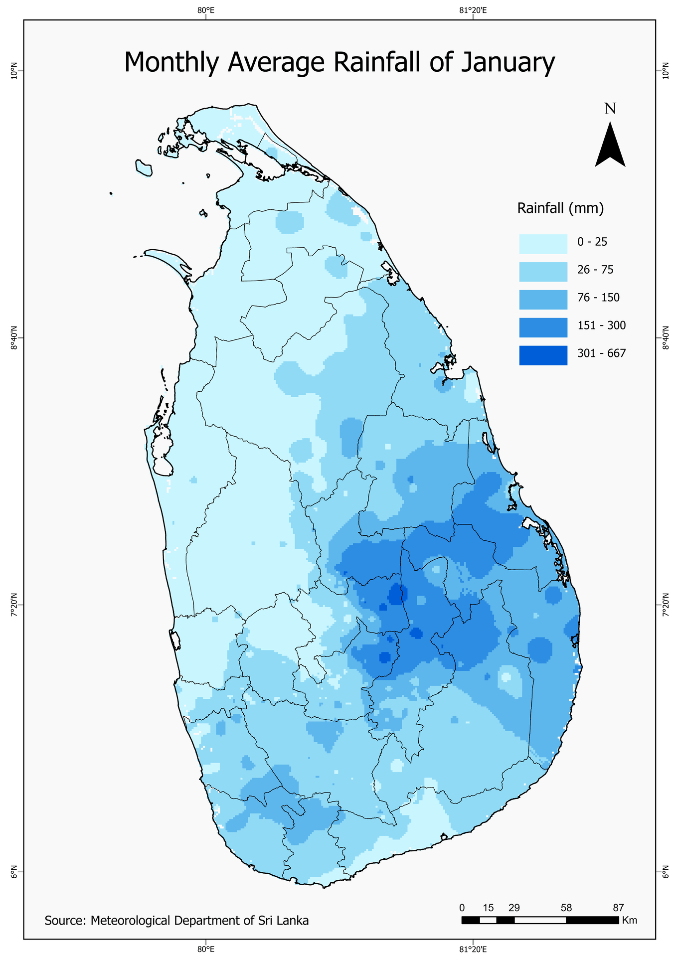
The animation illustrates monthly rainfall variation across Sri Lanka, with higher rainfall intensities observed during monsoonal periods. A consistent colour scheme enables direct comparison between months.
Animated GIS-based Rainfall Visualisation (January–December)
This project presents an animated GIS visualisation of monthly average rainfall distribution across Sri Lanka from January to December. The animation highlights spatial and temporal rainfall variability to support climate, hydrological, and seasonal pattern analysis.
The study covers the entire island of Sri Lanka, located between 5°55′–9°51′ N latitude and 79°41′–81°53′ E longitude. The country experiences distinct seasonal rainfall patterns influenced by monsoonal systems and topography.
The animation illustrates monthly rainfall variation across Sri Lanka, with higher rainfall intensities observed during monsoonal periods. A consistent colour scheme enables direct comparison between months.
This project strengthened skills in spatio-temporal climate data visualisation and GIS-based animation techniques. The animated rainfall maps provide an effective tool for communicating seasonal climate variability and supporting hydrological and environmental analysis.