Physical & Human Geography of North Central Province

A Thematic Cartographic Map Series Using GIS

Project Overview

This project presents a comprehensive series of thematic maps illustrating the physical and human geographical characteristics of the North Central Province of Sri Lanka. The map series was developed using GIS techniques to visually represent spatial patterns related to climate, topography, natural resources, population, and settlement structure.

Study Area

The study area covers the North Central Province of Sri Lanka, comprising the Anuradhapura and Polonnaruwa districts. The province is characterized by dry zone climatic conditions, ancient irrigation systems, agricultural landscapes, and diverse demographic patterns.

Data Sources

All datasets were obtained from open-source and authoritative platforms and processed using GIS software for thematic map production.

Methodology

Thematic Map Series

Rainfall Map of North Central Province

1. Rainfall Map: Illustrates spatial variation of annual rainfall across the province.

Temperature Map of North Central Province

2. Temperature Map: Displays average temperature distribution under dry zone conditions.

Contour Map of North Central Province

3. Contour Map: Represents elevation and terrain characteristics of the province.

Streams and Waterbodies Map

4. Streams & Waterbodies: Shows rivers, tanks, and irrigation reservoirs.

Land Cover Map

5. Land Cover Map: Depicts forests, agricultural land, water bodies, and settlements.

Mineral Resources Map

6. Mineral Resources Map: Highlights the distribution of mineral resources.

Soil Map

7. Soil Map: Shows major soil types influencing agriculture.

Population Distribution Map

8. Population Map: Illustrates population density and spatial distribution.

Urban Centres Map

9. Urban Centers Map: Illustrates the locations of urban and sub-urban city centers across the North Central Province.

Ethnic Distribution Map

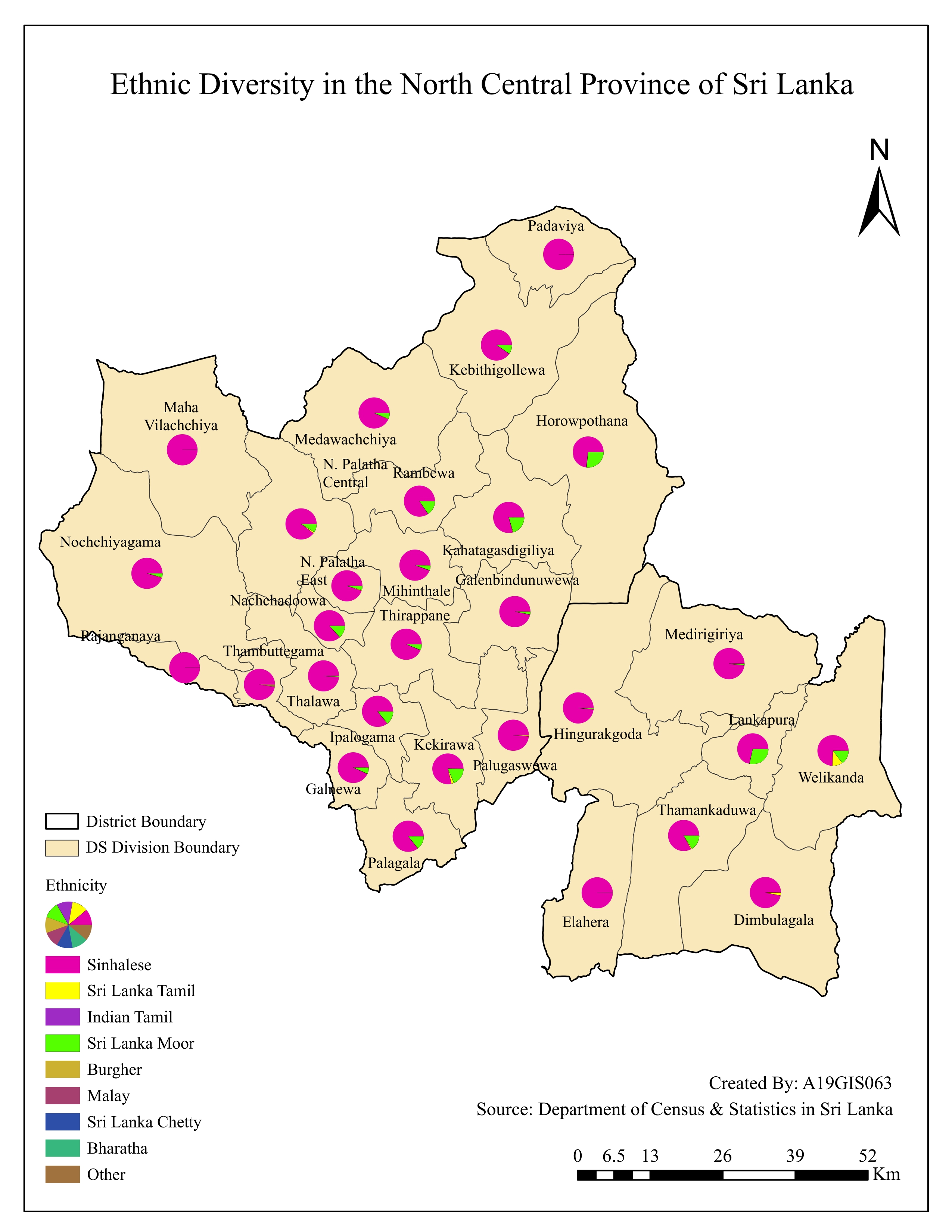
10. Ethnic Distribution Map: Shows spatial patterns of ethnic composition.

Key Observations

Tools & Skills

Conclusion

This project strengthened practical skills in thematic mapping, cartographic design, and spatial interpretation of regional geography. The map series provides a clear visual understanding of the physical and human geography of the North Central Province.