←
New Dams and Reservoirs in Sri Lanka
National-Scale Water Resources Mapping using GIS
Project Overview
This project presents a comprehensive GIS-based map of new,
existing, under-construction, and proposed dams and reservoirs
across Sri Lanka. The mapping integrates construction status,
managing organisations, river basins, and reservoir capacity
to support national water resources planning and decision-making.
Study Area
The study covers the entire island of Sri Lanka, encompassing
all major river basins including Mahaweli, Kelani, Walawe,
Kala Oya, Gal Oya, Deduru Oya, Malwathu Oya, and several
regional and coastal catchments.
Data Sources
- National dam and reservoir inventory – Irrigation Department
- River basin boundaries – Irrigation Department
- Administrative boundary of Sri Lanka – Survey Department
- Institutional data (ID, MASL, CEB, NWSDB, NPC)
- Reservoir capacity, construction year, and status records
Methodology
- Compilation and validation of national dam and reservoir datasets
- Standardisation of attribute information (status, organisation, basin)
- Classification of reservoirs by development status (completed, under construction, pending, design ongoing)
- River basin-wise spatial analysis
- Professional cartographic symbolisation and map layout design
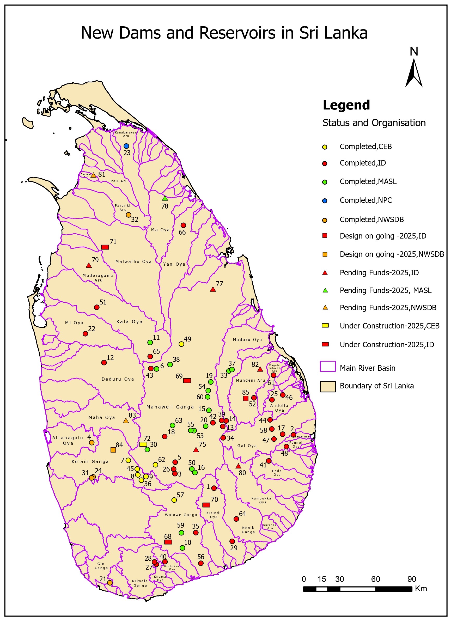
New Dams and Reservoirs Map of Sri Lanka
The map illustrates the spatial distribution of dams and reservoirs
across Sri Lanka, classified by construction status and managing
organisation, and overlaid with major river basins to highlight
hydrological significance.
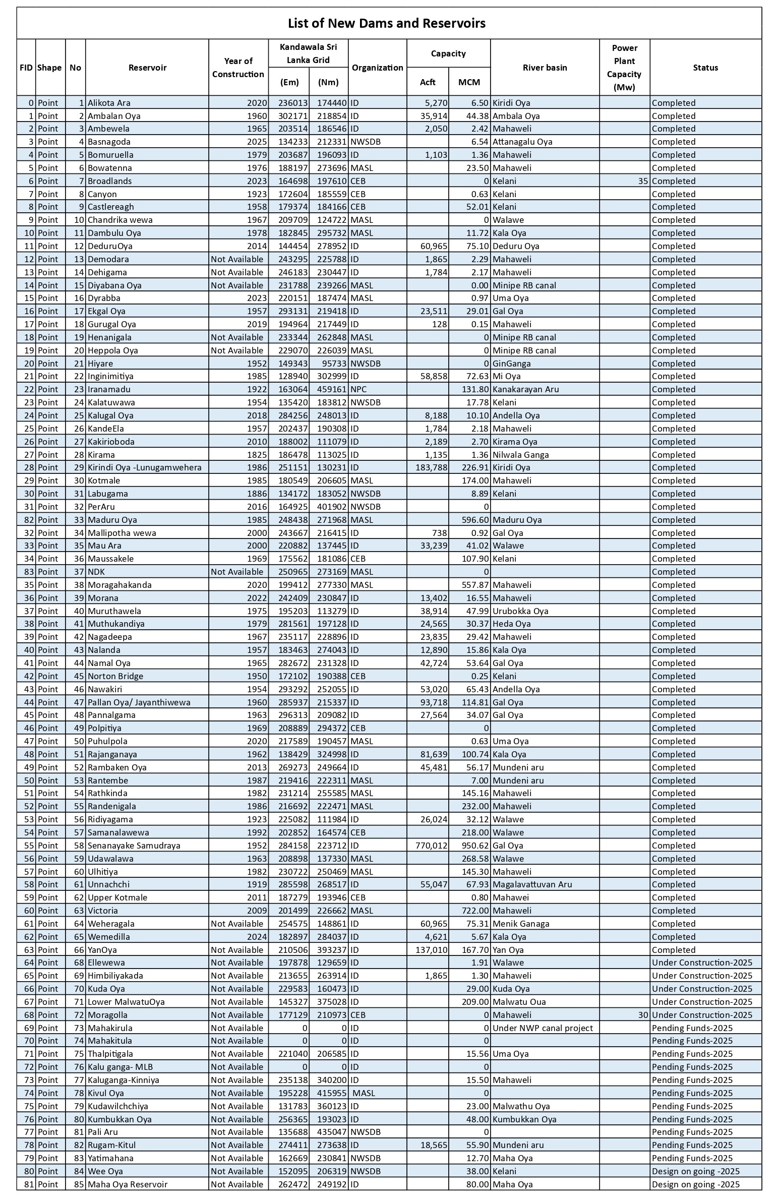
List of New Dams and Reservoirs
The attribute table summarises key information including reservoir
name, construction year, managing organisation, river basin,
storage capacity, and current development status.
Key Observations
- The Mahaweli River Basin contains the highest number of large-scale reservoirs
- Most newly proposed reservoirs are concentrated in dry zone river basins
- Multiple institutions contribute to national water infrastructure development
- Several projects are currently under construction or pending funding as of 2025
Tools & Skills
- ArcGIS Pro
- Spatial database management
- National-scale hydrological mapping
- Cartographic design and layout preparation
- Data validation and standardisation
Conclusion
This project strengthened practical skills in large-scale GIS
mapping, hydrological data integration, and professional
cartographic presentation. The final outputs support national
water resource planning and reflect real-world GIS work
conducted during my internship at the Irrigation Department.