←
District Population of Sri Lanka – 2012
Thematic Population Mapping using GIS
Project Overview
This project presents a district-level population distribution map
of Sri Lanka based on the National Population and Housing Census
conducted in 2012. The thematic map visualises spatial variations
in population size across districts to support demographic analysis,
regional planning, and policy decision-making.
Study Area
The study area covers the entire island of Sri Lanka at the
administrative district level. Sri Lanka consists of 25 districts
with varying population concentrations influenced by urbanisation,
economic activities, infrastructure development, and physical
geography.
Data Sources
- District boundary shapefile – Survey Department of Sri Lanka
- Population Census data (2012) – Department of Census and Statistics, Sri Lanka
Methodology
- Preparation and cleaning of district-level population data
- Attribute table joining of census data with district boundaries
- Classification of population values into meaningful ranges
- Choropleth mapping using graduated colour symbology
- Map layout design including legend, scale bar, and north arrow
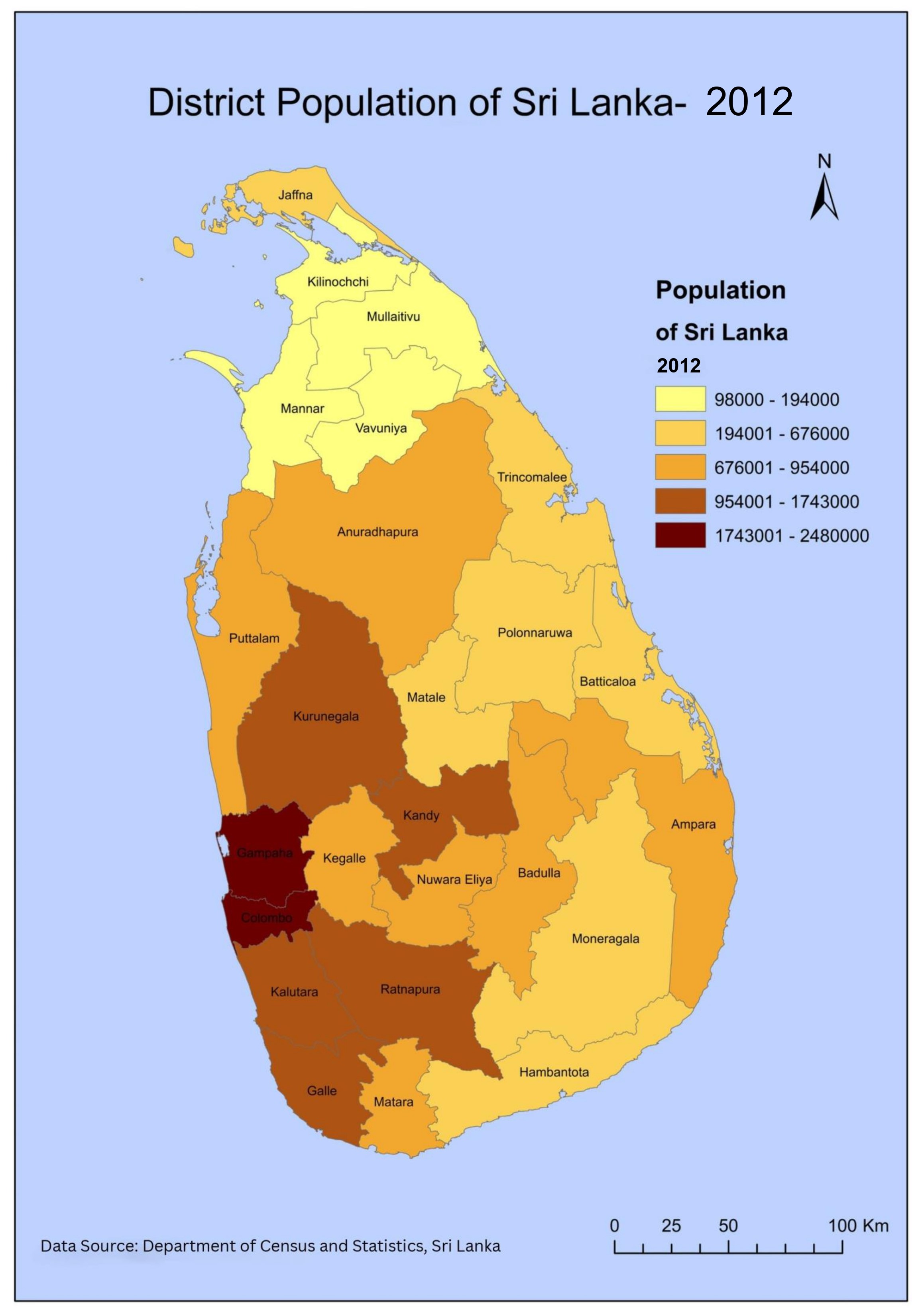
District Population Map – 2012
The map illustrates population distribution across Sri Lankan
districts, with higher population concentrations observed in
Colombo, Gampaha, and Kurunegala districts, while lower population
levels are evident in districts such as Mullaitivu, Mannar, and
Moneragala.
Population Classes
- 98,000 – 194,000
- 194,001 – 676,000
- 676,001 – 954,000
- 954,001 – 1,743,000
- 1,743,001 – 2,480,000
Key Observations
- Western Province districts show the highest population concentration
- Urbanised districts exhibit significantly higher population values
- Northern and eastern districts show comparatively lower population levels
- Population distribution reflects patterns of economic development and infrastructure
Tools & Skills
- ArcGIS Desktop (ArcMap)
- Socioeconomic thematic mapping
- Choropleth classification techniques
- Cartographic layout design
Conclusion
This project strengthened skills in population data handling,
thematic mapping, and cartographic visualisation. The district-level
population map provides valuable insights for urban planning,
regional development, and demographic studies in Sri Lanka.